Letzte 6 TageScroll links für die letzten 6 TageJetzt
Next 3 days weather summary:
starker Regen (gesamt 51.0mm), stärkstens In der Nacht zu Freitag. Warm (maximal 27°C am Mittwoch Nachm., min 14°C in der Nacht zu Donnerstag). Der Wind bleibt meist schwach..
Tage 4-6 Peisey/Vallandry Wetter-Zusammenfassung
leichter Regen (gesamt 9.0mm), meistens fallend in der Nacht zu Freitag. Warm (maximal 26°C am Freitag Nachm., min 11°C in der Nacht zu Sonntag). Der Wind bleibt meist schwach..
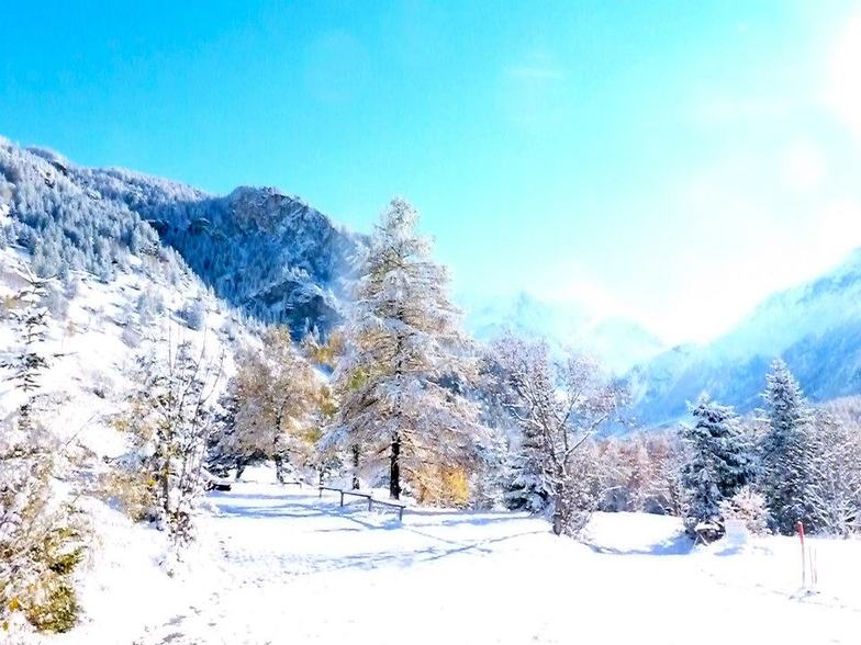
Die Tabelle oben zeigt die Wettervorhersage für Peisey/Vallandry auf der angegebenen Höhe von 1301 m. Unsere ausgeklügelten Wettermodelle ermöglichen uns die Schneevorhersage für die Gipfel-, Mittel- und Talstationen für Peisey/Vallandry. Das Fenster über der Tabelle ermöglicht das Abrufen der Wettervorhersage für andere Höhen. Für einen umfassenderen Blick auf das Wetter, siehe die Wetterkarte" von France.Peisey/Vallandry
Klicken Sie hier, um weitere Informationen über Gefrierpunkte zu erhalten und zu lesen wie wir unsere Temperaturen prognostizieren.
Besucher-Beurteilung fuer Peisey/Vallandry
Allgemein 4.3 Basiert auf 12 Abstimmungen und 13 Beurteilungen
We just checked at ll'Oree ges Cimes in Vallandry for our second ski week of the year here and the third in two years. This is the place to stay if you're very serious about your skiing but have kids and have to keep them occupied so you can engage in some serious skiing. Peisey-Vallandry is basically part of the massive Les Arcs complex. Last time here, I even made it from 1600 m base, at Vallandry, to the highest part of Les Arcs (at 3200 m) and back in two hours (having to pick my toddler up from the garderie). The Garderie, "Tom Pouce", is fabulous. That and a super ESF school and great learning terrain for our seven year old makes the great skiing possible. And the skiing is great not only at Les Arcs, but also at Peisey- Vallandry itself, with long high speed lifts and super fall line skiing. In fact, my favorite lift in the whole greater complex is The Derby in Peisy-Vallandry, which is half above the tree line and half in the trees.
Allgemein: 4.3 Basiert auf 12 Abstimmungen und 13 Beurteilungen
Schneesicher
4.5
Vielfalt der Pisten
4.8
Off Piste
4.2
Landschaft
4.6
Apres-Ski
3.6
Kerry aus Switzerland schreibt:
We just checked at ll'Oree ges Cimes in Vallandry for our second ski week of the year here and the third in two years. This is the place to stay if you're very serious about your skiing but have kids and have to keep them occupied so you can engage in some serious skiing. Peisey-Vallandry is basically part of the massive Les Arcs complex. Last time here, I even made it from 1600 m base, at Vallandry, to the highest part of Les Arcs (at 3200 m) and back in two hours (having to pick my toddler up from the garderie). The Garderie, "Tom Pouce", is fabulous. That and a super ESF school and great learning terrain for our seven year old makes the great skiing possible. And the skiing is great not only at Les Arcs, but also at Peisey- Vallandry itself, with long high speed lifts and super fall line skiing. In fact, my favorite lift in the whole greater complex is The Derby in Peisy-Vallandry, which is half above the tree line and half in the trees.
Kostenlose Snow-Forecast.com Wetter Widget für Ihre Website
Das Peisey/Vallandry Skiwetter Wideget unten, ist auf externen Seiten kostenlos eigebettet. Es bietet eine tägliche Zusammenfassung über unsere Peisey/Vallandry Schneevorhersage und derzeitige Wetterbedingungen. gehen Sie einfach auf die Feed-Konfiguration Seite und folgen Sie den 3 einfachen Schritten, um den eigenen HTML-Code-Snippet zu packen und fügen Sie ihn auf Ihrer eigenen Website. Sie können die Höhe der Schneevorhersage wählen (Gipfel, mittel Berg, oder unterer Gipfel) und Messeinheiten metrisch / Schneevorhersage für den Feed auf Ihre eigene Website & hellip anpassen; Klicken Sie hier, um den Code zu bekommen.


 Nearest