Herausgegeben on Snow-Forecast.com um:7 am (lokale Zeit) / 16 Jul 2026
Letzte 6 TageScroll links für die letzten 6 TageJetzt
Next 3 days weather summary:
starker Regen (gesamt 23.0mm), stärkstens währ. der Nacht zu Freitag. Sehr mild (maximal 17°C am Donnerstag Nachm., min 9°C in der Nacht zu Donnerstag). Der Wind bleibt meist schwach..
Tage 4-6 Peisey/Vallandry Wetter-Zusammenfassung
leichter Regen (gesamt 2.0mm), meistens fallend am Sonntag Nachm.. Sehr mild (maximal 11°C am Sonntag Nachm., min 7°C in der Nacht zu Montag). Der Wind bleibt meist schwach..
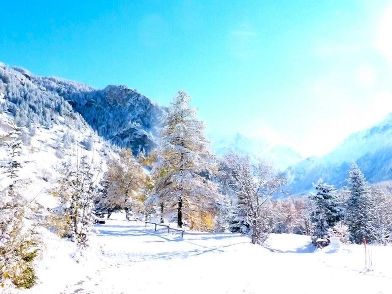
Die Tabelle oben zeigt die Wettervorhersage für Peisey/Vallandry auf der angegebenen Höhe von 2401 m. Unsere ausgeklügelten Wettermodelle ermöglichen uns die Schneevorhersage für die Gipfel-, Mittel- und Talstationen für Peisey/Vallandry. Das Fenster über der Tabelle ermöglicht das Abrufen der Wettervorhersage für andere Höhen. Für einen umfassenderen Blick auf das Wetter, siehe die Wetterkarte" von France.Peisey/Vallandry
Klicken Sie hier, um weitere Informationen über Gefrierpunkte zu erhalten und zu lesen wie wir unsere Temperaturen prognostizieren.
Besucher-Beurteilung fuer Peisey/Vallandry
Allgemein 4.3 Basiert auf 12 Abstimmungen und 13 Beurteilungen
March 30 2013. We came here with a party of 15 ranging from mid 50's to a 10 year old. Skiing and boarding experience was equally varied, from expert to first time boarder. The village is a fantastic base from which to explore the whole of the paradiski. The links to Les Arc are much quicker than we had expected. The Derby chair lift is the place to aim for to get across to Les Arc as the main gondola from 1850 stops at the mid point of a run at the left of the top of Derby. The runs back to the villages of Peisey and Vallendry are all tree lined and wide, and are ideal for cruisers and beginners. ESF was fantastic. Our children had both skiing and boarding lessons and made great progress and had a nice time. They even split a class of 9 kids into 2 groups!! The village lacks character but has some nice restaurants for lunch by the main chair lifts. We stayed in a little village that was accessible by 'lobster pots' below Peissey. It was a charming village, with a few bars and restaurants. It was very English with lots of Chalets owned by British companies. The late snow and cold conditions this year made it the best Easter skiing in 20 years. An ideal base for families but not a great deal to do once you are off the slopes.
Allgemein: 4.3 Basiert auf 12 Abstimmungen und 13 Beurteilungen
Schneesicher
4.5
Vielfalt der Pisten
4.8
Off Piste
4.2
Landschaft
4.6
Apres-Ski
3.6
Nigel Emery aus United Kingdom schreibt:
March 30 2013. We came here with a party of 15 ranging from mid 50's to a 10 year old. Skiing and boarding experience was equally varied, from expert to first time boarder. The village is a fantastic base from which to explore the whole of the paradiski. The links to Les Arc are much quicker than we had expected. The Derby chair lift is the place to aim for to get across to Les Arc as the main gondola from 1850 stops at the mid point of a run at the left of the top of Derby. The runs back to the villages of Peisey and Vallendry are all tree lined and wide, and are ideal for cruisers and beginners. ESF was fantastic. Our children had both skiing and boarding lessons and made great progress and had a nice time. They even split a class of 9 kids into 2 groups!! The village lacks character but has some nice restaurants for lunch by the main chair lifts. We stayed in a little village that was accessible by 'lobster pots' below Peissey. It was a charming village, with a few bars and restaurants. It was very English with lots of Chalets owned by British companies. The late snow and cold conditions this year made it the best Easter skiing in 20 years. An ideal base for families but not a great deal to do once you are off the slopes.
Kostenlose Snow-Forecast.com Wetter Widget für Ihre Website
Das Peisey/Vallandry Skiwetter Wideget unten, ist auf externen Seiten kostenlos eigebettet. Es bietet eine tägliche Zusammenfassung über unsere Peisey/Vallandry Schneevorhersage und derzeitige Wetterbedingungen. gehen Sie einfach auf die Feed-Konfiguration Seite und folgen Sie den 3 einfachen Schritten, um den eigenen HTML-Code-Snippet zu packen und fügen Sie ihn auf Ihrer eigenen Website. Sie können die Höhe der Schneevorhersage wählen (Gipfel, mittel Berg, oder unterer Gipfel) und Messeinheiten metrisch / Schneevorhersage für den Feed auf Ihre eigene Website & hellip anpassen; Klicken Sie hier, um den Code zu bekommen.


 Nearest