Herausgegeben on Snow-Forecast.com um:1 am (lokale Zeit) / 03 Aug 2026
Letzte 6 TageScroll links für die letzten 6 TageJetzt
Next 3 days weather summary:
starker Regen (gesamt 39.0mm), stärkstens währ. Dienstag Nnachm.. Warm (maximal 25°C am Montag Nachm., min 16°C am Dienstag Nachm.). Der Wind bleibt meist schwach..
Tage 4-6 Morzine Wetter-Zusammenfassung
Mäßiger Regen (gesamt 16.0mm), stärkstens am Donnerstag Nachm.. Warm (maximal 22°C am Samstag Nachm., min 15°C in der Nacht zu Donnerstag). Der Wind bleibt meist schwach..
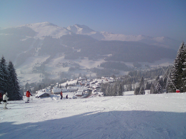
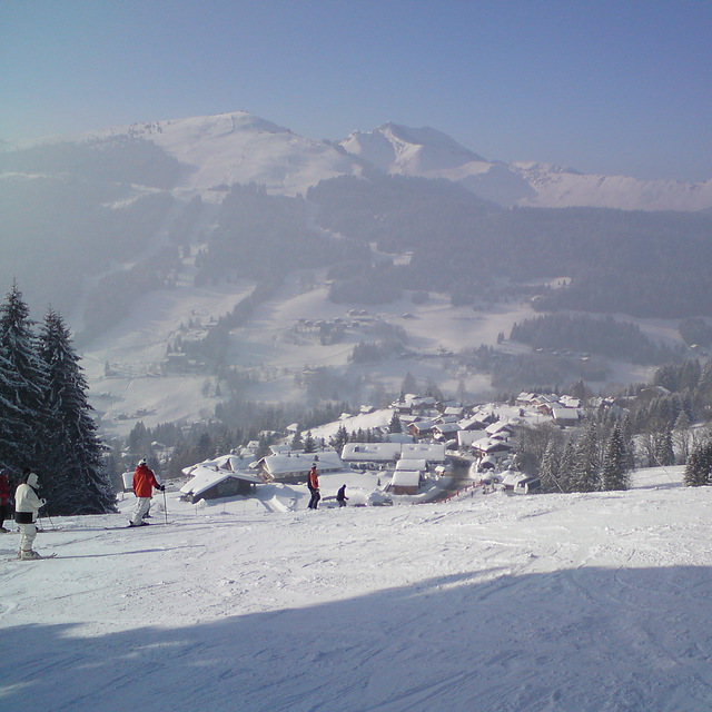
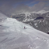
Die Tabelle oben zeigt die Wettervorhersage für Morzine auf der angegebenen Höhe von 1509 m. Unsere ausgeklügelten Wettermodelle ermöglichen uns die Schneevorhersage für die Gipfel-, Mittel- und Talstationen für Morzine. Das Fenster über der Tabelle ermöglicht das Abrufen der Wettervorhersage für andere Höhen. Für einen umfassenderen Blick auf das Wetter, siehe die Wetterkarte" von France.Morzine
Klicken Sie hier, um weitere Informationen über Gefrierpunkte zu erhalten und zu lesen wie wir unsere Temperaturen prognostizieren.
Besucher-Beurteilung fuer Morzine
Allgemein 4.5 Basiert auf 80 Abstimmungen und 114 Beurteilungen
Been coming to Morzine and PDS skiing for many years. Morzine is a
living mountain town in and out of season so no apologies for being more real than tourist-only ski resorts. A big enough town to wander about and find what suits you according to your age and stage of ski holidays. For us, now our children are adults, it’s about cruising over a few valleys for lunch. Mountain restaurants are everywhere, and what’s not to like about a fabulous view and a tartiflette lunch? If you think expensive then you haven’t been to the 3 valleys or Chamonix recently! The great advantages of being UK orientated with many UK people living there is the great choice of ski schools for adults and kids, and there’s always someone who can chat to you in the bar!
Allgemein: 4.5 Basiert auf 80 Abstimmungen und 114 Beurteilungen
Schneesicher
4.1
Vielfalt der Pisten
4.8
Off Piste
4.2
Landschaft
4.7
Apres-Ski
4.7
Shelly aus United Kingdom schreibt:
Been coming to Morzine and PDS skiing for many years. Morzine is a
living mountain town in and out of season so no apologies for being more real than tourist-only ski resorts. A big enough town to wander about and find what suits you according to your age and stage of ski holidays. For us, now our children are adults, it’s about cruising over a few valleys for lunch. Mountain restaurants are everywhere, and what’s not to like about a fabulous view and a tartiflette lunch? If you think expensive then you haven’t been to the 3 valleys or Chamonix recently! The great advantages of being UK orientated with many UK people living there is the great choice of ski schools for adults and kids, and there’s always someone who can chat to you in the bar!
Kostenlose Snow-Forecast.com Wetter Widget für Ihre Website
Das Morzine Skiwetter Wideget unten, ist auf externen Seiten kostenlos eigebettet. Es bietet eine tägliche Zusammenfassung über unsere Morzine Schneevorhersage und derzeitige Wetterbedingungen. gehen Sie einfach auf die Feed-Konfiguration Seite und folgen Sie den 3 einfachen Schritten, um den eigenen HTML-Code-Snippet zu packen und fügen Sie ihn auf Ihrer eigenen Website. Sie können die Höhe der Schneevorhersage wählen (Gipfel, mittel Berg, oder unterer Gipfel) und Messeinheiten metrisch / Schneevorhersage für den Feed auf Ihre eigene Website & hellip anpassen; Klicken Sie hier, um den Code zu bekommen.


 Nearest