

America’s Next Indoor Snow Centre Takes Shape
Construction of a new indoor snow centre for skiers, boarders and tubers appears to be making good progress at Heritage Farm in Wayne County, West Virginia.

Next 4 days weather summary:Mäßiger Regen (gesamt 14.0mm), stärkstens am Donnerstag Morg.. Warm (maximal 21°C am Mittwoch Nachm., min 9°C in der Nacht zu Dienstag). Der Wind bleibt meist schwach.. | Tage 5-7 Alpbachtal Wetter-Zusammenfassungstarker Regen (gesamt 21.0mm), stärkstens währ. Sonntag Nachmittag. Warm (maximal 27°C am Samstag Nachm., min 8°C in der Nacht zu Donnerstag). Der Wind bleibt meist schwach.. | |||||||||||||||
Dienstag 21 | Mittwoch 22 | Donnerstag 23 | Freitag 24 | Samstag 25 | ||||||||||||
Nacht | AM | PM | Nacht | AM | PM | Nacht | AM | PM | Nacht | AM | PM | Nacht | AM | PM | Nacht | |
Schauer | einige Wolken | etwas Regen | Schauer | klar | klar | Schauer | Schauer | etwas Regen | Schauer | klar | klar | einige Wolken | klar | klar | etwas Regen | |
km/h | ||||||||||||||||
Schnee Karte |  |  |  |  |  |  | ||||||||||
— | — | — | — | — | — | — | — | — | — | — | — | — | — | — | — | |
mm | 1 | — | 2 | 3 | — | — | 1 | 3 | 4 | 4 | — | — | — | — | — | 3 |
max °C | 16 | 18 | 18 | 14 | 18 | 21 | 16 | 15 | 17 | 13 | 18 | 21 | 16 | 23 | 27 | 21 |
min °C | 10 | 14 | 17 | 9 | 12 | 21 | 12 | 12 | 15 | 8 | 12 | 21 | 12 | 17 | 26 | 15 |
chill °C | 10 | 14 | 17 | 9 | 12 | 21 | 12 | 12 | 15 | 8 | 12 | 21 | 12 | 17 | 26 | 15 |
Feuchte % | 85 | 68 | 68 | 83 | 50 | 37 | 63 | 76 | 70 | 75 | 48 | 32 | 57 | 42 | 30 | 84 |
Gefrierpunkt m | 3450 | 3300 | 3000 | 2700 | 3100 | 3150 | 3100 | 2900 | 2900 | 2700 | 3100 | 3350 | 3750 | 3750 | 4050 | 3800 |
— | 5:35 | — | — | 5:37 | — | — | 5:37 | — | — | 5:39 | — | — | 5:41 | — | — | |
— | — | — | 9:00 | — | — | 8:59 | — | — | 8:58 | — | — | 8:55 | — | — | 8:54 | |
Werde Profi und carve ein:
Lawineninformationen: European Avalanche Warning Services (EAWS)
Letzte Schneeberichte in der Nähe von Alpbachtal:
| Die obere Schneetiefe ist: | 0 cm |
|---|---|
| Die untere Schneetiefe ist: | 0 cm |
| Neuschneetiefe Berg | — |
| Wann hat es das letzte Mal geschneit? | 16 May 2026 |
0.0 | Bluebird Powder Tage Frischer Schnee, meist sonnig, leichter Wind. |
|---|---|
0.0 | Pulverschneetage Neuschnee, bewölkt, Wind |
0.0 | Bluebird Tage Schnee, meist sonnig, leichter Wind. |
Die Tabelle oben zeigt die Wettervorhersage für Alpbachtal auf der angegebenen Höhe von 813 m. Unsere ausgeklügelten Wettermodelle ermöglichen uns die Schneevorhersage für die Gipfel-, Mittel- und Talstationen für Alpbachtal. Das Fenster über der Tabelle ermöglicht das Abrufen der Wettervorhersage für andere Höhen. Für einen umfassenderen Blick auf das Wetter, siehe die Wetterkarte" von Austria.Alpbachtal
Klicken Sie hier, um weitere Informationen über Gefrierpunkte zu erhalten und zu lesen wie wir unsere Temperaturen prognostizieren.
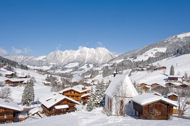
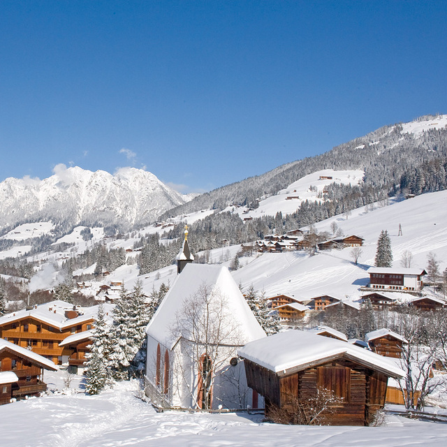
Skigebietsname wird auch Alpbach.geschrieben.
Allgemein 4.2 Basiert auf 22 Abstimmungen und 15 Beurteilungen
Just returned from a five night trip to Alpbach and have to say it was the best skiing holiday we have ever had in 22 years of skiing. We booked independently, flights via Easyjet, Gatwick/Innsbruck, Taxi and Alpbacherhof Hotel and saved a great deal on the Inghams price. The Hotel is excellent, great food, superb Spa area and very friendly and helpful staff. Hotel staff organised the taxi, lift passes etc (who needs a rep?) The ski area was just what we wanted as it was our daughters second skiing holiday and conditions were perfect and she was going down black runs on day 2. Austria has always been our favourite choice but we wanted a change, we read the previous reviews and Alpbach did not disappoint. We will be going back asap.
Phil Yates aus United Kingdom schreibt:
Just returned from a five night trip to Alpbach and have to say it was the best skiing holiday we have ever had in 22 years of skiing.
We booked independently, flights via Easyjet, Gatwick/Innsbruck, Taxi and Alpbacherhof Hotel and saved a great deal on the Inghams price.
The Hotel is excellent, great food, superb Spa area and very friendly and helpful staff. Hotel staff organised the taxi, lift passes etc (who needs a rep?)
The ski area was just what we wanted as it was our daughters second skiing holiday and conditions were perfect and she was going down black runs on day 2.
Austria has always been our favourite choice but we wanted a change, we read the previous reviews and Alpbach did not disappoint.
We will be going back asap.
Lesen Sie 14 andere Beurteilungen ueber Alpbachtal oder geben Sie Ihre eigene Bewertung ab.


 Nearest