

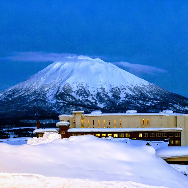
Niseko Announce New Gondola
Niseko Village has confirmed a major lift expansion that will reshape access on the southern side of the Niseko United ski area, with a new gondola scheduled to open next winter and a second stage planned for 2027–28.

Next 3 days weather summary:leichter Regen (gesamt 5.0mm), meistens fallend am Freitag Morg.. Warm (maximal 23°C am Sonntag Morg., min 14°C In der Nacht zu Samstag). Der Wind bleibt meist schwach.. | Tage 4-6 Niseko Grand Hirafu Wetter-ZusammenfassungMeist trocken. Warm (maximal 26°C am Mittwoch Morg., min 14°C in der Nacht zu Montag). Der Wind bleibt meist schwach.. | |||||||||||||||||
Freitag 31 | Samstag 1 | Sonntag 2 | Montag 3 | Dienstag 4 | Mittwoch 5 | |||||||||||||
AM | PM | Nacht | AM | PM | Nacht | AM | PM | Nacht | AM | PM | Nacht | AM | PM | Nacht | AM | PM | Nacht | |
etwas Regen | etwas Regen | bewölkt | etwas Regen | einige Wolken | einige Wolken | einige Wolken | einige Wolken | klar | klar | einige Wolken | einige Wolken | einige Wolken | klar | klar | klar | klar | einige Wolken | |
km/h | ||||||||||||||||||
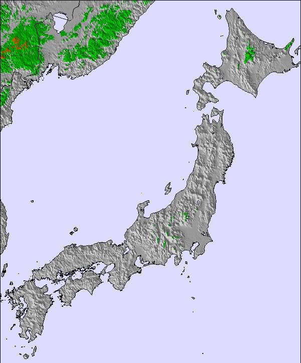
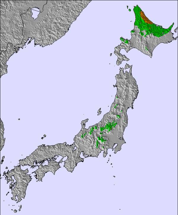
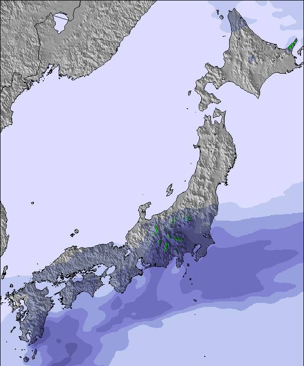
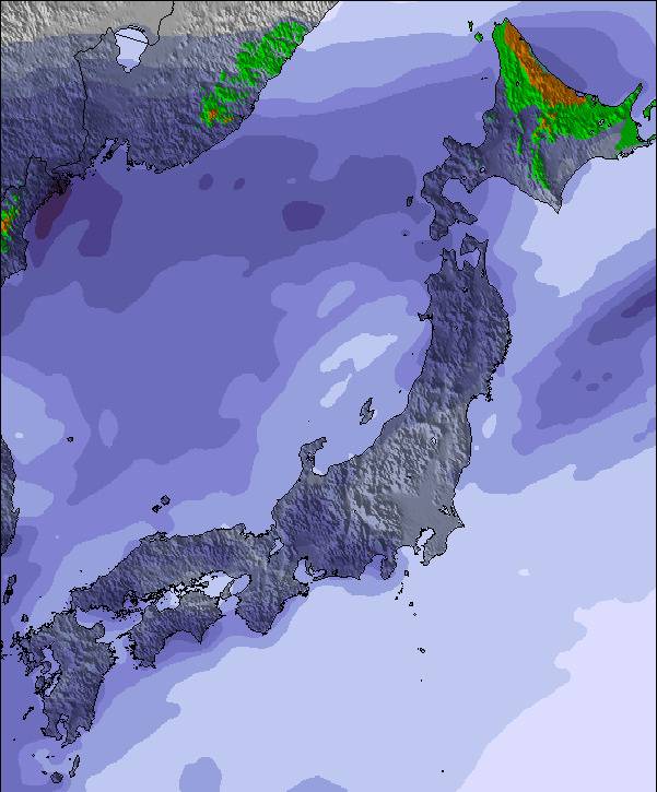
Schnee Karte |  |  |  |  |  |  | ||||||||||||
— | — | — | — | — | — | — | — | — | — | — | — | — | — | — | — | — | — | |
mm | 1 | 2 | — | 2 | — | — | — | — | — | — | — | — | — | — | — | — | — | — |
max °C | 19 | 19 | 17 | 18 | 18 | 16 | 23 | 22 | 16 | 24 | 24 | 16 | 25 | 25 | 17 | 26 | 26 | 19 |
min °C | 18 | 19 | 17 | 18 | 17 | 14 | 20 | 19 | 14 | 21 | 20 | 14 | 21 | 20 | 15 | 23 | 22 | 18 |
chill °C | 18 | 19 | 17 | 18 | 17 | 14 | 20 | 19 | 14 | 21 | 20 | 14 | 21 | 20 | 15 | 23 | 22 | 18 |
Feuchte % | 94 | 92 | 98 | 94 | 91 | 93 | 78 | 74 | 91 | 60 | 57 | 86 | 70 | 58 | 88 | 70 | 66 | 94 |
Gefrierpunkt m | 4350 | 4300 | 4450 | 4150 | 4400 | 4500 | 4650 | 4750 | 5000 | 5100 | 5250 | 5250 | 5150 | 5250 | 5400 | 5400 | 5500 | 5400 |
4:26 | — | — | 4:26 | — | — | 4:28 | — | — | 4:28 | — | — | 4:30 | — | — | 4:31 | — | — | |
— | 7:00 | — | — | 6:58 | — | — | 6:57 | — | — | 6:55 | — | — | 6:54 | — | — | 6:53 | — | |
Werde Profi und carve ein:
Lawineninformationen: Japan Avalanche Network
Letzte Schneeberichte in der Nähe von Niseko Grand Hirafu:
| Die obere Schneetiefe ist: | 0 cm |
|---|---|
| Die untere Schneetiefe ist: | 0 cm |
| Neuschneetiefe Berg | — |
| Wann hat es das letzte Mal geschneit? | 4 May 2026 |
0.0 | Bluebird Powder Tage Frischer Schnee, meist sonnig, leichter Wind. |
|---|---|
0.0 | Pulverschneetage Neuschnee, bewölkt, Wind |
0.0 | Bluebird Tage Schnee, meist sonnig, leichter Wind. |
Die Tabelle oben zeigt die Wettervorhersage für Niseko Grand Hirafu auf der angegebenen Höhe von 256 m. Unsere ausgeklügelten Wettermodelle ermöglichen uns die Schneevorhersage für die Gipfel-, Mittel- und Talstationen für Niseko Grand Hirafu. Das Fenster über der Tabelle ermöglicht das Abrufen der Wettervorhersage für andere Höhen. Für einen umfassenderen Blick auf das Wetter, siehe die Wetterkarte" von Japan.Niseko Grand Hirafu
Klicken Sie hier, um weitere Informationen über Gefrierpunkte zu erhalten und zu lesen wie wir unsere Temperaturen prognostizieren.
Skigebietsname wird auch Niseko Hirafu.geschrieben.
Allgemein 3.9 Basiert auf 81 Abstimmungen und 120 Beurteilungen
My fifth visit to Niseko over the last 17 years. Its changed a lot but not for the better. There is now practically no Japanese experience to be had here. Its overcrowded with all infrastructure lifts/resort restaurants/mountain restaurants/buses/trains packed to the max (the only time I didn't stand on public transport in 2 weeks was on the train from Sapporo to the airport). You will probably get some great snow during your visit but be prepared to queue for it in all aspects of your holiday lifts/eating/getting around and theres a good chance most of the good stuff will be tracked out by lunch (or earlier). It may be me but it seems that they have made it harder to get to other resorts close by, Rusutsu/Moiwa used to be easy public/free transport now it's taxi and a bus or 2 buses. A car is becoming more essential in Niseko just from making getting around less painful. Although it will be chaos if that eventuates, pretty sure parking is not on anyone's list! The old Niseko is gone and the current one is losing its appeal (other than the snow of course)!
Cam aus Australia schreibt:
My fifth visit to Niseko over the last 17 years. Its changed a lot but not for the better. There is now practically no Japanese experience to be had here. Its overcrowded with all infrastructure lifts/resort restaurants/mountain restaurants/buses/trains packed to the max (the only time I didn't stand on public transport in 2 weeks was on the train from Sapporo to the airport). You will probably get some great snow during your visit but be prepared to queue for it in all aspects of your holiday lifts/eating/getting around and theres a good chance most of the good stuff will be tracked out by lunch (or earlier). It may be me but it seems that they have made it harder to get to other resorts close by, Rusutsu/Moiwa used to be easy public/free transport now it's taxi and a bus or 2 buses. A car is becoming more essential in Niseko just from making getting around less painful. Although it will be chaos if that eventuates, pretty sure parking is not on anyone's list! The old Niseko is gone and the current one is losing its appeal (other than the snow of course)!

 Nearest