Herausgegeben on Snow-Forecast.com um:7 am (lokale Zeit) / 02 Aug 2026
Letzte 6 TageScroll links für die letzten 6 TageJetzt
Next 3 days weather summary:
Mäßiger Regen (gesamt 12.0mm), stärkstens am Dienstag Nachm.. Sehr mild (maximal 19°C am Sonntag Nachm., min 13°C in der Nacht zu Dienstag). Der Wind bleibt meist schwach..
Tage 4-6 Mottaret Wetter-Zusammenfassung
starker Regen (gesamt 28.0mm), stärkstens In der Nacht zu Freitag. Sehr mild (maximal 18°C am Mittwoch Nachm., min 12°C am Freitag Morg.). Der Wind bleibt meist schwach..
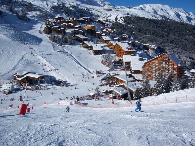
Die Tabelle oben zeigt die Wettervorhersage für Mottaret auf der angegebenen Höhe von 2200 m. Unsere ausgeklügelten Wettermodelle ermöglichen uns die Schneevorhersage für die Gipfel-, Mittel- und Talstationen für Mottaret. Das Fenster über der Tabelle ermöglicht das Abrufen der Wettervorhersage für andere Höhen. Für einen umfassenderen Blick auf das Wetter, siehe die Wetterkarte" von France.Mottaret
Klicken Sie hier, um weitere Informationen über Gefrierpunkte zu erhalten und zu lesen wie wir unsere Temperaturen prognostizieren.
Besucher-Beurteilung fuer Mottaret
Allgemein 4.3 Basiert auf 6 Abstimmungen und 10 Beurteilungen
I have been visiting Mottaret for 10+ years since learning to ski there when I was young.
I have also ski'd in Mayrhofen in Austria, Verbier in Switzerland, Whistler in Canada and Chamonix in France. I can say without question the 3 Valleys and Motteret is second to none!
The sheer size of the ski area is incredible, you can ski all day without having to do any runs twice. My suggestion is plan your day and destination, try and get somewhere different as there are so many places to see and experience with a variety of exciting slopes to ski.
We have an apartment there so I can't say much for the accommodation, however, we have had friends stay and they give very good reviews of the hotels.
It is not cheap; the 3 valleys is the biggest and best ski resort in the world and you'll pay a premium for that, but with it you get the most incredible skiing, stunning views, lovely food and a very accessible resort.
Great for beginners, who can navigate blue runs easily, and also offers plenty for the experienced skier too.
Allgemein: 4.3 Basiert auf 6 Abstimmungen und 10 Beurteilungen
Schneesicher
4.7
Vielfalt der Pisten
4.8
Off Piste
4.4
Landschaft
4.8
Apres-Ski
4.4
James aus United Kingdom schreibt:
I have been visiting Mottaret for 10+ years since learning to ski there when I was young.
I have also ski'd in Mayrhofen in Austria, Verbier in Switzerland, Whistler in Canada and Chamonix in France. I can say without question the 3 Valleys and Motteret is second to none!
The sheer size of the ski area is incredible, you can ski all day without having to do any runs twice. My suggestion is plan your day and destination, try and get somewhere different as there are so many places to see and experience with a variety of exciting slopes to ski.
We have an apartment there so I can't say much for the accommodation, however, we have had friends stay and they give very good reviews of the hotels.
It is not cheap; the 3 valleys is the biggest and best ski resort in the world and you'll pay a premium for that, but with it you get the most incredible skiing, stunning views, lovely food and a very accessible resort.
Great for beginners, who can navigate blue runs easily, and also offers plenty for the experienced skier too.
Kostenlose Snow-Forecast.com Wetter Widget für Ihre Website
Das Mottaret Skiwetter Wideget unten, ist auf externen Seiten kostenlos eigebettet. Es bietet eine tägliche Zusammenfassung über unsere Mottaret Schneevorhersage und derzeitige Wetterbedingungen. gehen Sie einfach auf die Feed-Konfiguration Seite und folgen Sie den 3 einfachen Schritten, um den eigenen HTML-Code-Snippet zu packen und fügen Sie ihn auf Ihrer eigenen Website. Sie können die Höhe der Schneevorhersage wählen (Gipfel, mittel Berg, oder unterer Gipfel) und Messeinheiten metrisch / Schneevorhersage für den Feed auf Ihre eigene Website & hellip anpassen; Klicken Sie hier, um den Code zu bekommen.


 Nearest