Herausgegeben on Snow-Forecast.com um:1 am (lokale Zeit) / 17 Jul 2026
Letzte 6 TageScroll links für die letzten 6 TageJetzt
Next 3 days weather summary:
starker Regen (gesamt 48.0mm), stärkstens währ. Sonntag Nachmittag. Warm (maximal 20°C am Freitag Nachm., min 10°C In der Nacht zu Samstag). Der Wind bleibt meist schwach..
Tage 4-6 Königsleiten Wetter-Zusammenfassung
leichter Regen (gesamt 6.0mm), meistens fallend in der Nacht zu Dienstag. Sehr mild (maximal 18°C am Montag Nachm., min 6°C in der Nacht zu Dienstag). Der Wind bleibt meist schwach..
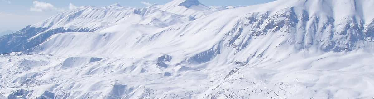
Die Tabelle oben zeigt die Wettervorhersage für Königsleiten auf der angegebenen Höhe von 1300 m. Unsere ausgeklügelten Wettermodelle ermöglichen uns die Schneevorhersage für die Gipfel-, Mittel- und Talstationen für Königsleiten. Das Fenster über der Tabelle ermöglicht das Abrufen der Wettervorhersage für andere Höhen. Für einen umfassenderen Blick auf das Wetter, siehe die Wetterkarte" von Austria.Königsleiten
Klicken Sie hier, um weitere Informationen über Gefrierpunkte zu erhalten und zu lesen wie wir unsere Temperaturen prognostizieren.
Skigebietsname wird auch Konigsleiten.geschrieben.
Besucher-Beurteilung fuer Königsleiten
Allgemein 4.0 Basiert auf 1 Abstimmung und 2 Beurteilungen
At the far end of the magnificent Zillertal Arena you'll find this fantastic ski resort. Although it's purpose built, it stil breathes the typical Austrian "gemütlichkeit"! If you want a less crowdy and noisy village (compared to party town Gerlos, for instance), but still well facilitated, this is the place to be. Après-ski is still possible, with the very cosy Schirmbar (party every night!) and several bars and a discotheque. And if you want to have a nice evening in Gerlos, it is just a 20 minute drive.
It's very suitable for families with kids as well, with the piste in the middle of the village and several ski schools for the youngsters.
Because the village itself is set at 1600m above sea level, snow is assured up until the end of March. From most appartments you can just click on your ski's and glide to the Sonnwendkopfbahn to enter the Zillertal Arena, or the Plattenkogel X-press to the Gerlosplatte (this is a very good option late season, it's on the north side and no direct sun on the slopes). Once in the Z'tal Arena you can make wonderful tours to the Gerlos and Zell am Ziller areas. I've been there twice now and it's a great place to spend your holiday. I will return there for sure!!
Allgemein: 4.0 Basiert auf 1 Abstimmung und 2 Beurteilungen
Schneesicher
4.0
Vielfalt der Pisten
4.0
Off Piste
3.0
Landschaft
5.0
Apres-Ski
3.0
Steven Vogel aus The Netherlands schreibt:
At the far end of the magnificent Zillertal Arena you'll find this fantastic ski resort. Although it's purpose built, it stil breathes the typical Austrian "gemütlichkeit"! If you want a less crowdy and noisy village (compared to party town Gerlos, for instance), but still well facilitated, this is the place to be. Après-ski is still possible, with the very cosy Schirmbar (party every night!) and several bars and a discotheque. And if you want to have a nice evening in Gerlos, it is just a 20 minute drive.
It's very suitable for families with kids as well, with the piste in the middle of the village and several ski schools for the youngsters.
Because the village itself is set at 1600m above sea level, snow is assured up until the end of March. From most appartments you can just click on your ski's and glide to the Sonnwendkopfbahn to enter the Zillertal Arena, or the Plattenkogel X-press to the Gerlosplatte (this is a very good option late season, it's on the north side and no direct sun on the slopes). Once in the Z'tal Arena you can make wonderful tours to the Gerlos and Zell am Ziller areas. I've been there twice now and it's a great place to spend your holiday. I will return there for sure!!
Kostenlose Snow-Forecast.com Wetter Widget für Ihre Website
Das Königsleiten Skiwetter Wideget unten, ist auf externen Seiten kostenlos eigebettet. Es bietet eine tägliche Zusammenfassung über unsere Königsleiten Schneevorhersage und derzeitige Wetterbedingungen. gehen Sie einfach auf die Feed-Konfiguration Seite und folgen Sie den 3 einfachen Schritten, um den eigenen HTML-Code-Snippet zu packen und fügen Sie ihn auf Ihrer eigenen Website. Sie können die Höhe der Schneevorhersage wählen (Gipfel, mittel Berg, oder unterer Gipfel) und Messeinheiten metrisch / Schneevorhersage für den Feed auf Ihre eigene Website & hellip anpassen; Klicken Sie hier, um den Code zu bekommen.


 Nearest