

America’s Next Indoor Snow Centre Takes Shape
Construction of a new indoor snow centre for skiers, boarders and tubers appears to be making good progress at Heritage Farm in Wayne County, West Virginia.

Next 3 days weather summary:Mäßiger Regen (gesamt 11.0mm), stärkstens am Sonntag Nachm.. Warm (maximal 20°C am Montag Nachm., min 9°C in der Nacht zu Dienstag). Der Wind bleibt meist schwach.. | Tage 4-6 Kitzbühel Wetter-ZusammenfassungMäßiger Regen (gesamt 16.0mm), stärkstens am Donnerstag Morg.. Warm (maximal 21°C am Mittwoch Nachm., min 8°C in der Nacht zu Donnerstag). Der Wind bleibt meist schwach.. | ||||||||||||||||
So 19 | Montag 20 | Dienstag 21 | Mittwoch 22 | Donnerstag 23 | Freitag 24 | ||||||||||||
PM | Nacht | AM | PM | Nacht | AM | PM | Nacht | AM | PM | Nacht | AM | PM | Nacht | AM | PM | Nacht | |
Gewitter gefahr | Schauer | einige Wolken | Schauer | Schauer | einige Wolken | etwas Regen | Schauer | einige Wolken | klar | einige Wolken | etwas Regen | Gewitter gefahr | Schauer | klar | klar | klar | |
km/h | |||||||||||||||||
Schnee Karte |  |  |  |  |  |  | |||||||||||
— | — | — | — | — | — | — | — | — | — | — | — | — | — | — | — | — | |
mm | 4 | 2 | — | 2 | 1 | — | 1 | 1 | — | — | — | 4 | 6 | 6 | — | — | — |
max °C | 17 | 15 | 19 | 20 | 16 | 17 | 19 | 14 | 18 | 21 | 16 | 13 | 14 | 12 | 18 | 21 | 16 |
min °C | 15 | 10 | 14 | 20 | 10 | 13 | 16 | 9 | 13 | 21 | 11 | 12 | 13 | 8 | 12 | 21 | 11 |
chill °C | 15 | 10 | 14 | 20 | 10 | 13 | 16 | 9 | 13 | 21 | 11 | 12 | 13 | 8 | 12 | 21 | 11 |
Feuchte % | 77 | 85 | 66 | 55 | 80 | 62 | 67 | 81 | 46 | 37 | 62 | 92 | 85 | 80 | 52 | 35 | 62 |
Gefrierpunkt m | 3300 | 3400 | 3300 | 3300 | 3300 | 3150 | 2950 | 2700 | 3300 | 3150 | 3050 | 2700 | 2850 | 2700 | 3050 | 3100 | 3400 |
— | — | 5:33 | — | — | 5:33 | — | — | 5:35 | — | — | 5:35 | — | — | 5:37 | — | — | |
— | 9:00 | — | — | 8:59 | — | — | 8:58 | — | — | 8:57 | — | — | 8:55 | — | — | 8:54 | |
Werde Profi und carve ein:
Lawineninformationen: European Avalanche Warning Services (EAWS)
Letzte Schneeberichte in der Nähe von Kitzbühel:
| Die obere Schneetiefe ist: | — |
|---|---|
| Die untere Schneetiefe ist: | — |
| Neuschneetiefe Berg | — |
| Wann hat es das letzte Mal geschneit? | 16 May 2026 |
0.0 | Bluebird Powder Tage Frischer Schnee, meist sonnig, leichter Wind. |
|---|---|
0.0 | Pulverschneetage Neuschnee, bewölkt, Wind |
0.0 | Bluebird Tage Schnee, meist sonnig, leichter Wind. |
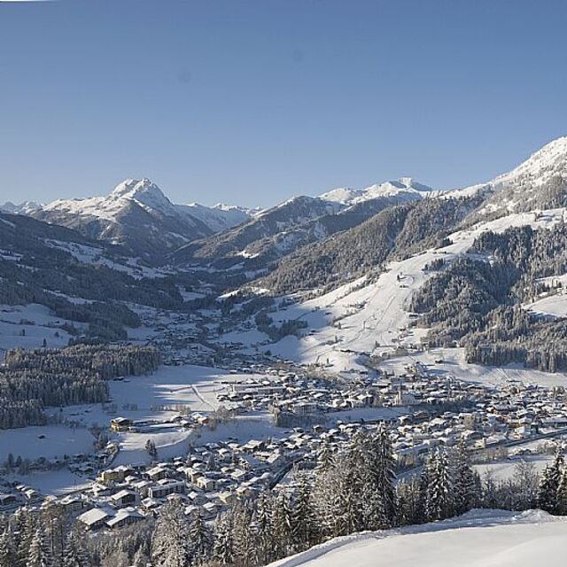
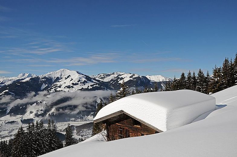
Die Tabelle oben zeigt die Wettervorhersage für Kitzbühel auf der angegebenen Höhe von 800 m. Unsere ausgeklügelten Wettermodelle ermöglichen uns die Schneevorhersage für die Gipfel-, Mittel- und Talstationen für Kitzbühel. Das Fenster über der Tabelle ermöglicht das Abrufen der Wettervorhersage für andere Höhen. Für einen umfassenderen Blick auf das Wetter, siehe die Wetterkarte" von Austria.Kitzbühel
Klicken Sie hier, um weitere Informationen über Gefrierpunkte zu erhalten und zu lesen wie wir unsere Temperaturen prognostizieren.
Skigebietsname wird auch Kitzbuhel.geschrieben.
Allgemein 4.3 Basiert auf 21 Abstimmungen und 26 Beurteilungen
Fancied going here for years so bit the bullet Feb half-term. Normally only ever pick a holiday that's ski in-ski out which isn't really available in Kitzbuel but thought we'd give it a try. Even though we had a locker up at the main gondola (Hannenkaumbahn), so we could walk up, found it all a bit of a pain. The whole ski shop, lift and locker room was just a bit stressful especially with kids in tow. Although there was rarely any lift queue only at 9.30 with the ski schools. Once up on top the pistes and lifts open up a good sizeable area but 3 of the 6 days it was all shrouded in low cloud and visibility was non existent. It was the same in lots of other resorts that week so that's just the way the cookie crumbles. To be honest, the best skiing was over Jochberg where the crowds diminished and the pistes open up or similarly up on the Kitbuelhorn where the crowds were non existent. I found the whole place a bit too busy with average skiing and the worst run back to resort I've been on: a steep wall of ice with beginners floundering all over the place. I've done 30 years skiing and still found the return journey at the end of the day nerve wracking. So much so, I came down in the gondola on the descent of shame to avoid the stress. You can forget about a good ski down the Hannenkaum downhill also because they don't piste the Streif making it virtually unskiable to most people. The town is beautiful but don't try shopping as the shops are high end. Nice week but choosing somewhere a bit more laid back where I can ski into the boot room next year.
chris roberts aus United Kingdom schreibt:
Fancied going here for years so bit the bullet Feb half-term. Normally only ever pick a holiday that's ski in-ski out which isn't really available in Kitzbuel but thought we'd give it a try. Even though we had a locker up at the main gondola (Hannenkaumbahn), so we could walk up, found it all a bit of a pain. The whole ski shop, lift and locker room was just a bit stressful especially with kids in tow. Although there was rarely any lift queue only at 9.30 with the ski schools. Once up on top the pistes and lifts open up a good sizeable area but 3 of the 6 days it was all shrouded in low cloud and visibility was non existent. It was the same in lots of other resorts that week so that's just the way the cookie crumbles. To be honest, the best skiing was over Jochberg where the crowds diminished and the pistes open up or similarly up on the Kitbuelhorn where the crowds were non existent. I found the whole place a bit too busy with average skiing and the worst run back to resort I've been on: a steep wall of ice with beginners floundering all over the place. I've done 30 years skiing and still found the return journey at the end of the day nerve wracking. So much so, I came down in the gondola on the descent of shame to avoid the stress. You can forget about a good ski down the Hannenkaum downhill also because they don't piste the Streif making it virtually unskiable to most people. The town is beautiful but don't try shopping as the shops are high end. Nice week but choosing somewhere a bit more laid back where I can ski into the boot room next year.
Lesen Sie 25 andere Beurteilungen ueber Kitzbühel oder geben Sie Ihre eigene Bewertung ab.


 Nearest