Herausgegeben on Snow-Forecast.com um:7 am (lokale Zeit) / 16 Jul 2026
Letzte 6 TageScroll links für die letzten 6 TageJetzt
Next 3 days weather summary:
starker Regen (gesamt 22.0mm), stärkstens währ. Freitag Nachm.. Milde Temperaturen (maximal 9°C am Donnerstag Nachm., min 2°C In der Nacht zu Samstag). Der Wind bleibt meist schwach..
Tage 4-6 Kaprun Wetter-Zusammenfassung
Mild mit leichtem Regen (gesamt 5.0mm) am Sonntag Nachm. kälter mit leichtem Schneebestreuung, fallend meistens am Sonntag Nachm.. Frost-Tau-Bedingungen (maximal 3°C am Sonntag Morg., min -3°C in der Nacht zu Dienstag). Wind abnehmend (frische Winde aus NW in der Nacht zu Sonntag, Windstille bis Montag Nacht).
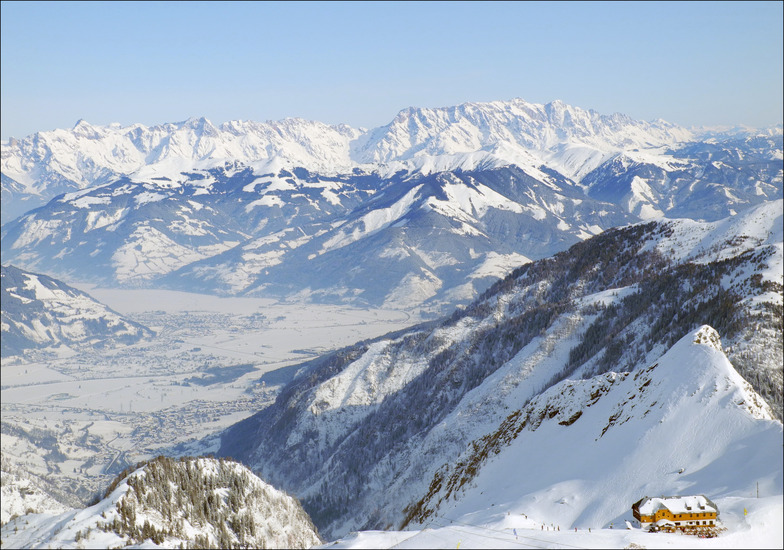
Die Tabelle oben zeigt die Wettervorhersage für Kaprun auf der angegebenen Höhe von 3029 m. Unsere ausgeklügelten Wettermodelle ermöglichen uns die Schneevorhersage für die Gipfel-, Mittel- und Talstationen für Kaprun. Das Fenster über der Tabelle ermöglicht das Abrufen der Wettervorhersage für andere Höhen. Für einen umfassenderen Blick auf das Wetter, siehe die Wetterkarte" von Austria.Kaprun
Klicken Sie hier, um weitere Informationen über Gefrierpunkte zu erhalten und zu lesen wie wir unsere Temperaturen prognostizieren.
Besucher-Beurteilung fuer Kaprun
Allgemein 4.2 Basiert auf 28 Abstimmungen und 29 Beurteilungen
We have been coming here for 4 years now and it just gets better. 2019 season here we come! So much to do, so many ski areas within 5 minutes or max 30 mins from Kaprun center if you want a change: Zell am See, Saalbach- Hinterglemm and Kaprun. This is a lovely village with great restaurants and bars plus lovely people. Zell close for nightlife if wanted (the bars in Kaprun can be pretty lively).
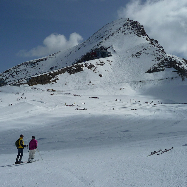
Always snow sure with the glacier (Kitzsteinhorn). We love a day on Maiskogel and with the new gondola it's easy for non-skier and beginners (no manoeuvring off the chair lift - lol). Agree with others that it's more beginner-intermediate. But that's what I am and I ski with a replaced hip so I avoid blacks anyway as I don't want anything too challenging :)
Allgemein: 4.2 Basiert auf 28 Abstimmungen und 29 Beurteilungen
Schneesicher
4.9
Vielfalt der Pisten
4.1
Off Piste
3.6
Landschaft
4.4
Apres-Ski
4.0
Alison aus United Kingdom schreibt:
We have been coming here for 4 years now and it just gets better. 2019 season here we come! So much to do, so many ski areas within 5 minutes or max 30 mins from Kaprun center if you want a change: Zell am See, Saalbach- Hinterglemm and Kaprun. This is a lovely village with great restaurants and bars plus lovely people. Zell close for nightlife if wanted (the bars in Kaprun can be pretty lively).
Always snow sure with the glacier (Kitzsteinhorn). We love a day on Maiskogel and with the new gondola it's easy for non-skier and beginners (no manoeuvring off the chair lift - lol). Agree with others that it's more beginner-intermediate. But that's what I am and I ski with a replaced hip so I avoid blacks anyway as I don't want anything too challenging :)
Kostenlose Snow-Forecast.com Wetter Widget für Ihre Website
Das Kaprun Skiwetter Wideget unten, ist auf externen Seiten kostenlos eigebettet. Es bietet eine tägliche Zusammenfassung über unsere Kaprun Schneevorhersage und derzeitige Wetterbedingungen. gehen Sie einfach auf die Feed-Konfiguration Seite und folgen Sie den 3 einfachen Schritten, um den eigenen HTML-Code-Snippet zu packen und fügen Sie ihn auf Ihrer eigenen Website. Sie können die Höhe der Schneevorhersage wählen (Gipfel, mittel Berg, oder unterer Gipfel) und Messeinheiten metrisch / Schneevorhersage für den Feed auf Ihre eigene Website & hellip anpassen; Klicken Sie hier, um den Code zu bekommen.


 Nearest