

Portillo Storm Snowfall Total Passes 5m / 17 Feet
A snow storm that has now continued for nine days has taken Chilean ski resort Portillo to a snowfall total of 5.2 metres (17 feet) so far, with more snow forecast.

Next 3 days weather summary:Mäßiger Regen (gesamt 16.0mm), stärkstens in der Nacht zu Mittwoch. Warm (maximal 23°C am Dienstag Nachm., min 13°C am Montag Morg.). Der Wind bleibt meist schwach.. | Tage 4-6 Hochjoch-Schruns Wetter-Zusammenfassungstarker Regen (gesamt 28.0mm), stärkstens währ. der Nacht zu Freitag. Warm (maximal 28°C am Freitag Nachm., min 16°C in der Nacht zu Freitag). Der Wind bleibt meist schwach.. | |||||||||||||||||
Montag 27 | Dienstag 28 | Mittwoch 29 | Donnerstag 30 | Freitag 31 | Samstag 1 | |||||||||||||
AM | PM | Nacht | AM | PM | Nacht | AM | PM | Nacht | AM | PM | Nacht | AM | PM | Nacht | AM | PM | Nacht | |
Schauer | Schauer | einige Wolken | klar | klar | klar | Gewitter gefahr | Gewitter gefahr | Schauer | klar | klar | klar | klar | klar | starker Regen | Gewitter gefahr | Gewitter gefahr | Schauer | |
km/h | ||||||||||||||||||
Schnee Karte |  |  |  |  |  |  | ||||||||||||
— | — | — | — | — | — | — | — | — | — | — | — | — | — | — | — | — | — | |
mm | 2 | 2 | — | — | — | — | 2 | 3 | 7 | — | — | — | — | — | 12 | 1 | 7 | 8 |
max °C | 15 | 18 | 15 | 19 | 23 | 20 | 21 | 23 | 20 | 24 | 26 | 25 | 26 | 28 | 17 | 20 | 22 | 17 |
min °C | 13 | 17 | 13 | 15 | 22 | 18 | 19 | 23 | 18 | 20 | 26 | 21 | 22 | 28 | 16 | 18 | 21 | 17 |
chill °C | 13 | 17 | 13 | 15 | 22 | 18 | 19 | 23 | 18 | 20 | 26 | 21 | 22 | 28 | 16 | 18 | 21 | 17 |
Feuchte % | 71 | 60 | 76 | 50 | 38 | 64 | 55 | 48 | 43 | 29 | 23 | 32 | 27 | 24 | 68 | 59 | 63 | 65 |
Gefrierpunkt m | 3700 | 3950 | 4400 | 4550 | 4600 | 4450 | 4350 | 4500 | 4400 | 4500 | 4700 | 4700 | 4700 | 4850 | 4450 | 4350 | 4400 | 4500 |
5:52 | — | — | 5:52 | — | — | 5:54 | — | — | 5:56 | — | — | 5:56 | — | — | 5:58 | — | — | |
— | — | 9:00 | — | — | 8:59 | — | — | 8:57 | — | — | 8:55 | — | — | 8:54 | — | — | 8:52 | |
Werde Profi und carve ein:
Lawineninformationen: European Avalanche Warning Services (EAWS)
Letzte Schneeberichte in der Nähe von Hochjoch-Schruns:
| Die obere Schneetiefe ist: | — |
|---|---|
| Die untere Schneetiefe ist: | — |
| Neuschneetiefe Berg | — |
| Wann hat es das letzte Mal geschneit? | 16 May 2026 |
0.0 | Bluebird Powder Tage Frischer Schnee, meist sonnig, leichter Wind. |
|---|---|
0.0 | Pulverschneetage Neuschnee, bewölkt, Wind |
0.0 | Bluebird Tage Schnee, meist sonnig, leichter Wind. |
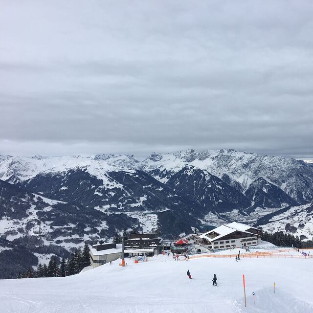
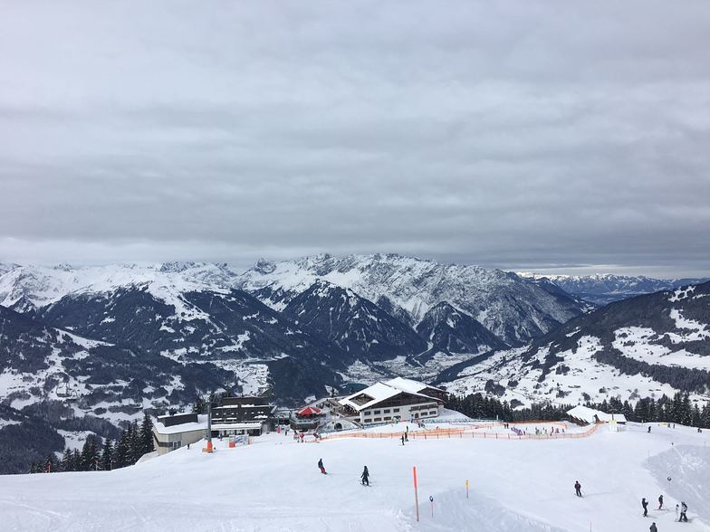
Die Tabelle oben zeigt die Wettervorhersage für Hochjoch-Schruns auf der angegebenen Höhe von 1540 m. Unsere ausgeklügelten Wettermodelle ermöglichen uns die Schneevorhersage für die Gipfel-, Mittel- und Talstationen für Hochjoch-Schruns. Das Fenster über der Tabelle ermöglicht das Abrufen der Wettervorhersage für andere Höhen. Für einen umfassenderen Blick auf das Wetter, siehe die Wetterkarte" von Austria.Hochjoch-Schruns
Klicken Sie hier, um weitere Informationen über Gefrierpunkte zu erhalten und zu lesen wie wir unsere Temperaturen prognostizieren.
Allgemein 4.5 Basiert auf 4 Abstimmungen und 2 Beurteilungen
I have been travelling to the Montafon valley, to ski with my family, for the past 10 years. When we started, it was very unusual to hear another English or Irish speaking person there. Amazingly, it's still rare enough! The Montafon valley has a huge variety of ski areas available with first-class facilities. Schruns is a lovely town and although it is not as "manic" as other ski resorts, when it comes to night-life, you can still find enough entertainment and excellent restaurants in the town itself and within a short drive/bus journey. It's Austria's best-kept ski resort secret!
M/ McAllister aus Ireland schreibt:
I have been travelling to the Montafon valley, to ski with my family, for the past 10 years. When we started, it was very unusual to hear another English or Irish speaking person there. Amazingly, it's still rare enough!
The Montafon valley has a huge variety of ski areas available with first-class facilities. Schruns is a lovely town and although it is not as "manic" as other ski resorts, when it comes to night-life, you can still find enough entertainment and excellent restaurants in the town itself and within a short drive/bus journey.
It's Austria's best-kept ski resort secret!
Lesen Sie 1 andere Beurteilungen ueber Hochjoch-Schruns oder geben Sie Ihre eigene Bewertung ab.


 Nearest