Herausgegeben on Snow-Forecast.com um:1 am (lokale Zeit) / 15 Jul 2026
Letzte 6 TageScroll links für die letzten 6 TageJetzt
Next 3 days weather summary:
starker Regen (gesamt 35.0mm), stärkstens In der Nacht zu Mittwoch. Warm (maximal 27°C am Mittwoch Nachm., min 13°C in der Nacht zu Freitag). Der Wind bleibt meist schwach..
Tage 4-6 Courchevel Wetter-Zusammenfassung
leichter Regen (gesamt 8.0mm), meistens fallend in der Nacht zu Sonntag. Warm (maximal 24°C am Montag Nachm., min 13°C In der Nacht zu Samstag). Der Wind bleibt meist schwach..
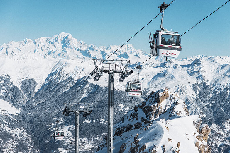
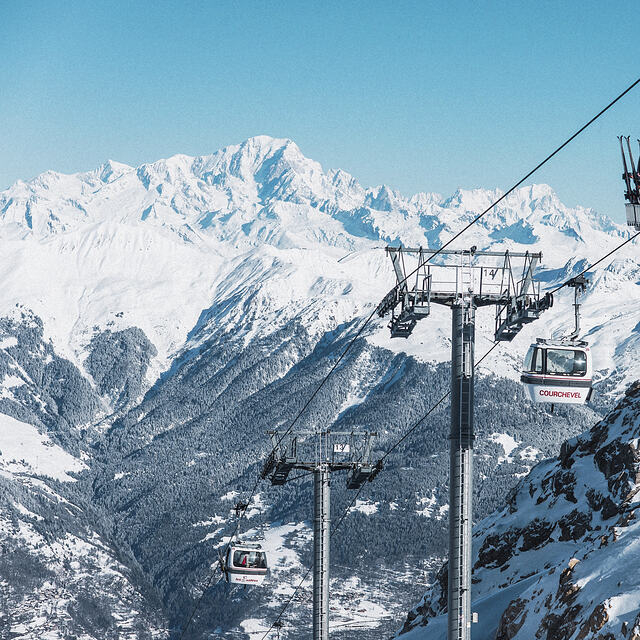
Die Tabelle oben zeigt die Wettervorhersage für Courchevel auf der angegebenen Höhe von 1338 m. Unsere ausgeklügelten Wettermodelle ermöglichen uns die Schneevorhersage für die Gipfel-, Mittel- und Talstationen für Courchevel. Das Fenster über der Tabelle ermöglicht das Abrufen der Wettervorhersage für andere Höhen. Für einen umfassenderen Blick auf das Wetter, siehe die Wetterkarte" von France.Courchevel
Klicken Sie hier, um weitere Informationen über Gefrierpunkte zu erhalten und zu lesen wie wir unsere Temperaturen prognostizieren.
Besucher-Beurteilung fuer Courchevel
Allgemein 4.3 Basiert auf 68 Abstimmungen und 68 Beurteilungen
We stayed in Courchevel 1650 (Moriond) and had a great time. It's at the far left end of the piste map and with very changeable weather we didn't make it as far as Val Thorens or Les Minueires but we did have one run down to St Martin. If you are planning a big ranging day from 1650, it's worth getting one of the very regular buses up to 1850 where the Verdons then Viselle or Saulire lifts will drop you over Meribel really quickly. Otherwise, 1650s ageing Arondinaz bubble will slowly get you above some lifts to take you to the same place.
The skiing above 1650 is great with gentle wide blues, a few greens and a few good reds; all with great views. One thing to note, the Vallee des Avals accessible from here with a short hike is a great adventure but quite a serious avalanche risk (the clue's in the name) so take a guide if unsure. It's also got a longish hike at the bottom back to the lifts. The rest of the skiing in Courchevel and the 3 vallees is as good as everyone says. We went in the last of the French half term weeks and found a fair bit of piste-side powder although it was snowing a lot! Queues in the Courchevel valley were very short but the Chaudanne in Meribel was really packed at times. Mottaret seemed easier to get through.
The village itself is cute enough but not Austrian chocolate box perfection. There are some good bars and our favourite was the Schuss Bar over the road from the bubble. Prices in 1650 are fairly high (7 euros for a pint) but not as bad as we'd feared. It's definitely not going after the same brash loaded crowd as 1850.
Allgemein: 4.3 Basiert auf 68 Abstimmungen und 68 Beurteilungen
Schneesicher
4.6
Vielfalt der Pisten
4.9
Off Piste
4.3
Landschaft
4.4
Apres-Ski
4.4
Martin Dore aus United Kingdom schreibt:
We stayed in Courchevel 1650 (Moriond) and had a great time. It's at the far left end of the piste map and with very changeable weather we didn't make it as far as Val Thorens or Les Minueires but we did have one run down to St Martin. If you are planning a big ranging day from 1650, it's worth getting one of the very regular buses up to 1850 where the Verdons then Viselle or Saulire lifts will drop you over Meribel really quickly. Otherwise, 1650s ageing Arondinaz bubble will slowly get you above some lifts to take you to the same place.
The skiing above 1650 is great with gentle wide blues, a few greens and a few good reds; all with great views. One thing to note, the Vallee des Avals accessible from here with a short hike is a great adventure but quite a serious avalanche risk (the clue's in the name) so take a guide if unsure. It's also got a longish hike at the bottom back to the lifts. The rest of the skiing in Courchevel and the 3 vallees is as good as everyone says. We went in the last of the French half term weeks and found a fair bit of piste-side powder although it was snowing a lot! Queues in the Courchevel valley were very short but the Chaudanne in Meribel was really packed at times. Mottaret seemed easier to get through.
The village itself is cute enough but not Austrian chocolate box perfection. There are some good bars and our favourite was the Schuss Bar over the road from the bubble. Prices in 1650 are fairly high (7 euros for a pint) but not as bad as we'd feared. It's definitely not going after the same brash loaded crowd as 1850.
Kostenlose Snow-Forecast.com Wetter Widget für Ihre Website
Das Courchevel Skiwetter Wideget unten, ist auf externen Seiten kostenlos eigebettet. Es bietet eine tägliche Zusammenfassung über unsere Courchevel Schneevorhersage und derzeitige Wetterbedingungen. gehen Sie einfach auf die Feed-Konfiguration Seite und folgen Sie den 3 einfachen Schritten, um den eigenen HTML-Code-Snippet zu packen und fügen Sie ihn auf Ihrer eigenen Website. Sie können die Höhe der Schneevorhersage wählen (Gipfel, mittel Berg, oder unterer Gipfel) und Messeinheiten metrisch / Schneevorhersage für den Feed auf Ihre eigene Website & hellip anpassen; Klicken Sie hier, um den Code zu bekommen.


 Nearest