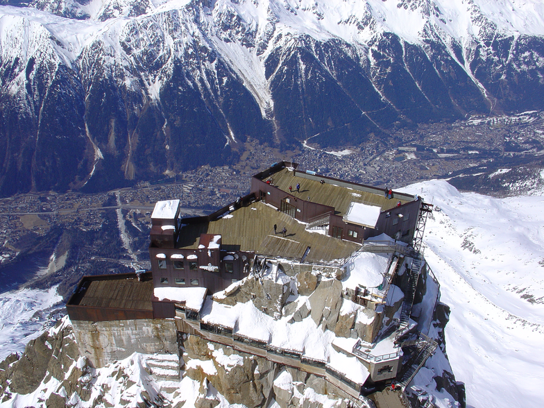

Freeride Added To 2030 Olympic Winter Games
The IOC has today announced a swathe of decisions ahead of the Alpes 2030 Winter Olympics and Paralympics in the French Alps.

Next 3 days weather summary:starker Regen (gesamt 21.0mm), stärkstens In der Nacht zu Freitag. Warm (maximal 28°C am Donnerstag Nachm., min 15°C In der Nacht zu Samstag). Der Wind bleibt meist schwach.. | Tage 4-6 Chamonix Wetter-Zusammenfassungleichter Regen (gesamt 2.0mm), meistens fallend am Sonntag Nachm.. Warm (maximal 23°C am Montag Nachm., min 12°C in der Nacht zu Montag). Der Wind bleibt meist schwach.. | ||||||||||||||||
Do 16 | Freitag 17 | Samstag 18 | Sonntag 19 | Montag 20 | Dienstag 21 | ||||||||||||
PM | Nacht | AM | PM | Nacht | AM | PM | Nacht | AM | PM | Nacht | AM | PM | Nacht | AM | PM | Nacht | |
bewölkt | Schauer | Gewitter gefahr | einige Wolken | Schauer | Gewitter gefahr | Schauer | Schauer | klar | Schauer | klar | einige Wolken | einige Wolken | klar | klar | klar | klar | |
km/h | |||||||||||||||||
Schnee Karte |  |  |  |  |  |  | |||||||||||
— | — | — | — | — | — | — | — | — | — | — | — | — | — | — | — | — | |
mm | — | 9 | 2 | — | 6 | 2 | 1 | 1 | — | 2 | — | — | — | — | — | — | — |
max °C | 28 | 23 | 24 | 26 | 20 | 21 | 23 | 20 | 21 | 21 | 19 | 21 | 23 | 20 | 19 | 21 | 19 |
min °C | 27 | 16 | 18 | 26 | 16 | 18 | 22 | 15 | 18 | 21 | 13 | 17 | 23 | 12 | 15 | 21 | 12 |
chill °C | 27 | 16 | 18 | 26 | 16 | 18 | 22 | 15 | 18 | 21 | 13 | 17 | 23 | 12 | 15 | 21 | 12 |
Feuchte % | 37 | 57 | 50 | 38 | 66 | 56 | 48 | 67 | 46 | 53 | 72 | 44 | 35 | 58 | 44 | 41 | 57 |
Gefrierpunkt m | 4400 | 4250 | 4100 | 4350 | 4000 | 3750 | 3900 | 3750 | 3600 | 3750 | 3850 | 3650 | 3800 | 3750 | 3500 | 3650 | 3950 |
— | — | 5:58 | — | — | 5:58 | — | — | 6:00 | — | — | 6:01 | — | — | 6:01 | — | — | |
— | 9:19 | — | — | 9:17 | — | — | 9:16 | — | — | 9:15 | — | — | 9:15 | — | — | 9:15 | |
Werde Profi und carve ein:
Lawineninformationen: European Avalanche Warning Services (EAWS)
Letzte Schneeberichte in der Nähe von Chamonix:
| Die obere Schneetiefe ist: | — |
|---|---|
| Die untere Schneetiefe ist: | — |
| Neuschneetiefe Berg | — |
| Wann hat es das letzte Mal geschneit? | 10 Jun 2026 |
0.0 | Bluebird Powder Tage Frischer Schnee, meist sonnig, leichter Wind. |
|---|---|
0.0 | Pulverschneetage Neuschnee, bewölkt, Wind |
0.0 | Bluebird Tage Schnee, meist sonnig, leichter Wind. |
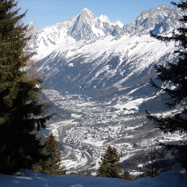
Die Tabelle oben zeigt die Wettervorhersage für Chamonix auf der angegebenen Höhe von 1037 m. Unsere ausgeklügelten Wettermodelle ermöglichen uns die Schneevorhersage für die Gipfel-, Mittel- und Talstationen für Chamonix. Das Fenster über der Tabelle ermöglicht das Abrufen der Wettervorhersage für andere Höhen. Für einen umfassenderen Blick auf das Wetter, siehe die Wetterkarte" von France.Chamonix
Klicken Sie hier, um weitere Informationen über Gefrierpunkte zu erhalten und zu lesen wie wir unsere Temperaturen prognostizieren.
Allgemein 4.1 Basiert auf 56 Abstimmungen und 92 Beurteilungen
If you want a idyllic mountain experience, forget Chamonix. If you like loud techno sound all night long on the streets, then Chamonix is perfect. For me I hated it. Will never come back! Worst experience ever.
JJ widman aus France schreibt:
If you want a idyllic mountain experience, forget Chamonix. If you like loud techno sound all night long on the streets, then Chamonix is perfect. For me I hated it. Will never come back! Worst experience ever.
Lesen Sie 91 andere Beurteilungen ueber Chamonix oder geben Sie Ihre eigene Bewertung ab.


 Nearest