Ein Besuch in Lungötz
Nützliche Informationen über Skigebiete, die Ihnen bei der Planung Ihrer Reise nach %{resort_name} helfen.
- Saison beginnt—
- Saison endet—
- Unterkunft—
- Restaurants | Bars— | —
- Nächster Flughafen —
- Nächster Bahnhof —
- Skigebiet Info-Website
- Infotelefon+43 06243404057
- Lawineninformationen:
Merkmale Lungötz
Das Gelände in Lungötz umfasst:
- Halfpipes—
- Terrainparks—
- Langlauf—
- Skiverleih—
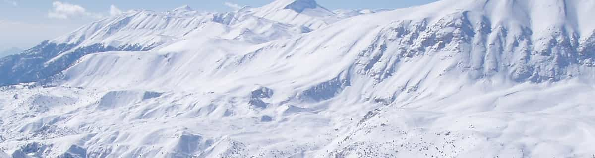
Wie sieht es in Lungötz aus?
Lungötz is part of the Dachstein West ski area which is in the Salzburg region of Austria. The village sits next to another ski field in the area: Annaberg. They are both connected to Gosau and Russback. Lungötz has 73 metres (240 feet) of vertical descent. We have no information about the existence of any cross country ski trails at Lungötz. Any suggestions to add to our notes about Annaberg-Lungötz are welcome.
Lungötz entdecken – Lageplan
Interaktive Wanderkarte und Pistenplan für Lungötz. Für Ihre Tourenplanung sehen Sie Pisten und Wanderwege sowie Umrisse des Geländes und der Berge in der Umgebung.

In welchem Monat gibt es am meisten Schnee in Lungötz?
Wie ist der Schnee derzeit in Lungötz?
Eine Zusammenfassung der aktuellen Schneeverhältnisse in Lungötz. Weitere Informationen über Lungötz Seite detaillierter Schneebericht.
- Pistenbedingungen—
- Bedingungen jenseits der Pisten—

| Schneetiefe in Höhenlage: | ||
|---|---|---|
| Schneetiefe Tal: | ||
Besucher-Beurteilung fuer Lungötz
Louise Dunn aus Austria schreibt:
Annaberg (Annaberg-Lungötz) is a quaint village adjoined to the Dachstein West Ski Region which has over 140 km of groomed slopes connecting it to the villages of Russbach & Gosau. The ski area is quite stunning with views of the Hoher Dachstein, at 3004m, and it's glacier and lake below. It has a new ski school and slopes to suit people of all abilities. A family friendly resort which offers some superb off-piste, border parks & 130km of cross-country ski trails. This ski area is a hidden gem to which many visitors return year after year.
Klicken Sie hier um Ihre eigene Beurteilung über Lungötz abzugeben
Skiorte in der Nähe von Lungötz
Entdecken Sie Skiorte in der Nähe von Lungötz. Klicken Sie unten, um die jeweiligen Reiseführer für Skiorte anzuzeigen
 WagrainLetzter Schnee: 12.0 cm Wed 10 Jun
 Skilifte: 18
 Pisten: —5 km entfernt
- St Johann-AlpendorfLetzter Schnee: 12.0 cm Wed 10 JunSkilifte: 3Pisten: —6 km entfernt
- Flachauwinkl-KleinarlLetzter Schnee: 13.0 cm Wed 10 JunSkilifte: 9Pisten: —7 km entfernt
- Grossarl-DorfgasteinLetzter Schnee: 13.0 cm Wed 10 JunSkilifte: 17Pisten: 149 km entfernt
- Flachau-ReitdorfLetzter Schnee: 12.0 cm Wed 10 JunSkilifte: 13Pisten: 1511 km entfernt
 Nearest