Herausgegeben on Snow-Forecast.com um:1 am (lokale Zeit) / 15 Jul 2026
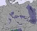
Letzte 6 TageScroll links für die letzten 6 TageJetzt
Next 3 days weather summary:
Mäßiger Regen (gesamt 13.0mm), stärkstens am Mittwoch Nachm.. Warm (maximal 23°C am Freitag Nachm., min 14°C in der Nacht zu Freitag). Wind zunehmend (Windstille in der Nacht zu Mittwoch, frische Winde aus Westen bis Freitag Nacht).
Tage 4-6 Zieleniec Wetter-Zusammenfassung
leichter Regen (gesamt 2.0mm), meistens fallend am Samstag Morgen. Sehr mild (maximal 19°C am Samstag Nachm., min 11°C in der Nacht zu Sonntag). Der Wind bleibt meist schwach..
Die Tabelle oben zeigt die Wettervorhersage für Zieleniec auf der angegebenen Höhe von 935 m. Unsere ausgeklügelten Wettermodelle ermöglichen uns die Schneevorhersage für die Gipfel-, Mittel- und Talstationen für Zieleniec. Das Fenster über der Tabelle ermöglicht das Abrufen der Wettervorhersage für andere Höhen. Für einen umfassenderen Blick auf das Wetter, siehe die Wetterkarte" von Poland.Zieleniec
Klicken Sie hier, um weitere Informationen über Gefrierpunkte zu erhalten und zu lesen wie wir unsere Temperaturen prognostizieren.
Besucher-Beurteilung fuer Zieleniec
Allgemein 2.5 Basiert auf 10 Abstimmungen und 3 Beurteilungen
Zieleniec is a great resort for learner and beginner skiers/boarders. It's also good for more experienced riders looking to break in the legs prior to a real holiday. They have two new chairlifts built in 2008 making three in total and plenty of other drags accessing many other runs. Basically the whole resort is on one side of a hill, Czech Republic being the other side.
Zieleniec has a surprisingly decent snow park near the church at the bottom and three big air hits on the first run as you drive in to resort, a 5, 10 and 15 m hit, they're not too user friendly but there if you have the skills. The drag lift accessing these is only open on weekends. They dug out a Half pipe in 2008, this should be open for the 09/10 season.
Due to the unreliable climate in Poland snow conditions vary considerably.
Allgemein: 2.5 Basiert auf 10 Abstimmungen und 3 Beurteilungen
Schneesicher
2.4
Vielfalt der Pisten
2.8
Apres-Ski
2.4
Kunstschnee
2.4
Erweitert
2.4
The Dude aus United Kingdom schreibt:
Zieleniec is a great resort for learner and beginner skiers/boarders. It's also good for more experienced riders looking to break in the legs prior to a real holiday. They have two new chairlifts built in 2008 making three in total and plenty of other drags accessing many other runs. Basically the whole resort is on one side of a hill, Czech Republic being the other side.
Zieleniec has a surprisingly decent snow park near the church at the bottom and three big air hits on the first run as you drive in to resort, a 5, 10 and 15 m hit, they're not too user friendly but there if you have the skills. The drag lift accessing these is only open on weekends. They dug out a Half pipe in 2008, this should be open for the 09/10 season.
Due to the unreliable climate in Poland snow conditions vary considerably.
Kostenlose Snow-Forecast.com Wetter Widget für Ihre Website
Das Zieleniec Skiwetter Wideget unten, ist auf externen Seiten kostenlos eigebettet. Es bietet eine tägliche Zusammenfassung über unsere Zieleniec Schneevorhersage und derzeitige Wetterbedingungen. gehen Sie einfach auf die Feed-Konfiguration Seite und folgen Sie den 3 einfachen Schritten, um den eigenen HTML-Code-Snippet zu packen und fügen Sie ihn auf Ihrer eigenen Website. Sie können die Höhe der Schneevorhersage wählen (Gipfel, mittel Berg, oder unterer Gipfel) und Messeinheiten metrisch / Schneevorhersage für den Feed auf Ihre eigene Website & hellip anpassen; Klicken Sie hier, um den Code zu bekommen.


 Nearest