Letzte 6 TageScroll links für die letzten 6 TageJetzt
Next 4 days weather summary:
starker Regen (gesamt 48.0mm), stärkstens währ. Freitag Morgen.. Warm (maximal 20°C am Donnerstag Nachm., min 7°C in der Nacht zu Freitag). Der Wind bleibt meist schwach..
Tage 5-7 Thyon-Printze Wetter-Zusammenfassung
leichter Regen (gesamt 7.0mm), meistens fallend In der Nacht zu Samstag. Sehr mild (maximal 15°C am Montag Nachm., min 5°C in der Nacht zu Montag). Der Wind bleibt meist schwach..
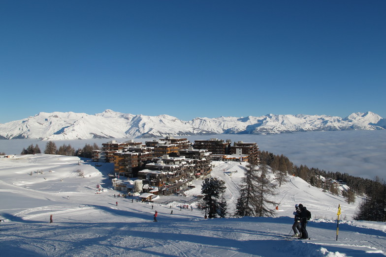
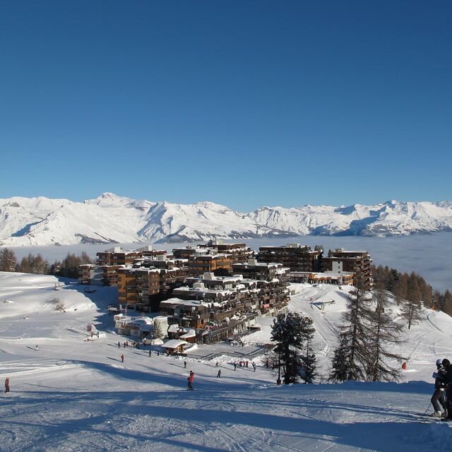
Die Tabelle oben zeigt die Wettervorhersage für Thyon-Printze auf der angegebenen Höhe von 2090 m. Unsere ausgeklügelten Wettermodelle ermöglichen uns die Schneevorhersage für die Gipfel-, Mittel- und Talstationen für Thyon-Printze. Das Fenster über der Tabelle ermöglicht das Abrufen der Wettervorhersage für andere Höhen. Für einen umfassenderen Blick auf das Wetter, siehe die Wetterkarte" von Switzerland.Thyon-Printze
Klicken Sie hier, um weitere Informationen über Gefrierpunkte zu erhalten und zu lesen wie wir unsere Temperaturen prognostizieren.
Besucher-Beurteilung fuer Thyon-Printze
Allgemein 3.9 Basiert auf 14 Abstimmungen und 6 Beurteilungen
We bought a chalet in Les Masses in 2003 and couldn't believe our luck in having a ski-in/ski-out home from home right next to the lifts. Over the years the resort has kept improving with a new lift for the Etherolla run in 2008 or so and the new Les Masses lift opening this year.
Generally speaking, the resort offers great skiing for all levels. Snow is usually guaranteed from the beginning of December until April and a few years I have been skiing around the 20th, although that is rare. I am an advanced skier and when it snows hard there are always loads of off-piste options and if we want to travel a bit further we can be sat eating lunch in Verbier 75 mins after walking out of our front door. We normally buy a 'Thyon-Printze' pass and buy the Verbier add-on when we go over as to go there every day defeats the object and misses all the good skiing and some great trails in between. Now that we have young children to teach, the ski-schools operate from Les Masses and Les Collons, but I think there may prove to be a shortage of blue and green runs so they'd better learn fast!!
The one area where this area is lacking is off the slopes. There are precious few restaurants and you have to seek the best ones out. Also, most require you to drive to them as the chalets and resort is quite spread out. There are signs of it improving and hopefully the Swiss will avoid the pitfalls of over-development as this is a real jewel.
Allgemein: 3.9 Basiert auf 14 Abstimmungen und 6 Beurteilungen
Schneesicher
4.8
Vielfalt der Pisten
4.7
Off Piste
3.9
Landschaft
4.4
Apres-Ski
2.8
Andrew aus United Kingdom schreibt:
We bought a chalet in Les Masses in 2003 and couldn't believe our luck in having a ski-in/ski-out home from home right next to the lifts. Over the years the resort has kept improving with a new lift for the Etherolla run in 2008 or so and the new Les Masses lift opening this year.
Generally speaking, the resort offers great skiing for all levels. Snow is usually guaranteed from the beginning of December until April and a few years I have been skiing around the 20th, although that is rare. I am an advanced skier and when it snows hard there are always loads of off-piste options and if we want to travel a bit further we can be sat eating lunch in Verbier 75 mins after walking out of our front door. We normally buy a 'Thyon-Printze' pass and buy the Verbier add-on when we go over as to go there every day defeats the object and misses all the good skiing and some great trails in between. Now that we have young children to teach, the ski-schools operate from Les Masses and Les Collons, but I think there may prove to be a shortage of blue and green runs so they'd better learn fast!!
The one area where this area is lacking is off the slopes. There are precious few restaurants and you have to seek the best ones out. Also, most require you to drive to them as the chalets and resort is quite spread out. There are signs of it improving and hopefully the Swiss will avoid the pitfalls of over-development as this is a real jewel.
Kostenlose Snow-Forecast.com Wetter Widget für Ihre Website
Das Thyon-Printze Skiwetter Wideget unten, ist auf externen Seiten kostenlos eigebettet. Es bietet eine tägliche Zusammenfassung über unsere Thyon-Printze Schneevorhersage und derzeitige Wetterbedingungen. gehen Sie einfach auf die Feed-Konfiguration Seite und folgen Sie den 3 einfachen Schritten, um den eigenen HTML-Code-Snippet zu packen und fügen Sie ihn auf Ihrer eigenen Website. Sie können die Höhe der Schneevorhersage wählen (Gipfel, mittel Berg, oder unterer Gipfel) und Messeinheiten metrisch / Schneevorhersage für den Feed auf Ihre eigene Website & hellip anpassen; Klicken Sie hier, um den Code zu bekommen.


 Nearest