
Ein Besuch in Ruwenzori
Nützliche Informationen über Skigebiete, die Ihnen bei der Planung Ihrer Reise nach %{resort_name} helfen.
- Saison beginnt—
- Saison endet—
- Unterkunft—
- Restaurants | Bars— | —
- Nächster Flughafen —
- Nächster Bahnhof —
- Skigebiet Info-Website
- Infotelefon—
Merkmale Ruwenzori
Das Gelände in Ruwenzori umfasst:
- Halfpipes—
- Terrainparks—
- Langlauf—
- Skiverleih—
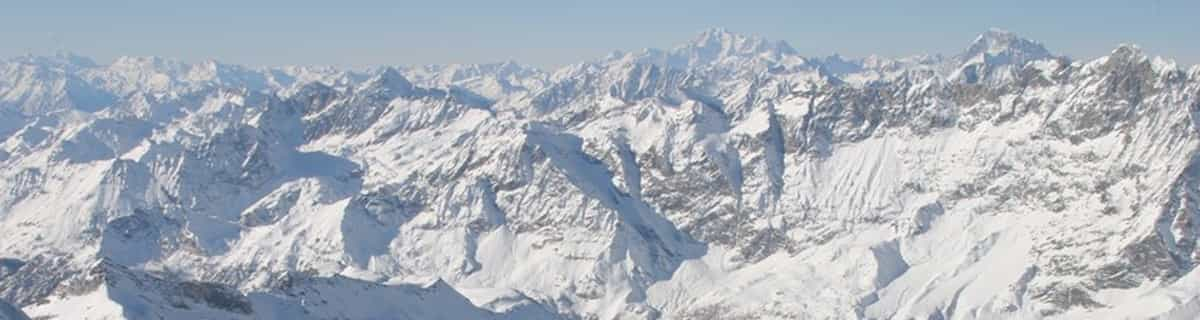
What's it like at Ruwenzori?
The Ruwenzori is a group of six high glaciated massifs, located in a small remote area between Lake Edward and Lake Albert on the border between Uganda and Zaire. This is part of the African Lake District, west of the Great Rift Valley. The massifs are all topped with several icy summits and are deeply divided by narrow 3,000-foot gorges. The complex is surrounded by a wide belt of boggy foothills, guarding the mountains with an approach through knee-deep mud and practically impassable vegetation. These conditions, coupled with frequent bad weather, saved Ruwenzori from exploration until well after the rest of East Africa had already been explored. In 150 AD, the distinguished geographer Claudius Ptolemy produced an early map of Africa on which a group of mountains just south of the equator were identified as Lunae Montes, or 'Mountains of the Moon'. They were shown to be an important water source, and were subsequently believed to be the source of the Nile. Although Kilimangaro and Kenya have been postulated as the mountains to which Ptolemy referred, it is widely held that the Ruwenzori Mountains are indeed the 'Mountains of the Moon'. The Zaire side is part of the Virunga National Park. Accommodations here are better than on the Uganda side, where mountain huts exist but are mostly run down and unsanitary.
Ruwenzori entdecken – Lageplan
Interaktive Wanderkarte und Pistenplan für Ruwenzori. Für Ihre Tourenplanung sehen Sie Pisten und Wanderwege sowie Umrisse des Geländes und der Berge in der Umgebung.

In welchem Monat gibt es am meisten Schnee in Ruwenzori?
Wie ist der Schnee derzeit in Ruwenzori?
Eine Zusammenfassung der aktuellen Schneeverhältnisse in Ruwenzori. Weitere Informationen über Ruwenzori Seite detaillierter Schneebericht.
- Pistenbedingungen—
- Bedingungen jenseits der Pisten—

| Schneetiefe in Höhenlage: | ||
|---|---|---|
| Schneetiefe Tal: | ||
Besucher-Beurteilung fuer Ruwenzori
Skiorte in der Nähe von Ruwenzori
Entdecken Sie Skiorte in der Nähe von Ruwenzori. Klicken Sie unten, um die jeweiligen Reiseführer für Skiorte anzuzeigen
 Afriski Mountain ResortLetzter Schnee: 4.0 cm Thu 02 Jul
 Skilifte: 4
 Pisten: 23255 km entfernt
 TiffindellLetzter Schnee: 1.0 cm Thu 02 JulSkilifte: 5Pisten: 23465 km entfernt
 Mount HermonLetzter Schnee: 2.0 cm Mon 04 MaySkilifte: 10Pisten: —3709 km entfernt
 Zaarour ClubLetzter Schnee: 1.0 cm Tue 05 MaySkilifte: 6Pisten: —3776 km entfernt
- Mzaar Ski ResortLetzter Schnee: 3.0 cm Tue 05 MaySkilifte: 14Pisten: 423784 km entfernt
 Nearest