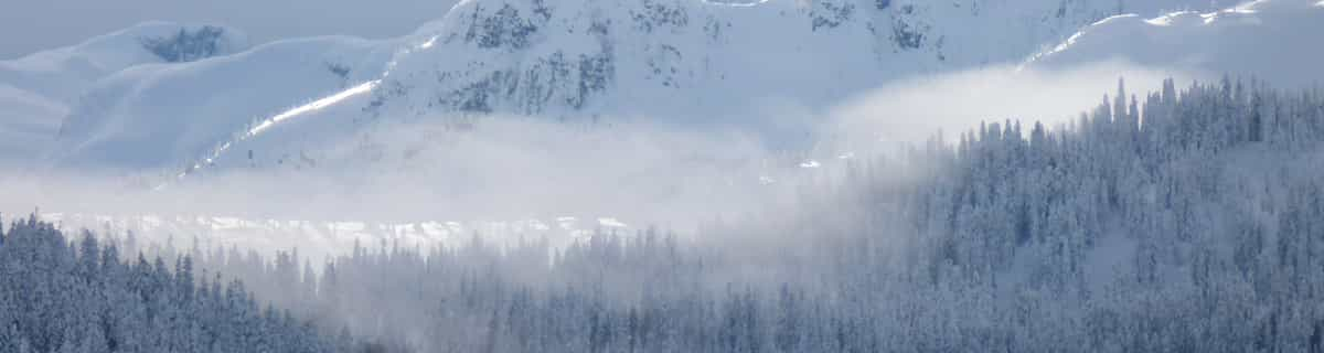


Portillo Storm Snowfall Total Passes 5m / 17 Feet
A snow storm that has now continued for nine days has taken Chilean ski resort Portillo to a snowfall total of 5.2 metres (17 feet) so far, with more snow forecast.

Next 3 days weather summary:leichter Regen (gesamt 4.0mm), meistens fallend in der Nacht zu Dienstag. Warm (maximal 28°C am Donnerstag Nachm., min 15°C in der Nacht zu Dienstag). Der Wind bleibt meist schwach.. | Tage 4-6 Pralognan La Vanoise Wetter-Zusammenfassungstarker Regen (gesamt 29.0mm), stärkstens währ. der Nacht zu Freitag. Warm (maximal 28°C am Freitag Nachm., min 15°C in der Nacht zu Sonntag). Der Wind bleibt meist schwach.. | |||||||||||||||||
Dienstag 28 | Mittwoch 29 | Donnerstag 30 | Freitag 31 | Samstag 1 | Sonntag 2 | |||||||||||||
AM | PM | Nacht | AM | PM | Nacht | AM | PM | Nacht | AM | PM | Nacht | AM | PM | Nacht | AM | PM | Nacht | |
klar | klar | Schauer | klar | klar | klar | klar | klar | Schauer | einige Wolken | Gewitter gefahr | Schauer | bewölkt | etwas Regen | Schauer | einige Wolken | Gewitter gefahr | Schauer | |
km/h | ||||||||||||||||||
Schnee Karte |  |  |  |  |  |  | ||||||||||||
— | — | — | — | — | — | — | — | — | — | — | — | — | — | — | — | — | — | |
mm | — | — | 3 | — | — | — | — | — | 1 | — | 1 | 7 | — | 3 | 4 | — | 1 | 13 |
max °C | 22 | 26 | 21 | 23 | 26 | 23 | 26 | 28 | 24 | 25 | 28 | 19 | 23 | 26 | 18 | 26 | 27 | 17 |
min °C | 16 | 25 | 15 | 18 | 26 | 16 | 20 | 28 | 18 | 20 | 26 | 17 | 20 | 19 | 17 | 20 | 25 | 15 |
chill °C | 16 | 25 | 15 | 18 | 26 | 16 | 20 | 28 | 18 | 20 | 26 | 17 | 20 | 19 | 17 | 20 | 25 | 15 |
Feuchte % | 49 | 49 | 82 | 54 | 36 | 42 | 24 | 21 | 50 | 35 | 40 | 45 | 45 | 70 | 51 | 35 | 47 | 60 |
Gefrierpunkt m | 4650 | 4700 | 4500 | 4400 | 4700 | 4700 | 4650 | 4850 | 4750 | 4650 | 4750 | 4800 | 4600 | 4600 | 4650 | 4700 | 4750 | 4700 |
6:11 | — | — | 6:13 | — | — | 6:13 | — | — | 6:15 | — | — | 6:16 | — | — | 6:16 | — | — | |
— | — | 9:06 | — | — | 9:05 | — | — | 9:04 | — | — | 9:01 | — | — | 9:00 | — | — | 9:00 | |
Werde Profi und carve ein:
Lawineninformationen: European Avalanche Warning Services (EAWS)
Letzte Schneeberichte in der Nähe von Pralognan La Vanoise:
| Die obere Schneetiefe ist: | 0 cm |
|---|---|
| Die untere Schneetiefe ist: | 0 cm |
| Neuschneetiefe Berg | — |
| Wann hat es das letzte Mal geschneit? | 15 May 2026 |
0.0 | Bluebird Powder Tage Frischer Schnee, meist sonnig, leichter Wind. |
|---|---|
0.0 | Pulverschneetage Neuschnee, bewölkt, Wind |
0.0 | Bluebird Tage Schnee, meist sonnig, leichter Wind. |
Die Tabelle oben zeigt die Wettervorhersage für Pralognan La Vanoise auf der angegebenen Höhe von 1410 m. Unsere ausgeklügelten Wettermodelle ermöglichen uns die Schneevorhersage für die Gipfel-, Mittel- und Talstationen für Pralognan La Vanoise. Das Fenster über der Tabelle ermöglicht das Abrufen der Wettervorhersage für andere Höhen. Für einen umfassenderen Blick auf das Wetter, siehe die Wetterkarte" von France.Pralognan La Vanoise
Klicken Sie hier, um weitere Informationen über Gefrierpunkte zu erhalten und zu lesen wie wir unsere Temperaturen prognostizieren.
Allgemein 4.1 Basiert auf 12 Abstimmungen und 3 Beurteilungen
I skied here for the first time last year for a day whilst visiting friends who go every year. This is a pleasant typical French resort, catering mainly for French nationals, although there is evidence of other nationalities starting to find it. The area is fairly small and will have been skied in a day by a reasonable skier. There are though some testing black runs, and the resort would be perfect for beginners and those on a budget. The accomodation, passes and ski school are a fraction of neighboring three valleys, and if you fancy a day on a larger area, Three Vallees and La Plagne etc are a short drive away, or there is a free bus each day to La Plagne. I would recommend a vist for a day if you are at a near resort.
Mark Wood aus United Kingdom schreibt:
I skied here for the first time last year for a day whilst visiting friends who go every year. This is a pleasant typical French resort, catering mainly for French nationals, although there is evidence of other nationalities starting to find it. The area is fairly small and will have been skied in a day by a reasonable skier. There are though some testing black runs, and the resort would be perfect for beginners and those on a budget. The accomodation, passes and ski school are a fraction of neighboring three valleys, and if you fancy a day on a larger area, Three Vallees and La Plagne etc are a short drive away, or there is a free bus each day to La Plagne. I would recommend a vist for a day if you are at a near resort.
Lesen Sie 2 andere Beurteilungen ueber Pralognan La Vanoise oder geben Sie Ihre eigene Bewertung ab.


 Nearest