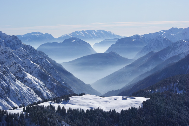


America’s Next Indoor Snow Centre Takes Shape
Construction of a new indoor snow centre for skiers, boarders and tubers appears to be making good progress at Heritage Farm in Wayne County, West Virginia.

Next 4 days weather summary:starker Regen (gesamt 29.0mm), stärkstens währ. Dienstag Nnachm.. Sehr mild (maximal 17°C in der Nacht zu Montag, min 10°C in der Nacht zu Dienstag). Der Wind bleibt meist schwach.. | Tage 5-7 Pinzolo Wetter-Zusammenfassungstarker Regen (gesamt 20.0mm), stärkstens währ. Sonntag Nachmittag. Sehr mild (maximal 19°C am Samstag Nachm., min 9°C in der Nacht zu Donnerstag). Der Wind bleibt meist schwach.. | |||||||||||||||
Dienstag 21 | Mittwoch 22 | Donnerstag 23 | Freitag 24 | Samstag 25 | ||||||||||||
Nacht | AM | PM | Nacht | AM | PM | Nacht | AM | PM | Nacht | AM | PM | Nacht | AM | PM | Nacht | |
Schauer | Gewitter gefahr | mäßiger Regen | Schauer | klar | klar | Schauer | einige Wolken | Gewitter gefahr | Schauer | klar | klar | einige Wolken | klar | Gewitter gefahr | etwas Regen | |
km/h | ||||||||||||||||
Schnee Karte |  |  |  |  |  |  | ||||||||||
— | — | — | — | — | — | — | — | — | — | — | — | — | — | — | — | |
mm | 6 | 4 | 10 | 3 | — | — | 3 | — | 3 | 2 | — | — | — | — | 1 | 1 |
max °C | 17 | 15 | 16 | 15 | 15 | 17 | 15 | 16 | 17 | 16 | 15 | 18 | 15 | 16 | 19 | 16 |
min °C | 12 | 13 | 16 | 10 | 12 | 17 | 12 | 13 | 17 | 9 | 11 | 18 | 11 | 13 | 19 | 13 |
chill °C | 12 | 13 | 16 | 10 | 12 | 17 | 12 | 13 | 17 | 8 | 11 | 18 | 11 | 13 | 19 | 13 |
Feuchte % | 80 | 75 | 70 | 66 | 51 | 56 | 72 | 50 | 47 | 59 | 38 | 50 | 82 | 59 | 54 | 81 |
Gefrierpunkt m | 3750 | 3650 | 3600 | 3450 | 3200 | 3800 | 3650 | 3400 | 3600 | 3350 | 3350 | 3800 | 3800 | 3750 | 3900 | 3600 |
— | 5:45 | — | — | 5:46 | — | — | 5:47 | — | — | 5:48 | — | — | 5:50 | — | — | |
— | — | — | 9:00 | — | — | 8:59 | — | — | 8:58 | — | — | 8:57 | — | — | 8:55 | |
Werde Profi und carve ein:
Lawineninformationen: European Avalanche Warning Services (EAWS)
Letzte Schneeberichte in der Nähe von Pinzolo:
| Die obere Schneetiefe ist: | — |
|---|---|
| Die untere Schneetiefe ist: | — |
| Neuschneetiefe Berg | — |
| Wann hat es das letzte Mal geschneit? | 15 May 2026 |
0.0 | Bluebird Powder Tage Frischer Schnee, meist sonnig, leichter Wind. |
|---|---|
0.0 | Pulverschneetage Neuschnee, bewölkt, Wind |
0.0 | Bluebird Tage Schnee, meist sonnig, leichter Wind. |
Die Tabelle oben zeigt die Wettervorhersage für Pinzolo auf der angegebenen Höhe von 1450 m. Unsere ausgeklügelten Wettermodelle ermöglichen uns die Schneevorhersage für die Gipfel-, Mittel- und Talstationen für Pinzolo. Das Fenster über der Tabelle ermöglicht das Abrufen der Wettervorhersage für andere Höhen. Für einen umfassenderen Blick auf das Wetter, siehe die Wetterkarte" von Italy.Pinzolo
Klicken Sie hier, um weitere Informationen über Gefrierpunkte zu erhalten und zu lesen wie wir unsere Temperaturen prognostizieren.
Allgemein 3.7 Basiert auf 6 Abstimmungen und 6 Beurteilungen
Great experience. Slopes were very fun and most of the ski instructors were lovely. Please avoid one female instructor as she was ignorant and rude. She threatened my group with fines and brought the police as she felt her regime was not respected. She commented on the weight of some of my party and was generally a nasty person. Avoid if with young children or vulnerable people. Apart from this unhelpful and nasty instructor it is a great spot.
Ski man 123 aus Ireland schreibt:
Great experience. Slopes were very fun and most of the ski instructors were lovely. Please avoid one female instructor as she was ignorant and rude. She threatened my group with fines and brought the police as she felt her regime was not respected. She commented on the weight of some of my party and was generally a nasty person. Avoid if with young children or vulnerable people. Apart from this unhelpful and nasty instructor it is a great spot.
Lesen Sie 5 andere Beurteilungen ueber Pinzolo oder geben Sie Ihre eigene Bewertung ab.


 Nearest