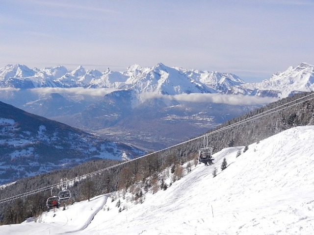


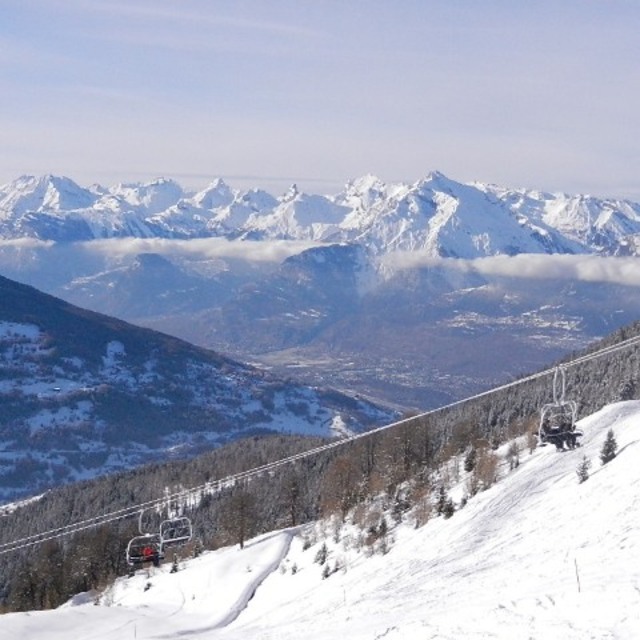
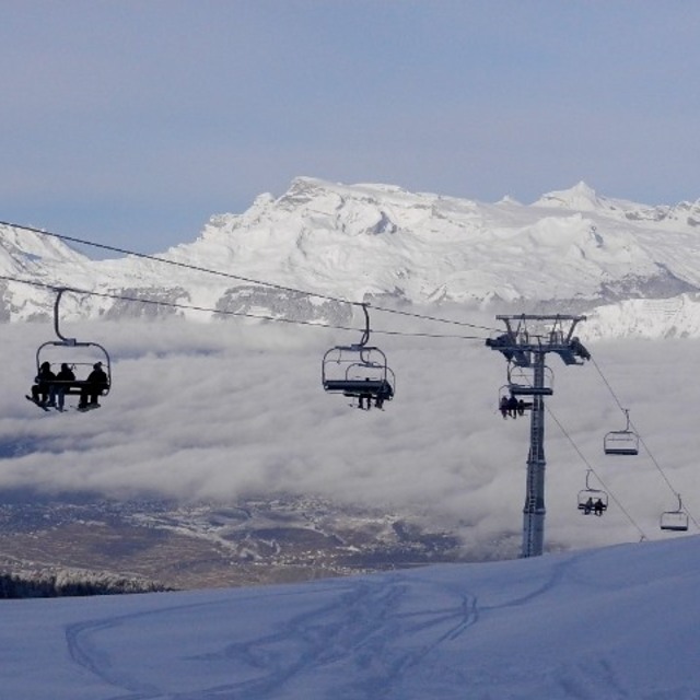
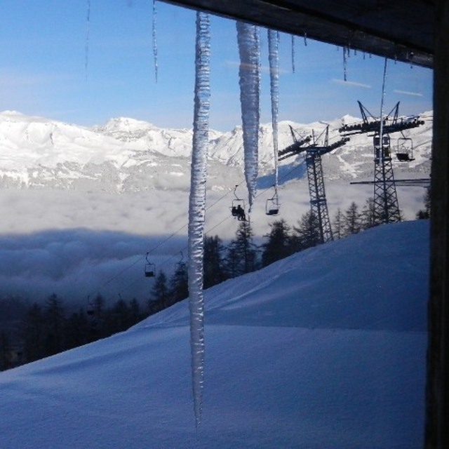
Portillo Storm Snowfall Total Passes 5m / 17 Feet
A snow storm that has now continued for nine days has taken Chilean ski resort Portillo to a snowfall total of 5.2 metres (17 feet) so far, with more snow forecast.

Next 3 days weather summary:leichter Regen (gesamt 7.0mm), meistens fallend am Freitag Nachm.. Sehr mild (maximal 16°C am Donnerstag Nachm., min 11°C in der Nacht zu Mittwoch). Der Wind bleibt meist schwach.. | Tage 4-6 Nax - Mont-Noble Wetter-ZusammenfassungMäßiger Regen (gesamt 16.0mm), stärkstens in der Nacht zu Montag. Sehr mild (maximal 15°C am Montag Nachm., min 10°C In der Nacht zu Samstag). Der Wind bleibt meist schwach.. | ||||||||||||||||
Mi 29 | Donnerstag 30 | Freitag 31 | Samstag 1 | Sonntag 2 | Montag 3 | ||||||||||||
PM | Nacht | AM | PM | Nacht | AM | PM | Nacht | AM | PM | Nacht | AM | PM | Nacht | AM | PM | Nacht | |
klar | klar | klar | klar | klar | klar | Gewitter gefahr | Schauer | einige Wolken | Gewitter gefahr | Schauer | klar | Gewitter gefahr | Schauer | klar | Gewitter gefahr | Schauer | |
km/h | |||||||||||||||||
Schnee Karte |  |  |  |  |  |  | |||||||||||
— | — | — | — | — | — | — | — | — | — | — | — | — | — | — | — | — | |
mm | — | — | — | — | — | — | 5 | 2 | — | 2 | 2 | — | 1 | 2 | — | 1 | 7 |
max °C | 15 | 13 | 14 | 16 | 15 | 15 | 16 | 12 | 12 | 14 | 12 | 12 | 14 | 13 | 14 | 15 | 11 |
min °C | 14 | 11 | 12 | 15 | 13 | 13 | 12 | 11 | 11 | 13 | 10 | 11 | 14 | 11 | 12 | 14 | 10 |
chill °C | 14 | 11 | 12 | 15 | 13 | 12 | 11 | 10 | 10 | 12 | 10 | 11 | 14 | 11 | 12 | 14 | 10 |
Feuchte % | 48 | 52 | 27 | 31 | 49 | 41 | 73 | 60 | 61 | 57 | 58 | 54 | 65 | 61 | 53 | 57 | 63 |
Gefrierpunkt m | 4700 | 4550 | 4600 | 4750 | 4750 | 4700 | 4450 | 4500 | 4400 | 4600 | 4550 | 4550 | 4700 | 4650 | 4650 | 4650 | 4500 |
— | — | 6:07 | — | — | 6:09 | — | — | 6:11 | — | — | 6:11 | — | — | 6:13 | — | — | |
— | 9:05 | — | — | 9:02 | — | — | 9:01 | — | — | 9:00 | — | — | 9:00 | — | — | 8:58 | |
Werde Profi und carve ein:
Lawineninformationen: European Avalanche Warning Services (EAWS)
Letzte Schneeberichte in der Nähe von Nax - Mont-Noble:
| Die obere Schneetiefe ist: | — |
|---|---|
| Die untere Schneetiefe ist: | — |
| Neuschneetiefe Berg | — |
| Wann hat es das letzte Mal geschneit? | 16 May 2026 |
0.1 | Bluebird Powder Tage Frischer Schnee, meist sonnig, leichter Wind. |
|---|---|
0.3 | Pulverschneetage Neuschnee, bewölkt, Wind |
0.0 | Bluebird Tage Schnee, meist sonnig, leichter Wind. |
Die Tabelle oben zeigt die Wettervorhersage für Nax - Mont-Noble auf der angegebenen Höhe von 2700 m. Unsere ausgeklügelten Wettermodelle ermöglichen uns die Schneevorhersage für die Gipfel-, Mittel- und Talstationen für Nax - Mont-Noble. Das Fenster über der Tabelle ermöglicht das Abrufen der Wettervorhersage für andere Höhen. Für einen umfassenderen Blick auf das Wetter, siehe die Wetterkarte" von Switzerland.Nax - Mont-Noble
Klicken Sie hier, um weitere Informationen über Gefrierpunkte zu erhalten und zu lesen wie wir unsere Temperaturen prognostizieren.
Allgemein 4.1 Basiert auf 5 Abstimmungen und 2 Beurteilungen
It's a really easy and laid back ski resort, great parking laid out over two tiers, park at the second park as you can ski straight to your car. Great vertical drop, my kids and I like to try speed racing against the imaginary clock, best time top to bottom 4mins 45 seconds. Because it's a medium sized resort the price is very reasonable. Once you have used your ski pass at the bottom there's no searching for your pass at the other lifts, so until you're at the bottom it's hands free. Food is priced the same as the ski pass but the views of Crans Montana and Anzere are fantastic. Try it, you'll not be disappointed.
Sean Maury aus United Kingdom schreibt:
It's a really easy and laid back ski resort, great parking laid out over two tiers, park at the second park as you can ski straight to your car. Great vertical drop, my kids and I like to try speed racing against the imaginary clock, best time top to bottom 4mins 45 seconds. Because it's a medium sized resort the price is very reasonable. Once you have used your ski pass at the bottom there's no searching for your pass at the other lifts, so until you're at the bottom it's hands free. Food is priced the same as the ski pass but the views of Crans Montana and Anzere are fantastic. Try it, you'll not be disappointed.
Lesen Sie 1 andere Beurteilungen ueber Nax - Mont-Noble oder geben Sie Ihre eigene Bewertung ab.


 Nearest