

America’s Next Indoor Snow Centre Takes Shape
Construction of a new indoor snow centre for skiers, boarders and tubers appears to be making good progress at Heritage Farm in Wayne County, West Virginia.

Next 3 days weather summary:Meist trocken. Warm (maximal 23°C am Montag Nachm., min 18°C am Montag Morg.). Der Wind bleibt meist schwach.. | Tage 4-6 Mt Seymour Wetter-Zusammenfassungleichter Regen (gesamt 7.0mm), meistens fallend am Samstag Morgen. Warm (maximal 20°C am Donnerstag Nachm., min 8°C am Samstag Morgen). Der Wind bleibt meist schwach.. | |||||||||||||||||
Montag 20 | Dienstag 21 | Mittwoch 22 | Donnerstag 23 | Freitag 24 | Samstag 25 | |||||||||||||
AM | PM | Nacht | AM | PM | Nacht | AM | PM | Nacht | AM | PM | Nacht | AM | PM | Nacht | AM | PM | Nacht | |
einige Wolken | einige Wolken | einige Wolken | klar | einige Wolken | einige Wolken | einige Wolken | einige Wolken | klar | klar | klar | klar | klar | klar | bewölkt | etwas Regen | etwas Regen | etwas Regen | |
km/h | ||||||||||||||||||
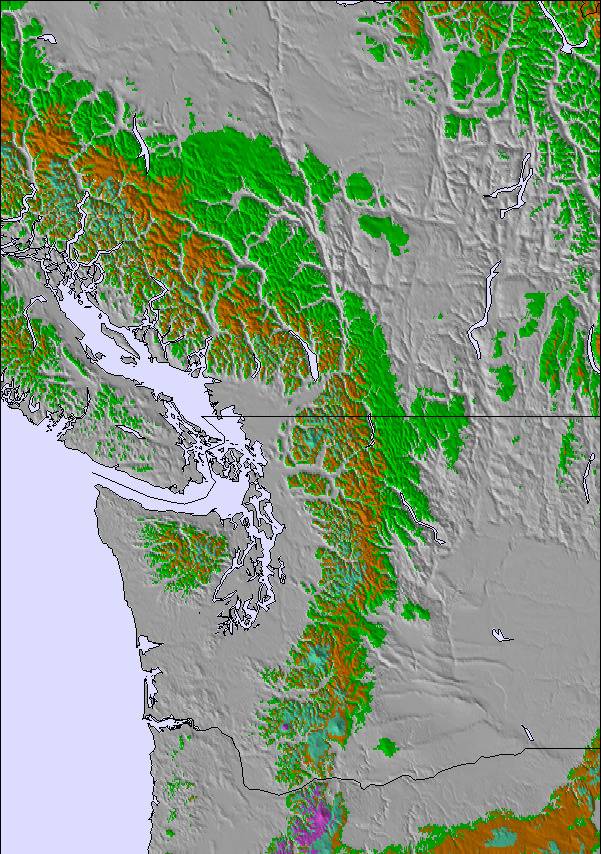
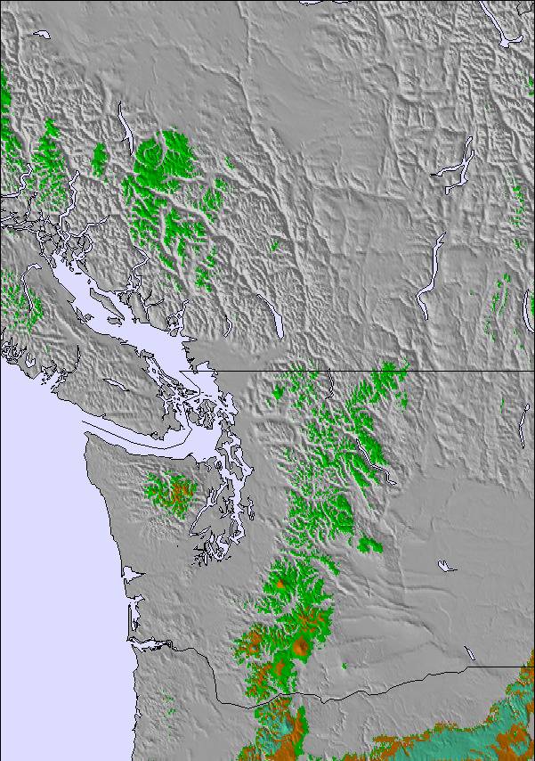
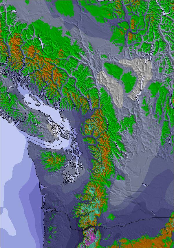
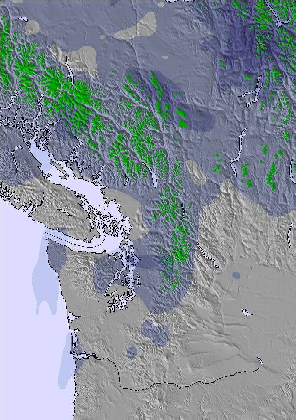
Schnee Karte | 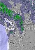 | 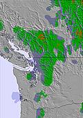 | 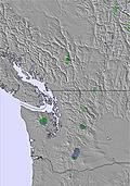 | 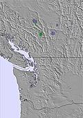 | 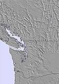 |  | ||||||||||||
— | — | — | — | — | — | — | — | — | — | — | — | — | — | — | — | — | — | |
mm | — | — | — | — | — | — | — | — | — | — | — | — | — | — | — | 2 | 2 | 3 |
max °C | 19 | 23 | 22 | 21 | 23 | 22 | 20 | 22 | 21 | 19 | 20 | 19 | 12 | 13 | 12 | 8 | 9 | 10 |
min °C | 18 | 21 | 19 | 20 | 22 | 20 | 20 | 21 | 19 | 18 | 20 | 13 | 11 | 12 | 9 | 8 | 9 | 9 |
chill °C | 18 | 21 | 19 | 20 | 22 | 20 | 20 | 21 | 19 | 18 | 20 | 12 | 10 | 11 | 7 | 5 | 7 | 7 |
Feuchte % | 39 | 28 | 37 | 39 | 31 | 31 | 38 | 26 | 36 | 45 | 33 | 51 | 82 | 69 | 86 | 98 | 95 | 95 |
Gefrierpunkt m | 4150 | 4150 | 4150 | 4200 | 4450 | 4500 | 4400 | 4450 | 4200 | 4000 | 4000 | 3800 | 3600 | 3600 | 3450 | 3200 | 3100 | 3100 |
5:26 | — | — | 5:28 | — | — | 5:30 | — | — | 5:31 | — | — | 5:31 | — | — | 5:33 | — | — | |
— | — | 9:07 | — | — | 9:06 | — | — | 9:05 | — | — | 9:04 | — | — | 9:02 | — | — | 9:01 | |
Werde Profi und carve ein:
Lawineninformationen: Avalanche Canada
Letzte Schneeberichte in der Nähe von Mt Seymour:
| Die obere Schneetiefe ist: | 0 cm |
|---|---|
| Die untere Schneetiefe ist: | 0 cm |
| Neuschneetiefe Berg | — |
| Wann hat es das letzte Mal geschneit? | 5 Jun 2026 |
0.0 | Bluebird Powder Tage Frischer Schnee, meist sonnig, leichter Wind. |
|---|---|
0.0 | Pulverschneetage Neuschnee, bewölkt, Wind |
0.0 | Bluebird Tage Schnee, meist sonnig, leichter Wind. |
Die Tabelle oben zeigt die Wettervorhersage für Mt Seymour auf der angegebenen Höhe von 1265 m. Unsere ausgeklügelten Wettermodelle ermöglichen uns die Schneevorhersage für die Gipfel-, Mittel- und Talstationen für Mt Seymour. Das Fenster über der Tabelle ermöglicht das Abrufen der Wettervorhersage für andere Höhen. Für einen umfassenderen Blick auf das Wetter, siehe die Wetterkarte" von Canada.Mt Seymour
Klicken Sie hier, um weitere Informationen über Gefrierpunkte zu erhalten und zu lesen wie wir unsere Temperaturen prognostizieren.
Allgemein 3.7 Basiert auf 78 Abstimmungen und 43 Beurteilungen
Watch out for grease drips on the chairs. Got the back of my North Face Gore-tex Pro jacket smeared with it. Response from their customer service was to go get it dry cleaned and they would pay for the cleaning. Who dry cleans Gore-tex fabric? It ruins it. Not impressed.
Marie aus Canada schreibt:
Watch out for grease drips on the chairs. Got the back of my North Face Gore-tex Pro jacket smeared with it. Response from their customer service was to go get it dry cleaned and they would pay for the cleaning. Who dry cleans Gore-tex fabric? It ruins it. Not impressed.
Lesen Sie 42 andere Beurteilungen ueber Mt Seymour oder geben Sie Ihre eigene Bewertung ab.

 Nearest