

America’s Next Indoor Snow Centre Takes Shape
Construction of a new indoor snow centre for skiers, boarders and tubers appears to be making good progress at Heritage Farm in Wayne County, West Virginia.

Next 3 days weather summary:leichter Regen (gesamt 4.0mm), meistens fallend in der Nacht zu Montag. Warm (maximal 21°C am Montag Nachm., min 14°C in der Nacht zu Dienstag). Der Wind bleibt meist schwach.. | Tage 4-6 Morillon Wetter-Zusammenfassungleichter Regen (gesamt 5.0mm), meistens fallend am Samstag Nachm.. Warm (maximal 22°C am Freitag Nachm., min 14°C am Donnerstag Morg.). Der Wind bleibt meist schwach.. | |||||||||||||||||
Montag 20 | Dienstag 21 | Mittwoch 22 | Donnerstag 23 | Freitag 24 | Samstag 25 | |||||||||||||
AM | PM | Nacht | AM | PM | Nacht | AM | PM | Nacht | AM | PM | Nacht | AM | PM | Nacht | AM | PM | Nacht | |
klar | klar | Schauer | Gewitter gefahr | Schauer | klar | klar | klar | einige Wolken | einige Wolken | klar | klar | klar | klar | einige Wolken | bewölkt | Schauer | Schauer | |
km/h | ||||||||||||||||||
Schnee Karte |  |  |  |  |  |  | ||||||||||||
— | — | — | — | — | — | — | — | — | — | — | — | — | — | — | — | — | — | |
mm | — | — | 1 | 2 | 1 | — | — | — | — | — | — | — | — | — | — | — | 2 | 3 |
max °C | 18 | 21 | 20 | 17 | 20 | 18 | 17 | 20 | 19 | 16 | 19 | 17 | 18 | 22 | 21 | 22 | 19 | 17 |
min °C | 16 | 20 | 15 | 15 | 19 | 14 | 14 | 19 | 15 | 14 | 18 | 14 | 14 | 21 | 18 | 19 | 18 | 14 |
chill °C | 16 | 20 | 15 | 15 | 19 | 14 | 14 | 19 | 15 | 14 | 18 | 14 | 14 | 21 | 18 | 19 | 18 | 14 |
Feuchte % | 56 | 38 | 56 | 55 | 38 | 49 | 49 | 34 | 43 | 50 | 35 | 51 | 28 | 25 | 31 | 31 | 54 | 68 |
Gefrierpunkt m | 3700 | 3850 | 3850 | 3700 | 3650 | 3800 | 3900 | 3850 | 3750 | 3350 | 3450 | 4300 | 4450 | 4300 | 4200 | 3950 | 3600 | 3400 |
6:01 | — | — | 6:01 | — | — | 6:03 | — | — | 6:03 | — | — | 6:05 | — | — | 6:05 | — | — | |
— | — | 9:16 | — | — | 9:15 | — | — | 9:15 | — | — | 9:14 | — | — | 9:13 | — | — | 9:12 | |
Werde Profi und carve ein:
Lawineninformationen: European Avalanche Warning Services (EAWS)
Letzte Schneeberichte in der Nähe von Morillon:
No information received. Clear blue skies, all lifts open. aus La Giettaz en Aravis
| Die obere Schneetiefe ist: | — |
|---|---|
| Die untere Schneetiefe ist: | — |
| Neuschneetiefe Berg | — |
| Wann hat es das letzte Mal geschneit? | 15 May 2026 |
0.0 | Bluebird Powder Tage Frischer Schnee, meist sonnig, leichter Wind. |
|---|---|
0.0 | Pulverschneetage Neuschnee, bewölkt, Wind |
0.0 | Bluebird Tage Schnee, meist sonnig, leichter Wind. |

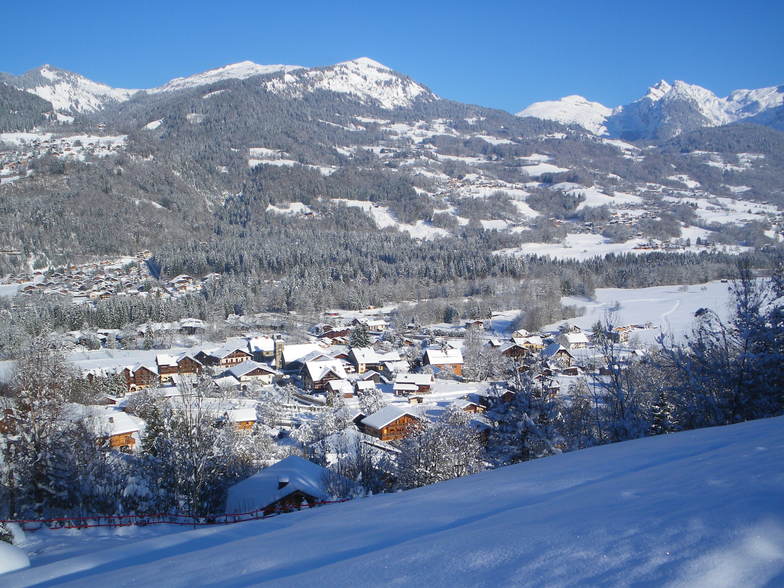
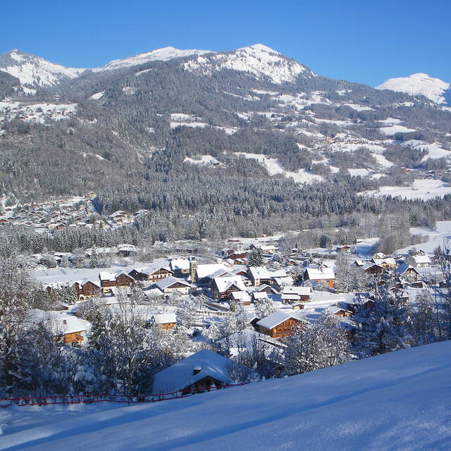
Die Tabelle oben zeigt die Wettervorhersage für Morillon auf der angegebenen Höhe von 1294 m. Unsere ausgeklügelten Wettermodelle ermöglichen uns die Schneevorhersage für die Gipfel-, Mittel- und Talstationen für Morillon. Das Fenster über der Tabelle ermöglicht das Abrufen der Wettervorhersage für andere Höhen. Für einen umfassenderen Blick auf das Wetter, siehe die Wetterkarte" von France.Morillon
Klicken Sie hier, um weitere Informationen über Gefrierpunkte zu erhalten und zu lesen wie wir unsere Temperaturen prognostizieren.
Allgemein 4.3 Basiert auf 19 Abstimmungen und 26 Beurteilungen
Lifts have improved so much from early days and it is a fabulous area to ski. No steps anywhere as completely equipped for the disabled skiers. Pistes very well looked after and there is something for everyone. .The Grand Massif has black off-piste bowls and runs, to lovely long green ones. There are also open slopes and tree runs so when the weather is bad you can usually ski. February does get busy but so does everywhere.
Crioutwo aus United Kingdom schreibt:
Lifts have improved so much from early days and it is a fabulous area to ski. No steps anywhere as completely equipped for the disabled skiers. Pistes very well looked after and there is something for everyone. .The Grand Massif has black off-piste bowls and runs, to lovely long green ones. There are also open slopes and tree runs so when the weather is bad you can usually ski.
February does get busy but so does everywhere.
Lesen Sie 25 andere Beurteilungen ueber Morillon oder geben Sie Ihre eigene Bewertung ab.


 Nearest