Herausgegeben on Snow-Forecast.com um:7 am (lokale Zeit) / 15 Jul 2026
Letzte 6 TageScroll links für die letzten 6 TageJetzt
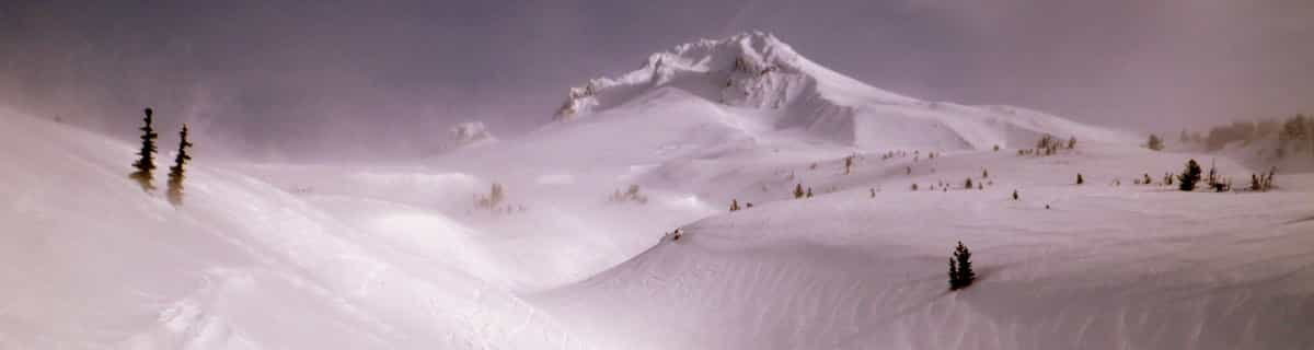
Next 3 days weather summary:
starker Regen (gesamt 24.0mm), stärkstens In der Nacht zu Mittwoch. Sehr mild (maximal 19°C am Mittwoch Nachm., min 10°C in der Nacht zu Freitag). Der Wind bleibt meist schwach..
Tage 4-6 Montchavin Wetter-Zusammenfassung
leichter Regen (gesamt 8.0mm), meistens fallend am Sonntag Nachm.. Sehr mild (maximal 14°C am Samstag Nachm., min 8°C in der Nacht zu Sonntag). Der Wind bleibt meist schwach..
Die Tabelle oben zeigt die Wettervorhersage für Montchavin auf der angegebenen Höhe von 2250 m. Unsere ausgeklügelten Wettermodelle ermöglichen uns die Schneevorhersage für die Gipfel-, Mittel- und Talstationen für Montchavin. Das Fenster über der Tabelle ermöglicht das Abrufen der Wettervorhersage für andere Höhen. Für einen umfassenderen Blick auf das Wetter, siehe die Wetterkarte" von France.Montchavin
Klicken Sie hier, um weitere Informationen über Gefrierpunkte zu erhalten und zu lesen wie wir unsere Temperaturen prognostizieren.
Besucher-Beurteilung fuer Montchavin
Allgemein 4.5 Basiert auf 8 Abstimmungen und 8 Beurteilungen
Montchavin is an old mountain village where you can smell
the animals tucked away safely for the winter as you wander through the beautiful traditional village centre. It is essentially a family resort and the ski schools are excellent. There is a beginners area for children at the bottom of the slope by the first lift up and a newly developed larger area for adult beginners just up 2 lifts. There are limited bars and restaurants in the village, so they do get busy, but most people self cater out here. There is a free bus service between Montchavin and Les Coches, which allows visitors to benefit from the facilities in both villages - e.g the cinema and pool in Montchavin, and the ice rink in Les Coches. The locals are very friendly, there is a tourist information office in both Montchavin and Les Coches with loads of events each week, so non-skiers will be able to find something of interest to do. Although the village is low down, the pisteurs do a fantastic job each year keeping routes open. Snow cannons are in use if snow conditions are low and temperature allows. In recent years with climate change, we have always managed to ski back to the village and if you don't fancy it, you can download on two bubbles. The fantastic thing about Montchavin/Les Coches is its location slap bang in the middle of Paradiski. We leave our apartment, ski down to the first lift and at the top decide whether to head left or right for Les Arcs or La Plagne. So easy to access the whole Paradiski area with such a lot of varied terrain and runs and some excellent off-piste to be found if you know where to go. Get a guide - they'll be able to show you some great routes. When it's white-out conditions and blowing a gale higher up, you can ski some lovely tree lined runs just in and above Montchavin/Les Coches. I really can't recommend it enough.
Allgemein: 4.5 Basiert auf 8 Abstimmungen und 8 Beurteilungen
Schneesicher
4.4
Vielfalt der Pisten
4.9
Off Piste
4.4
Landschaft
4.7
Apres-Ski
4.0
Joanne W aus United Kingdom schreibt:
Montchavin is an old mountain village where you can smell
the animals tucked away safely for the winter as you wander through the beautiful traditional village centre. It is essentially a family resort and the ski schools are excellent. There is a beginners area for children at the bottom of the slope by the first lift up and a newly developed larger area for adult beginners just up 2 lifts. There are limited bars and restaurants in the village, so they do get busy, but most people self cater out here. There is a free bus service between Montchavin and Les Coches, which allows visitors to benefit from the facilities in both villages - e.g the cinema and pool in Montchavin, and the ice rink in Les Coches. The locals are very friendly, there is a tourist information office in both Montchavin and Les Coches with loads of events each week, so non-skiers will be able to find something of interest to do. Although the village is low down, the pisteurs do a fantastic job each year keeping routes open. Snow cannons are in use if snow conditions are low and temperature allows. In recent years with climate change, we have always managed to ski back to the village and if you don't fancy it, you can download on two bubbles. The fantastic thing about Montchavin/Les Coches is its location slap bang in the middle of Paradiski. We leave our apartment, ski down to the first lift and at the top decide whether to head left or right for Les Arcs or La Plagne. So easy to access the whole Paradiski area with such a lot of varied terrain and runs and some excellent off-piste to be found if you know where to go. Get a guide - they'll be able to show you some great routes. When it's white-out conditions and blowing a gale higher up, you can ski some lovely tree lined runs just in and above Montchavin/Les Coches. I really can't recommend it enough.
Kostenlose Snow-Forecast.com Wetter Widget für Ihre Website
Das Montchavin Skiwetter Wideget unten, ist auf externen Seiten kostenlos eigebettet. Es bietet eine tägliche Zusammenfassung über unsere Montchavin Schneevorhersage und derzeitige Wetterbedingungen. gehen Sie einfach auf die Feed-Konfiguration Seite und folgen Sie den 3 einfachen Schritten, um den eigenen HTML-Code-Snippet zu packen und fügen Sie ihn auf Ihrer eigenen Website. Sie können die Höhe der Schneevorhersage wählen (Gipfel, mittel Berg, oder unterer Gipfel) und Messeinheiten metrisch / Schneevorhersage für den Feed auf Ihre eigene Website & hellip anpassen; Klicken Sie hier, um den Code zu bekommen.


 Nearest