Herausgegeben on Snow-Forecast.com um:7 pm (lokale Zeit) / 02 Aug 2026
Letzte 6 TageScroll links für die letzten 6 TageJetzt
Next 4 days weather summary:
Mäßiger Regen (gesamt 18.0mm), stärkstens am Montag Morg.. Warm (maximal 23°C am Mittwoch Nachm., min 11°C in der Nacht zu Montag). Wind abnehmend (fast Sturm aus WNW in der Nacht zu Montag, leichte Winde aus SSW bis Mittwoch Morg).
Tage 5-7 Mont Orford Wetter-Zusammenfassung
leichter Regen (gesamt 9.0mm), meistens fallend am Freitag Nachm.. Warm (maximal 24°C am Donnerstag Nachm., min 17°C in der Nacht zu Mittwoch). Wind zunehmend (leichte Winde aus WSW in der Nacht zu Mittwoch, frische Winde aus Westen bis Freitag Nachm.).
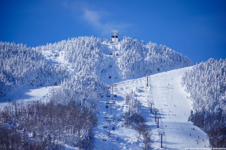
Die Tabelle oben zeigt die Wettervorhersage für Mont Orford auf der angegebenen Höhe von 853 m. Unsere ausgeklügelten Wettermodelle ermöglichen uns die Schneevorhersage für die Gipfel-, Mittel- und Talstationen für Mont Orford. Das Fenster über der Tabelle ermöglicht das Abrufen der Wettervorhersage für andere Höhen. Für einen umfassenderen Blick auf das Wetter, siehe die Wetterkarte" von Canada.Mont Orford
Klicken Sie hier, um weitere Informationen über Gefrierpunkte zu erhalten und zu lesen wie wir unsere Temperaturen prognostizieren.
Besucher-Beurteilung fuer Mont Orford
Allgemein 4.0 Basiert auf 3 Abstimmungen und 1 Bewertung
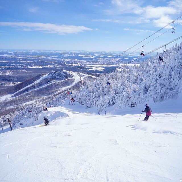
Skied Mont Orford for the first time Dec 30/19 to Jan 2/19. Family of 5: 2 adults, 2 youth(13 & 16), 1 child(10yo), all of whom have been skiing for about 7 years (Bristol Mtn, Gore, Mt Ste. Anne, Massif, Tremblant). Very icy the first day but got a great dump of snow for the next three days. Stuck to the greens and blues as the blacks were very icy due to wind. The 4km and Famiiliale were quite good as well as Magog. The kids loved Escapade and Foret Magique. There is only one real building but it is large and we had no problems finding space for our stuff. There is a microwave in the basement along with nice washrooms. There were really only two lifts: express quad and an express hybrid (6 seat lift/8 seat gondola). There was a triple working every once in a while part way up the main hill. The lift lines can get long, especially for the quad - lots of switchbacks. The staff was exceptionally nice and put up with my terrible French and switched to English with no problems. It is nice buying lift tickets inside rather than waiting in the cold. There was only a long line on our last day but it moved very quickly. The views from the summits are gorgeous. You can see across the valley and the lake to Owl's Head, another resort. The town of Magog is larger than you think and has everything you need (multiple grocery stores, CTC, Walmart). There is also a 2.5km ice skating trail down by the lake that is free (parking costs a little bit).
Allgemein: 4.0 Basiert auf 3 Abstimmungen und 1 Bewertung
Schneesicher
4.0
Vielfalt der Pisten
4.7
Off Piste
2.7
Landschaft
4.7
Apres-Ski
4.0
Andrea aus Canada schreibt:
Skied Mont Orford for the first time Dec 30/19 to Jan 2/19. Family of 5: 2 adults, 2 youth(13 & 16), 1 child(10yo), all of whom have been skiing for about 7 years (Bristol Mtn, Gore, Mt Ste. Anne, Massif, Tremblant). Very icy the first day but got a great dump of snow for the next three days. Stuck to the greens and blues as the blacks were very icy due to wind. The 4km and Famiiliale were quite good as well as Magog. The kids loved Escapade and Foret Magique. There is only one real building but it is large and we had no problems finding space for our stuff. There is a microwave in the basement along with nice washrooms. There were really only two lifts: express quad and an express hybrid (6 seat lift/8 seat gondola). There was a triple working every once in a while part way up the main hill. The lift lines can get long, especially for the quad - lots of switchbacks. The staff was exceptionally nice and put up with my terrible French and switched to English with no problems. It is nice buying lift tickets inside rather than waiting in the cold. There was only a long line on our last day but it moved very quickly. The views from the summits are gorgeous. You can see across the valley and the lake to Owl's Head, another resort. The town of Magog is larger than you think and has everything you need (multiple grocery stores, CTC, Walmart). There is also a 2.5km ice skating trail down by the lake that is free (parking costs a little bit).
Kostenlose Snow-Forecast.com Wetter Widget für Ihre Website
Das Mont Orford Skiwetter Wideget unten, ist auf externen Seiten kostenlos eigebettet. Es bietet eine tägliche Zusammenfassung über unsere Mont Orford Schneevorhersage und derzeitige Wetterbedingungen. gehen Sie einfach auf die Feed-Konfiguration Seite und folgen Sie den 3 einfachen Schritten, um den eigenen HTML-Code-Snippet zu packen und fügen Sie ihn auf Ihrer eigenen Website. Sie können die Höhe der Schneevorhersage wählen (Gipfel, mittel Berg, oder unterer Gipfel) und Messeinheiten metrisch / Schneevorhersage für den Feed auf Ihre eigene Website & hellip anpassen; Klicken Sie hier, um den Code zu bekommen.


 Nearest