Ein Besuch in Kurodake
Nützliche Informationen über Skigebiete, die Ihnen bei der Planung Ihrer Reise nach %{resort_name} helfen.
- Saison beginnt28 Nov 2026
- Saison endet9 May 2027
- Unterkunft—
- Restaurants | Bars— | —
- Nächster Flughafen —
- Nächster Bahnhof Kamikawa
- Skigebiet Info-Website
- Infotelefon+81 / 1658 / 53031
- Lawineninformationen:
Merkmale Kurodake
Das Gelände in Kurodake umfasst:
- HalfpipesNo
- Terrainparks—
- Langlauf—
- Skiverleih—
Wie sieht es in Kurodake aus?
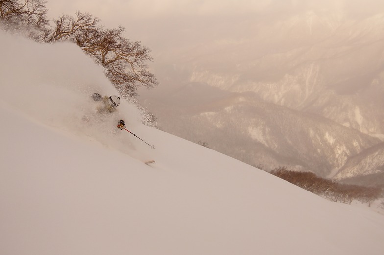
Kurodake (meaning Black Mountain) rises up above Sounkyo town in north central Hokkaido. The area forms part of the Daisetsuzan National park and is home to Hokkaido's tallest mountains. Along with skiers, the resort area also attracts a large number of sightseers who visit to see the impressive Sounkyo gorge, spectacular mountain scenery and the town's annual winter ice festival. The ski area only has two lifts; the first is the Kurodake ropeway which ascends approximately 600m above the valley floor up to 1300m. This is the steepest and most heavily forested portion of the mountain but if you look for it, there are some incredible lines to be had through this zone. There is one semi-marked run from the top of the ropeway to the valley but it is not groomed. Route finding can be difficult as there are many unmarked hazards, no avalanche control and no ski patrol. If you choose to ride the ropeway, please ride with caution and select your route carefully. Above the ropeway, there is a short, double chairlift which ascends a much lower angle slope than the ropeway up to 1560m and offers two groomed piste runs along with access to a mellow powder bowl. Given the nature of this resort, everything outside of its 2 groomed pistes should be considered backcountry terrain and treated with the appropriate respect. If you are uncomfortable accepting these risks on your own, please contact one of the local guiding companies to help you safely explore the area.
Die neuesten Fotos aus Kurodake. Sehen Sie sich alle Fotos auf der Galerieseite von Kurodake an.
 Bildnachweis: Rodney Braithwaite
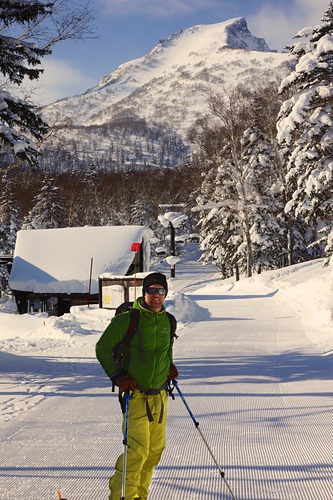 Bildnachweis: Joel O'Rourke
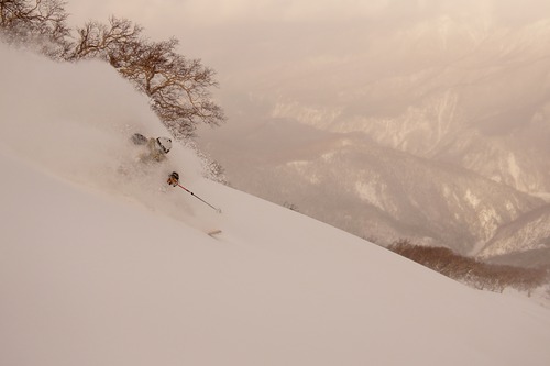 Bildnachweis: Joel O'Rourke
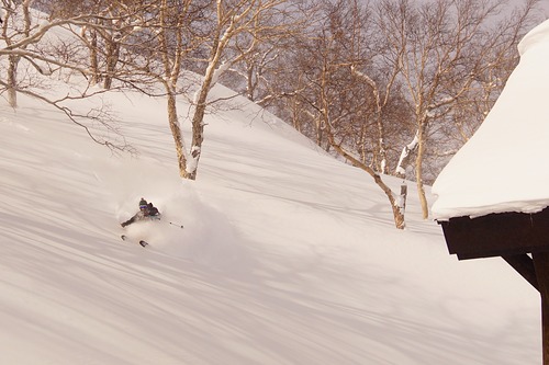 Bildnachweis: Joel O'Rourke
Kurodake entdecken – Lageplan
Interaktive Wanderkarte und Pistenplan für Kurodake. Für Ihre Tourenplanung sehen Sie Pisten und Wanderwege sowie Umrisse des Geländes und der Berge in der Umgebung.

In welchem Monat gibt es am meisten Schnee in Kurodake?

Besucher-Beurteilung fuer Kurodake
Skiorte in der Nähe von Kurodake
Entdecken Sie Skiorte in der Nähe von Kurodake. Klicken Sie unten, um die jeweiligen Reiseführer für Skiorte anzuzeigen
 AsahidakeLetzter Schnee: 1.0 cm Wed 10 Jun
 Skilifte: 1
 Pisten: —10 km entfernt
- Shirogane Ski Highland Parkhill ValleyLetzter Schnee: 2.0 cm Sat 09 MaySkilifte: 1Pisten: 433 km entfernt
- Biei ChominLetzter Schnee: 3.0 cm Mon 04 MaySkilifte: 2Pisten: 339 km entfernt
- PippuLetzter Schnee: 1.0 cm Sat 09 MaySkilifte: 3Pisten: 1042 km entfernt
- Nukabira OnsenLetzter Schnee: 3.0 cm Mon 04 MaySkilifte: 4Pisten: 943 km entfernt
 Nearest