
Ein Besuch in Craigieburn
Nützliche Informationen über Skigebiete, die Ihnen bei der Planung Ihrer Reise nach %{resort_name} helfen.
- Saison beginnt18 Jul 2026
- Saison endet30 Sep 2026
- Unterkunft—
- Restaurants | Bars1 | 1
- Nächster Flughafen Christchurch
- Nächster Bahnhof —
- Skigebiet Info-Website
- Infotelefon+6433652514
- Lawineninformationen:
Merkmale Craigieburn
Das Gelände in Craigieburn umfasst:
- Halfpipes—
- Terrainparks—
- Langlauf—
- Skiverleih—
Wie sieht es in Craigieburn aus?
Craigieburn Valley Ski Area, located in the heart of New Zealand's Southern Alps, has achieved cult status amongst NZ's hottest skiers. Steep deep and cheap. Three high capacity rope tows service a vertical rise of 500m. Terrain at Craigieburn Valley is varied, exciting and challenging with the infamous 600m vertical descent of Middle basin, which is often compared to a heli skiing experience, accessible by a short traverse from the tow. Wide open powder bowls, steep narrow chutes and when you come off the hill at Craigieburn at the end of a big day, kick back in the bar at our cosy alpine lodge.
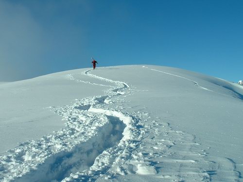
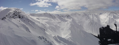
Die neuesten Fotos aus Craigieburn. Sehen Sie sich alle Fotos auf der Galerieseite von Craigieburn an.
 Bildnachweis: T
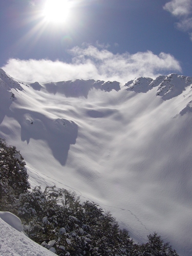 Bildnachweis: T
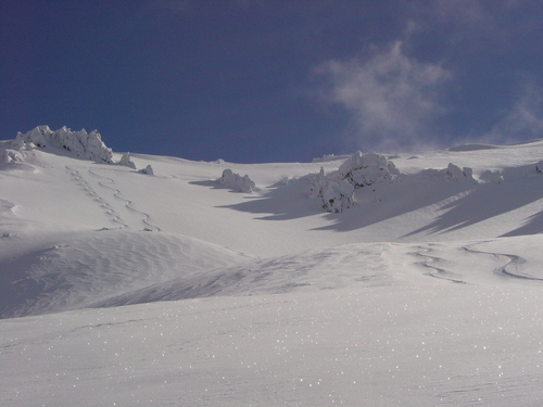 Bildnachweis: T
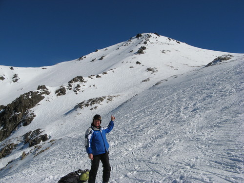 Bildnachweis: Stephen Harlow
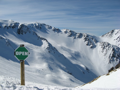 Bildnachweis: Stephen Harlow
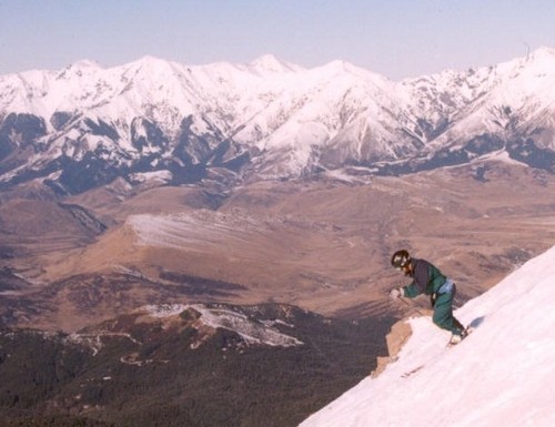 Bildnachweis: shiraz
 Bildnachweis: admin
Craigieburn entdecken – Lageplan
Interaktive Wanderkarte und Pistenplan für Craigieburn. Für Ihre Tourenplanung sehen Sie Pisten und Wanderwege sowie Umrisse des Geländes und der Berge in der Umgebung.

In welchem Monat gibt es am meisten Schnee in Craigieburn?
Wie ist der Schnee derzeit in Craigieburn?
Eine Zusammenfassung der aktuellen Schneeverhältnisse in Craigieburn. Weitere Informationen über Craigieburn Seite detaillierter Schneebericht.
- Pistenbedingungen—
- Bedingungen jenseits der Pisten—

| Schneetiefe in Höhenlage: | ||
|---|---|---|
| Schneetiefe Tal: | ||
Besucher-Beurteilung fuer Craigieburn
Nick Jarman aus New Zealand schreibt:
Hi Snow-Forecast team, you have a great site and we use it often.
As some more information, Craigieburn and Broken River ski areas are next door neighbours!! It's an easy ski over to Broken River from Hamilton Col at Craigieburn (5/10 minutes, depending on conditions) and a 1/2-1hour walk (once again, depending on conditions) back along the ridge line from Broken River to Craigieburn. So in essence, Craigieburn and Broken River are the closest resorts to each other!! In fact on a topo map our main lifts are 2km apart!!
Hope this is of some use.
Lesen Sie 2 andere Beurteilungen ueber Craigieburn oder geben Sie Ihre eigene Bewertung ab.
Skiorte in der Nähe von Craigieburn
Entdecken Sie Skiorte in der Nähe von Craigieburn. Klicken Sie unten, um die jeweiligen Reiseführer für Skiorte anzuzeigen
 Broken RiverLetzter Schnee: 1.0 cm Wed 15 Jul
 Skilifte: 5
 Pisten: —2 km entfernt
- Mount CheesemanLetzter Schnee: 3.0 cm Wed 15 JulSkilifte: 3Pisten: —6 km entfernt
- Mount OlympusLetzter Schnee: 5.0 cm Wed 15 JulSkilifte: 4Pisten: —12 km entfernt
- PortersLetzter Schnee: 3.0 cm Tue 14 JulSkilifte: 6Pisten: —18 km entfernt
- Temple BasinLetzter Schnee: 13.0 cm Wed 15 JulSkilifte: 4Pisten: 2224 km entfernt
 Nearest