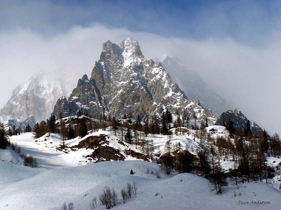


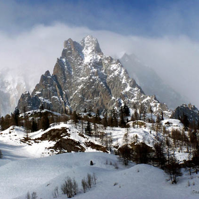
Portillo Storm Snowfall Total Passes 5m / 17 Feet
A snow storm that has now continued for nine days has taken Chilean ski resort Portillo to a snowfall total of 5.2 metres (17 feet) so far, with more snow forecast.

Next 3 days weather summary:leichter Regen (gesamt 6.0mm), meistens fallend in der Nacht zu Freitag. Sehr mild (maximal 16°C am Donnerstag Nachm., min 11°C in der Nacht zu Freitag). Der Wind bleibt meist schwach.. | Tage 4-6 Courmayeur Wetter-ZusammenfassungMäßiger Regen (gesamt 15.0mm), stärkstens in der Nacht zu Montag. Sehr mild (maximal 13°C am Sonntag Nachm., min 10°C am Montag Morg.). Der Wind bleibt meist schwach.. | |||||||||||||||||
Donnerstag 30 | Freitag 31 | Samstag 1 | Sonntag 2 | Montag 3 | Dienstag 4 | |||||||||||||
AM | PM | Nacht | AM | PM | Nacht | AM | PM | Nacht | AM | PM | Nacht | AM | PM | Nacht | AM | PM | Nacht | |
klar | klar | einige Wolken | klar | Gewitter gefahr | Schauer | klar | klar | klar | klar | einige Wolken | etwas Regen | Schauer | Schauer | Schauer | Gewitter gefahr | Schauer | Schauer | |
km/h | ||||||||||||||||||
Schnee Karte |  |  |  |  |  |  | ||||||||||||
— | — | — | — | — | — | — | — | — | — | — | — | — | — | — | — | — | — | |
mm | — | — | — | — | 1 | 5 | — | — | — | — | — | 3 | 1 | 2 | 4 | 1 | 3 | 1 |
max °C | 13 | 16 | 15 | 14 | 15 | 13 | 12 | 13 | 12 | 12 | 13 | 13 | 11 | 13 | 11 | 11 | 12 | 11 |
min °C | 12 | 15 | 13 | 13 | 14 | 11 | 11 | 13 | 11 | 11 | 13 | 11 | 10 | 11 | 10 | 10 | 12 | 10 |
chill °C | 12 | 15 | 13 | 13 | 14 | 9 | 10 | 12 | 10 | 11 | 13 | 11 | 10 | 10 | 10 | 10 | 12 | 9 |
Feuchte % | 20 | 29 | 44 | 44 | 65 | 68 | 52 | 43 | 40 | 51 | 55 | 68 | 59 | 67 | 65 | 64 | 65 | 61 |
Gefrierpunkt m | 4550 | 4700 | 4750 | 4650 | 4650 | 4450 | 4500 | 4650 | 4600 | 4500 | 4700 | 4500 | 4450 | 4400 | 4350 | 4300 | 4550 | 4450 |
6:11 | — | — | 6:13 | — | — | 6:13 | — | — | 6:15 | — | — | 6:16 | — | — | 6:16 | — | — | |
— | — | 9:04 | — | — | 9:02 | — | — | 9:00 | — | — | 9:00 | — | — | 8:59 | — | — | 8:57 | |
Werde Profi und carve ein:
Lawineninformationen: European Avalanche Warning Services (EAWS)
Letzte Schneeberichte in der Nähe von Courmayeur:
| Die obere Schneetiefe ist: | 0 cm |
|---|---|
| Die untere Schneetiefe ist: | 0 cm |
| Neuschneetiefe Berg | — |
| Wann hat es das letzte Mal geschneit? | 16 May 2026 |
0.0 | Bluebird Powder Tage Frischer Schnee, meist sonnig, leichter Wind. |
|---|---|
0.1 | Pulverschneetage Neuschnee, bewölkt, Wind |
0.1 | Bluebird Tage Schnee, meist sonnig, leichter Wind. |

Die Tabelle oben zeigt die Wettervorhersage für Courmayeur auf der angegebenen Höhe von 2755 m. Unsere ausgeklügelten Wettermodelle ermöglichen uns die Schneevorhersage für die Gipfel-, Mittel- und Talstationen für Courmayeur. Das Fenster über der Tabelle ermöglicht das Abrufen der Wettervorhersage für andere Höhen. Für einen umfassenderen Blick auf das Wetter, siehe die Wetterkarte" von Italy.Courmayeur
Klicken Sie hier, um weitere Informationen über Gefrierpunkte zu erhalten und zu lesen wie wir unsere Temperaturen prognostizieren.
Allgemein 4.0 Basiert auf 28 Abstimmungen und 22 Beurteilungen
Spent 4 days in Courmayeur in March 2019. Good snow fell just before but the top lifts were winded-off for 3 of the four days. Great daytime atmosphere on the mountain with Checrouit mid-mountain feeling like a mini village in itself. The back side Veny has shady and narrow runs which are often icy. They are marked as blue but are very difficult for beginners so the amount of beginners terrain is half of what the piste map claims. The town is pretty and the main pedestrian street has nice shops. I have to say thought the apres-ski is literally non existent! We booked one night on the mountain because we read in several articles that the apres was "loud and late" on the mountain... pure rubbish, by 16:30 there was 4 people playing fussball at the main Super G terrace and then the DJ finished at 17:00! The town itself was also incredibly quiet, with nothing in the way of music or even a lightly full bar. The best apres-ski was the pizza place which also had no music but at least there were people. We ended up cutting our losses and heading to Chamonix for our remaining three nights where we danced on tables to the incredible No Limits band in Chambre Neuf. In summary, it's a lovely place for a day trip or if you have young children but if you like to have even one drink after your day's skiing forget it!
Steve aus Ireland schreibt:
Spent 4 days in Courmayeur in March 2019. Good snow fell just before but the top lifts were winded-off for 3 of the four days. Great daytime atmosphere on the mountain with Checrouit mid-mountain feeling like a mini village in itself. The back side Veny has shady and narrow runs which are often icy. They are marked as blue but are very difficult for beginners so the amount of beginners terrain is half of what the piste map claims.
The town is pretty and the main pedestrian street has nice shops. I have to say thought the apres-ski is literally non existent! We booked one night on the mountain because we read in several articles that the apres was "loud and late" on the mountain... pure rubbish, by 16:30 there was 4 people playing fussball at the main Super G terrace and then the DJ finished at 17:00!
The town itself was also incredibly quiet, with nothing in the way of music or even a lightly full bar. The best apres-ski was the pizza place which also had no music but at least there were people. We ended up cutting our losses and heading to Chamonix for our remaining three nights where we danced on tables to the incredible No Limits band in Chambre Neuf.
In summary, it's a lovely place for a day trip or if you have young children but if you like to have even one drink after your day's skiing forget it!
Lesen Sie 21 andere Beurteilungen ueber Courmayeur oder geben Sie Ihre eigene Bewertung ab.


 Nearest