

Global Weekly Snow Roundup #314
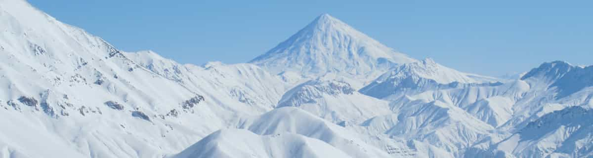
Weekly Global Snow News, updated 14 May 2026: Fresh snowfall in Argentina, Australia and Lesotho signals winter’s approach, while Japan maintains the world’s deepest snowpack.

Next 3 days weather summary:leichter Regen (gesamt 6.0mm), meistens fallend In der Nacht zu Samstag. Warm (maximal 20°C am Montag Nachm., min 9°C in der Nacht zu Sonntag). Wind abnehmend (frische Winde aus Westen In der Nacht zu Samstag, Windstille bis Sonntag Nacht). | Days 4-6 weather summary:Mäßiger Regen (gesamt 17.0mm), stärkstens in der Nacht zu Dienstag. Warm (maximal 23°C am Dienstag Nachm., min 2°C in der Nacht zu Mittwoch). Wind abnehmend (starke Winde aus Westen in der Nacht zu Dienstag, Windstille bis Donnerstag Nacht). | |||||||||||||||||
Saturday 16 | Sunday 17 | Monday 18 | Tuesday 19 | Wednesday 20 | Thursday 21 | |||||||||||||
AM | PM | Nacht | AM | PM | Nacht | AM | PM | Nacht | AM | PM | Nacht | AM | PM | Nacht | AM | PM | Nacht | |
einige Wolken | einige Wolken | Schauer | bewölkt | einige Wolken | einige Wolken | bewölkt | einige Wolken | klar | Gewittergefahr | Gewittergefahr | Schauer | Gewittergefahr | etwas Regen | etwas Regen | einige Wolken | einige Wolken | einige Wolken | |
km/h | ||||||||||||||||||
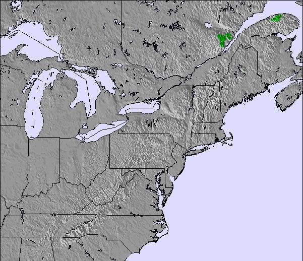
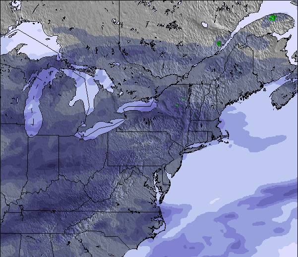
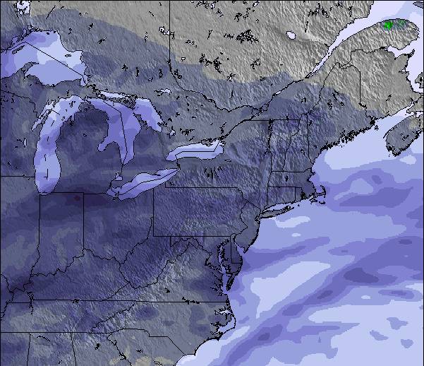
Snow map |  |  |  |  |  |  | ||||||||||||
— | — | — | — | — | — | — | — | — | — | — | — | — | — | — | — | — | — | |
— | — | 6 | — | — | — | — | — | — | 2 | 2 | 5 | 2 | 4 | 2 | — | — | — | |
max °C | 13 | 18 | 13 | 12 | 13 | 11 | 12 | 20 | 19 | 19 | 23 | 21 | 19 | 18 | 13 | 5 | 8 | 8 |
min °C | 11 | 16 | 11 | 11 | 12 | 9 | 11 | 17 | 18 | 18 | 21 | 17 | 18 | 17 | 2 | 3 | 7 | 4 |
8 | 15 | 8 | 8 | 10 | 8 | 11 | 16 | 17 | 17 | 21 | 16 | 17 | 16 | -2 | -1 | 4 | 2 | |
55 | 57 | 96 | 73 | 66 | 68 | 66 | 64 | 82 | 91 | 76 | 88 | 93 | 98 | 88 | 66 | 56 | 57 | |
3000 | 3300 | 2800 | 2700 | 3050 | 3600 | 3600 | 4150 | 4100 | 4300 | 4200 | 4000 | 3950 | 3750 | 1400 | 1050 | 1450 | 1400 | |
5:18 | — | — | 5:18 | — | — | 5:16 | — | — | 5:16 | — | — | 5:15 | — | — | 5:13 | — | — | |
— | — | 8:14 | — | — | 8:15 | — | — | 8:15 | — | — | 8:16 | — | — | 8:19 | — | — | 8:20 | |
Letzte Schneeberichte in der Nähe von Ski Bromont:
| Die obere Schneetiefe ist: | — |
|---|---|
| Die untere Schneetiefe ist: | — |
| Neuschneetiefe Berg | — |
| Wann hat es das letzte Mal geschneit? | 20 Apr 2026 |
0.1 | Bluebird Powder Tage Frischer Schnee, meist sonnig, leichter Wind. |
|---|---|
0.0 | Pulverschneetage Neuschnee, bewölkt, Wind |
0.0 | Bluebird Tage Schnee, meist sonnig, leichter Wind. |
Die Tabelle oben zeigt die Wettervorhersage für Ski Bromont auf der angegebenen Höhe von 573 m. Unsere ausgeklügelten Wettermodelle ermöglichen uns die Schneevorhersage für die Gipfel-, Mittel- und Talstationen für Ski Bromont. Das Fenster über der Tabelle ermöglicht das Abrufen der Wettervorhersage für andere Höhen. Für einen umfassenderen Blick auf das Wetter, siehe die Wetterkarte" von Canada.Ski Bromont
Klicken Sie hier, um weitere Informationen über Gefrierpunkte zu erhalten und zu lesen wie wir unsere Temperaturen prognostizieren.
Allgemein 3.2 Basiert auf 9 Abstimmungen und 3 Beurteilungen
I had a terrible experience. They confirmed by phone 2 days prior that they were open until 6pm on the day that I was flying in. Their website sold me lift tickets for 1-6pm. They then closed the mountain at 4pm, which apparently was according to their schedule. But I paid for tickets for 1-6pm. They have refused to refund any portion of my tickets, despite several polite requests both in person and online. I'm so disappointed in my first experience at Bromont, and will never return. If you're looking for great skiing I would suggest Saint-Sauveur or Mont Tremblant. If you're looking for great mountain biking, I would suggest the Quebec City area, specifically Sentier Du Moulin, Vallee Bras du Nord, and Mont Saint Anne. Skip Bromont, they're a joke.
Adrian aus Canada schreibt:
I had a terrible experience. They confirmed by phone 2 days prior that they were open until 6pm on the day that I was flying in. Their website sold me lift tickets for 1-6pm. They then closed the mountain at 4pm, which apparently was according to their schedule. But I paid for tickets for 1-6pm. They have refused to refund any portion of my tickets, despite several polite requests both in person and online. I'm so disappointed in my first experience at Bromont, and will never return.
If you're looking for great skiing I would suggest Saint-Sauveur or Mont Tremblant.
If you're looking for great mountain biking, I would suggest the Quebec City area, specifically Sentier Du Moulin, Vallee Bras du Nord, and Mont Saint Anne.
Skip Bromont, they're a joke.
Lesen Sie 2 andere Beurteilungen ueber Ski Bromont oder geben Sie Ihre eigene Bewertung ab.


 Nearest