Alternatively, you can now use your Outside account to sign in to any brand in the Outside digital ecosystem, including Snow-Forecast, Surf-Forecast, and Mountain-Forecast.
Die Schneevorhersage für Morzine ist: starker Regen (gesamt 21.0mm), stärkstens In der Nacht zu Freitag. Warm (maximal 22°C am Montag Nachm., min 11°C am Samstag Morgen). Wind schwächt ab.
Morzine Weather (Next 3 days): The snow forecast for Morzine is: starker Regen (gesamt 21.0mm), stärkstens In der Nacht zu Freitag. Warm (maximal 22°C am Montag Nachm., min 11°C am Samstag Morgen). Wind schwächt ab.
Morzine Weather (Days 4-6): leichter Regen (gesamt 3.0mm), meistens fallend am Dienstag Morg.. Warm (maximal 22°C am Donnerstag Nachm., min 10°C in der Nacht zu Dienstag). Wind schwächt ab.
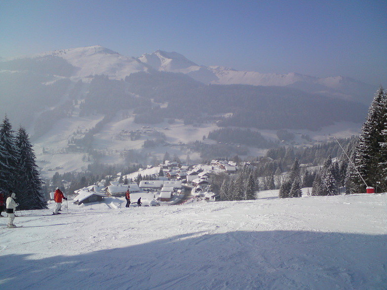
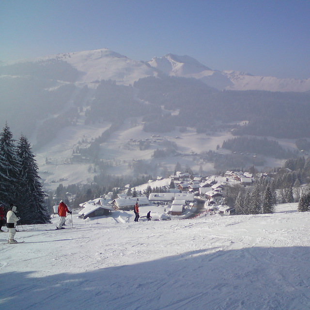
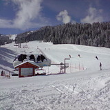
Morzine live Schnee
Höhenlage
Schneehöhe
Temp. (°C)
Wind (km/h)
Wetter
Bergstation:
6
Mittelstation:
9
Tal:
9
Betrieben von Snow-Forecast.com
Morzine Wetter
(Nächste 3 Tage):
Die Schneevorhersage für Morzine ist: starker Regen (gesamt 21.0mm), stärkstens In der Nacht zu Freitag. Warm (maximal 22°C am Montag Nachm., min 11°C am Samstag Morgen). Wind schwächt ab.
Morzine Wetter (Tage 4-6):
leichter Regen (gesamt 3.0mm), meistens fallend am Dienstag Morg.. Warm (maximal 22°C am Donnerstag Nachm., min 10°C in der Nacht zu Dienstag). Wind schwächt ab.
Zusammenfassung Wetterprognose an folgenden Tagen 0 - 3
starker Regen (gesamt 21.0mm), stärkstens In der Nacht zu Freitag. Warm (maximal 22°C am Montag Nachm., min 11°C am Samstag Morgen). Wind schwächt ab.
Zusammenfassung Wetterprognose an folgenden Tagen 4 - 6
leichter Regen (gesamt 3.0mm), meistens fallend am Dienstag Morg.. Warm (maximal 22°C am Donnerstag Nachm., min 10°C in der Nacht zu Dienstag). Wind schwächt ab.
Die Tabelle oben zeigt die Wettervorhersage für Morzine auf der angegebenen Höhe von 999 m. Unsere ausgeklügelten Wettermodelle ermöglichen uns die Schneevorhersage für die Gipfel-, Mittel- und Talstationen für Morzine. Das Fenster über der Tabelle ermöglicht das Abrufen der Wettervorhersage für andere Höhen. Für einen umfassenderen Blick auf das Wetter, siehe die Wetterkarte" von France.Morzine
Klicken Sie hier, um weitere Informationen über Gefrierpunkte zu erhalten und zu lesen wie wir unsere Temperaturen prognostizieren.
Besucher-Beurteilung fuer Morzine
Allgemein 4.5 Basiert auf 79 Abstimmungen und 114 Beurteilungen
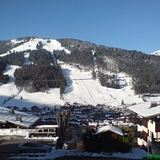
Morzine is low altitude but pretty. Moderate priced compared to other French resorts. More expensive than Austria and Italy. Lots of moderately sloped blues and even the reds aren't very red. Not a heck of a lot of off-piste. Be prepared to do a bit of walking if you aren't near the lifts, and to be fair, most accommodation is a hike.
Very easy transfer from Geneva.
If renting kit, try and leave it at the rental shop if near the lifts. If taking your own, then bribe a shop to keep your kit!
Supermorzine telecabine is not very super, 6 seater and tired.
Avoriaz is good for altitude but horrendously unpretty, despite sticking wood onto the concrete buildings.
All in all, morzine is fine and pretty, but not very snowy. Thank god for artificial snow cannons.
Kostenlose Snow-Forecast.com Wetter Widget für Ihre Website
Das Morzine Skiwetter Wideget unten, ist auf externen Seiten kostenlos eigebettet. Es bietet eine tägliche Zusammenfassung über unsere Morzine Schneevorhersage und derzeitige Wetterbedingungen. gehen Sie einfach auf die Feed-Konfiguration Seite und folgen Sie den 3 einfachen Schritten, um den eigenen HTML-Code-Snippet zu packen und fügen Sie ihn auf Ihrer eigenen Website. Sie können die Höhe der Schneevorhersage wählen (Gipfel, mittel Berg, oder unterer Gipfel) und Messeinheiten metrisch / Schneevorhersage für den Feed auf Ihre eigene Website & hellip anpassen; Klicken Sie hier, um den Code zu bekommen.


 Nearest