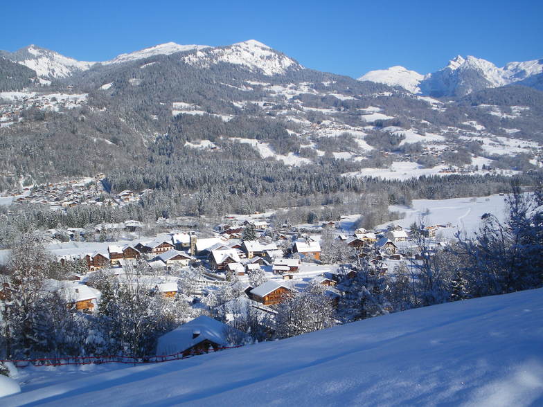


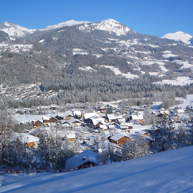
Global Weekly Snow Roundup #314
Weekly Global Snow News, updated 14 May 2026: Fresh snowfall in Argentina, Australia and Lesotho signals winter’s approach, while Japan maintains the world’s deepest snowpack.

Next 4 days weather summary:Sehr leichter Schneefall übergehend in leichten Regen (gesamt 6.0mm) am Montag Nachm.. Frost-Tau-Bedingungen (maximal 5°C am Sonntag Nachm., min -4°C in der Nacht zu Freitag). Wind schwächt ab. | Days 5-7 weather summary:Mäßiger Regen (gesamt 15.0mm) stärkstens in der Nacht zu Montag, dann kälter mit Schneebestreuung in der Nacht zu Montag. Sehr mild (maximal 12°C am Donnerstag Nachm., min 1°C in der Nacht zu Montag). Wind schwächt ab. | |||||||||||||||
Saturday 16 | Sunday 17 | Monday 18 | Tuesday 19 | Wednesday 20 | ||||||||||||
Nacht | AM | PM | Nacht | AM | PM | Nacht | AM | PM | Nacht | AM | PM | Nacht | AM | PM | Nacht | |
leichter Schnee | Schneeschauer | leichter Schnee | Schneeschauer | einige Wolken | bewölkt | einige Wolken | etwas Regen | etwas Regen | leichter Schnee | etwas Regen | Schauer | mäßiger Regen | etwas Regen | etwas Regen | Schauer | |
km/h | ||||||||||||||||
Snow map |  |  |  |  |  |  | ||||||||||
2 | — | 1 | — | — | — | — | — | — | 1 | — | — | — | — | — | — | |
— | — | — | — | — | — | — | 1 | 5 | 2 | 1 | 1 | 7 | 1 | 2 | 1 | |
max °C | -3 | -3 | -1 | -1 | 1 | 5 | 4 | 3 | 4 | 2 | 2 | 7 | 6 | 6 | 7 | 7 |
min °C | -4 | -4 | -2 | -2 | 0 | 4 | 2 | 2 | 4 | 1 | 2 | 6 | 4 | 4 | 7 | 6 |
-7 | -6 | -4 | -2 | 0 | 2 | -1 | -1 | 1 | -2 | 0 | 5 | 3 | 3 | 6 | 5 | |
92 | 87 | 84 | 75 | 60 | 63 | 74 | 82 | 75 | 92 | 96 | 75 | 94 | 76 | 71 | 67 | |
1250 | 1550 | 1750 | 1500 | 2150 | 2400 | 2200 | 2300 | 2400 | 2150 | 2400 | 2900 | 2550 | 2700 | 2850 | 3250 | |
— | 6:00 | — | — | 5:58 | — | — | 5:58 | — | — | 5:56 | — | — | 5:56 | — | — | |
— | — | — | 8:59 | — | — | 9:00 | — | — | 9:00 | — | — | 9:01 | — | — | 9:04 | |
Letzte Schneeberichte in der Nähe von Morillon:
Light rain reported from Haute-Savoie Mont Blanc Airport/Aéroport Annecy/Meythet at 711 metres elevation only 3 kms WNW of Annecy-LeSemnoz but it is forecast cold enough for snow at the ski area aus Annecy-LeSemnoz
| Die obere Schneetiefe ist: | — |
|---|---|
| Die untere Schneetiefe ist: | — |
| Neuschneetiefe Berg | 5 cm |
| Wann hat es das letzte Mal geschneit? | 14 May 2026 |
0.1 | Bluebird Powder Tage Frischer Schnee, meist sonnig, leichter Wind. |
|---|---|
0.1 | Pulverschneetage Neuschnee, bewölkt, Wind |
0.0 | Bluebird Tage Schnee, meist sonnig, leichter Wind. |


Die Tabelle oben zeigt die Wettervorhersage für Morillon auf der angegebenen Höhe von 1900 m. Unsere ausgeklügelten Wettermodelle ermöglichen uns die Schneevorhersage für die Gipfel-, Mittel- und Talstationen für Morillon. Das Fenster über der Tabelle ermöglicht das Abrufen der Wettervorhersage für andere Höhen. Für einen umfassenderen Blick auf das Wetter, siehe die Wetterkarte" von France.Morillon
Klicken Sie hier, um weitere Informationen über Gefrierpunkte zu erhalten und zu lesen wie wir unsere Temperaturen prognostizieren.
Allgemein 4.3 Basiert auf 19 Abstimmungen und 26 Beurteilungen
The review by V was accurate until two years ago when the Lanche Lift was replaced by a high speed 6-man chair-lift on a new run to Samoëns called Chars + a new 6-man lift at Moliettes to Tete de Saix. Thus speeding up the process of skiing over to Flaine and other parts of the Grand Massif Overall, the Grand Massif has high speed links, great pistes and a warm welcome
Bongo aus United Kingdom schreibt:
The review by V was accurate until two years ago when the Lanche Lift was replaced by a high speed 6-man chair-lift on a new run to Samoëns called Chars + a new 6-man lift at Moliettes to Tete de Saix. Thus speeding up the process of skiing over to Flaine and other parts of the Grand Massif
Overall, the Grand Massif has high speed links, great pistes and a warm welcome
Lesen Sie 25 andere Beurteilungen ueber Morillon oder geben Sie Ihre eigene Bewertung ab.


 Nearest