
Ski Lessons by SkiBro
BOOK NOW
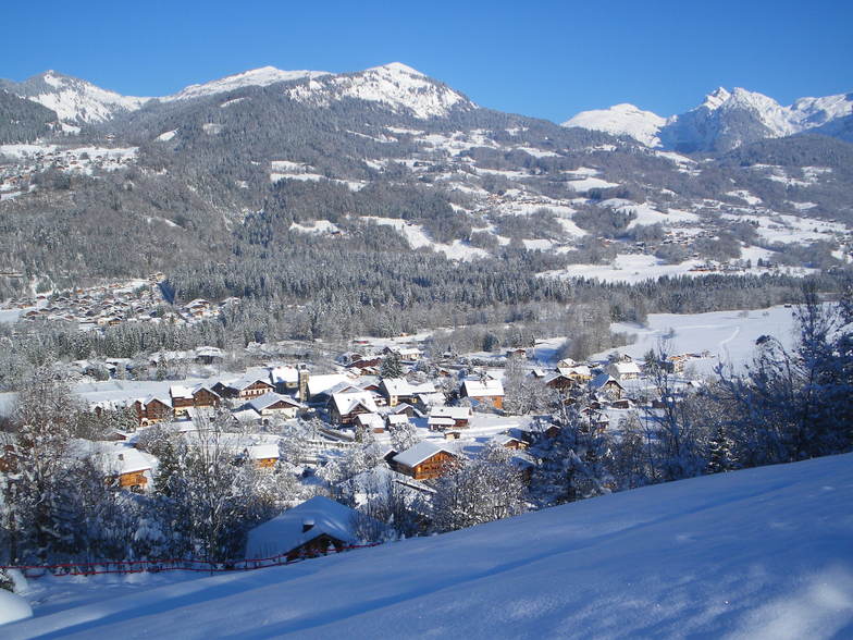
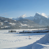
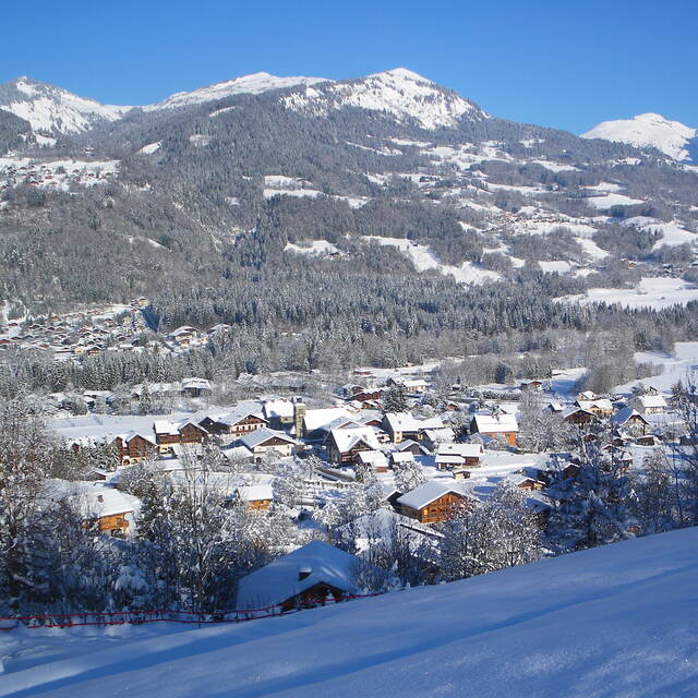
Ski lessons in Morillon
Book now

Morillon Weather (Next 3 days): The snow forecast for Morillon is: leichter Regen (gesamt 8.0mm), meistens fallend in der Nacht zu Freitag. Sehr mild (maximal 14°C am Samstag Nachm., min 1°C am Donnerstag Morg.). Wind schwächt ab.
Morillon Weather (Days 4-6): leichter Regen (gesamt 8.0mm), meistens fallend am Sonntag Morg.. Sehr mild (maximal 18°C am Dienstag Nachm., min 7°C in der Nacht zu Sonntag). Wind schwächt ab.
| Höhenlage | Schneehöhe | Temp. (°C) | Wind (km/h) | Wetter | ||
|---|---|---|---|---|---|---|
| Bergstation: | -7 | |||||
| Mittelstation: | -3 | |||||
| Tal: | 0 |
Letzte Schneeberichte in der Nähe von Morillon:
Rain showers reported from Aigle at 479 metres elevation 7 kms WSW of Leysin but it is forecast cold enough for snow at the ski area aus Leysin
Light rain reported from Leysin at 1356 metres elevation only 2 kms NE of Leysin but it is forecast cold enough for snow at the ski area aus Leysin
Resort closed for the season. See you this summer! aus La Giettaz en Aravis

Thursday 25 | Friday 26 | Saturday 27 | Sunday 28 | Monday 29 | Tuesday 30 | Wednesday 1 | |||||||||||||||
AM | PM | Nacht | AM | PM | Nacht | AM | PM | Nacht | AM | PM | Nacht | AM | PM | Nacht | AM | PM | Nacht | AM | PM | Nacht | |
einige Wolken | klar | einige Wolken | bewölkt | etwas Regen | Schauer | einige Wolken | bewölkt | bewölkt | etwas Regen | etwas Regen | etwas Regen | einige Wolken | bewölkt | einige Wolken | bewölkt | Schauer | Schauer | einige Wolken | Gewittergefahr | Schauer | |
km/h | |||||||||||||||||||||
Snow map |  |  |  |  |  |  |  | ||||||||||||||
cm | — | — | — | — | — | — | — | — | — | — | — | — | — | — | — | — | — | — | — | — | — |
mm | — | — | — | — | 2.0 | 6 | — | — | — | 1.0 | 1.0 | 1.0 | — | — | — | — | 1.0 | 4 | — | 3 | 6 |
max°C | 4 | 10 | 6 | 10 | 10 | 7 | 11 | 14 | 9 | 13 | 14 | 10 | 15 | 17 | 13 | 16 | 18 | 13 | 15 | 16 | 13 |
min°C | 1 | 8 | 3 | 7 | 10 | 4 | 6 | 13 | 6 | 9 | 12 | 7 | 9 | 16 | 9 | 12 | 16 | 10 | 11 | 15 | 11 |
chill°C | 1 | 8 | 1 | 6 | 10 | 2 | 5 | 12 | 4 | 9 | 12 | 6 | 8 | 16 | 8 | 12 | 16 | 10 | 11 | 15 | 11 |
Feuchte% | 63 | 48 | 70 | 54 | 85 | 75 | 60 | 52 | 74 | 64 | 77 | 77 | 60 | 64 | 79 | 56 | 64 | 83 | 68 | 78 | 84 |
Gefrierpunkt (m) | 1300 | 1850 | 1600 | 2000 | 2050 | 1700 | 2400 | 2600 | 2550 | 2600 | 2550 | 2900 | 2850 | 2900 | 3150 | 3000 | 2850 | 2600 | 2700 | 2850 | 2650 |
6:28 | — | — | 6:26 | — | — | 6:24 | — | — | 6:24 | — | — | 6:22 | — | — | 6:20 | — | — | 6:18 | — | — | |
— | — | 8:34 | — | — | 8:35 | — | — | 8:36 | — | — | 8:37 | — | — | 8:38 | — | — | 8:39 | — | — | 8:40 | |
leichter Regen (gesamt 8.0mm), meistens fallend in der Nacht zu Freitag. Sehr mild (maximal 14°C am Samstag Nachm., min 1°C am Donnerstag Morg.). Wind schwächt ab.
leichter Regen (gesamt 8.0mm), meistens fallend am Sonntag Morg.. Sehr mild (maximal 18°C am Dienstag Nachm., min 7°C in der Nacht zu Sonntag). Wind schwächt ab.
Letzte Schneeberichte in der Nähe von Morillon:
Rain showers reported from Aigle at 479 metres elevation 7 kms WSW of Leysin but it is forecast cold enough for snow at the ski area aus Leysin
Light rain reported from Leysin at 1356 metres elevation only 2 kms NE of Leysin but it is forecast cold enough for snow at the ski area aus Leysin
Resort closed for the season. See you this summer! aus La Giettaz en Aravis
| Die obere Schneetiefe ist: | — |
|---|---|
| Die untere Schneetiefe ist: | — |
| Neuschneetiefe Berg | 2.0 cm |
| Wann hat es das letzte Mal geschneit? | 24 Apr 2024 |
0.0 | Bluebird Powder Tage Frischer Schnee, meist sonnig, leichter Wind. |
|---|---|
0.0 | Pulverschneetage Neuschnee, bewölkt, Wind |
0.0 | Bluebird Tage Schnee, meist sonnig, leichter Wind. |


Die Tabelle oben zeigt die Wettervorhersage für Morillon auf der angegebenen Höhe von 689 m. Unsere ausgeklügelten Wettermodelle ermöglichen uns die Schneevorhersage für die Gipfel-, Mittel- und Talstationen für Morillon. Das Fenster über der Tabelle ermöglicht das Abrufen der Wettervorhersage für andere Höhen. Für einen umfassenderen Blick auf das Wetter, siehe die Wetterkarte" von France.Morillon
Klicken Sie hier, um weitere Informationen über Gefrierpunkte zu erhalten und zu lesen wie wir unsere Temperaturen prognostizieren.
Allgemein 4.3 Basiert auf 19 Abstimmungen und 26 Beurteilungen
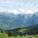
Morillon is a small resort but with very good connections to 3 other major resorts: Samoen, Carroz and Flaine. Access to the other resorts is via new express ski lift or other older ski lifts. From the main village you can use gondola to reach the ski area and when snow conditions are good you can ski all the way down to the center of the village. Overall, it is a good resort and not too crowded. It offers a peaceful place to relax in the evenings and no crazy drunk tourists everywhere.
T aus France schreibt:
Morillon is a small resort but with very good connections to 3 other major resorts: Samoen, Carroz and Flaine. Access to the other resorts is via new express ski lift or other older ski lifts.
From the main village you can use gondola to reach the ski area and when snow conditions are good you can ski all the way down to the center of the village. Overall, it is a good resort and not too crowded. It offers a peaceful place to relax in the evenings and no crazy drunk tourists everywhere.
Lesen Sie 25 andere Beurteilungen ueber Morillon oder geben Sie Ihre eigene Bewertung ab.
Das Morillon Skiwetter Wideget unten, ist auf externen Seiten kostenlos eigebettet. Es bietet eine tägliche Zusammenfassung über unsere Morillon Schneevorhersage und derzeitige Wetterbedingungen. gehen Sie einfach auf die Feed-Konfiguration Seite und folgen Sie den 3 einfachen Schritten, um den eigenen HTML-Code-Snippet zu packen und fügen Sie ihn auf Ihrer eigenen Website. Sie können die Höhe der Schneevorhersage wählen (Gipfel, mittel Berg, oder unterer Gipfel) und Messeinheiten metrisch / Schneevorhersage für den Feed auf Ihre eigene Website & hellip anpassen; Klicken Sie hier, um den Code zu bekommen.
Detaillierte Schneevorhersage für Morillon in:
snow-forecast.com


 Nearest