Herausgegeben on Snow-Forecast.com um:1 am (lokale Zeit) / 16 May 2026
Letzte 6 TageScroll links für die letzten 6 TageJetzt
Next 3 days weather summary:
leichte Neuschneedecke, fallend meistens in der Nacht zu Montag. Die Temperaturen werden deutlich unter dem Gefrierpunkt sein (maximal -8°C in der Nacht zu Montag, min -17°C am Samstag Morgen). Wind schwächt ab.
Days 4-6 weather summary:
Eine dünne Neuschneedecke. Frost-Tau-Bedingungen (maximal 1°C in der Nacht zu Donnerstag, min -8°C am Dienstag Morg.). Wind schwächt ab.
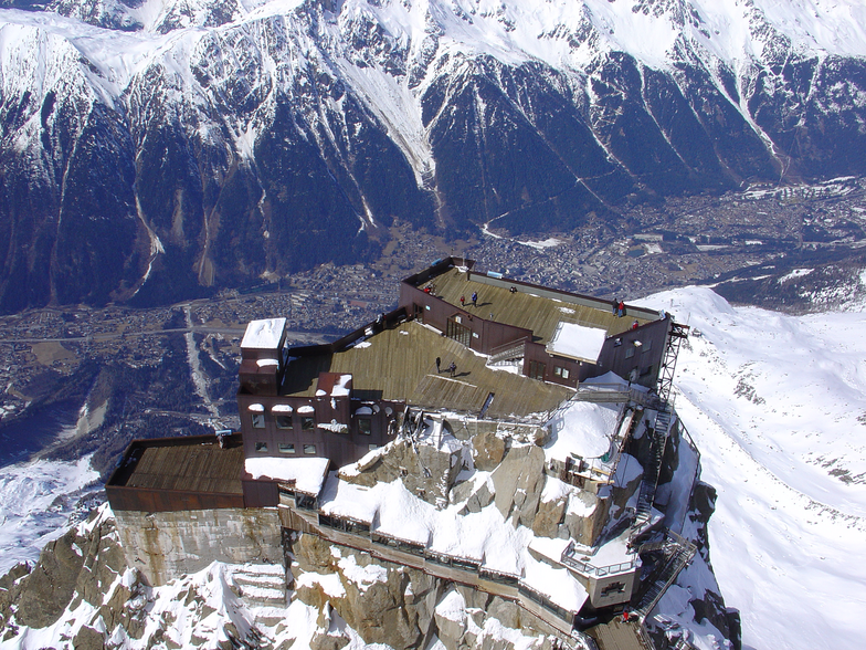
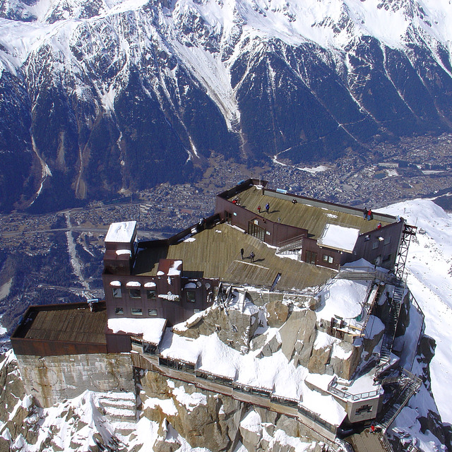
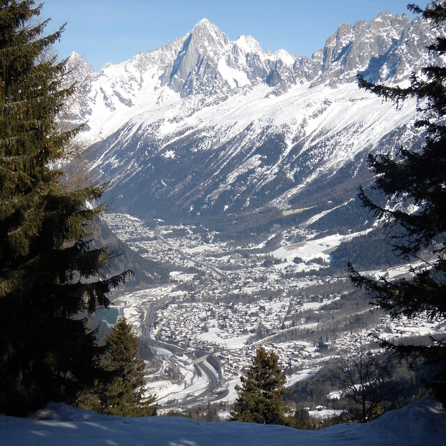
Die Tabelle oben zeigt die Wettervorhersage für Chamonix auf der angegebenen Höhe von 3842 m. Unsere ausgeklügelten Wettermodelle ermöglichen uns die Schneevorhersage für die Gipfel-, Mittel- und Talstationen für Chamonix. Das Fenster über der Tabelle ermöglicht das Abrufen der Wettervorhersage für andere Höhen. Für einen umfassenderen Blick auf das Wetter, siehe die Wetterkarte" von France.Chamonix
Klicken Sie hier, um weitere Informationen über Gefrierpunkte zu erhalten und zu lesen wie wir unsere Temperaturen prognostizieren.
Besucher-Beurteilung fuer Chamonix
Allgemein 4.1 Basiert auf 56 Abstimmungen und 92 Beurteilungen
I have been going to Chamonix for several years now, both winter and summer, and it just gets better and better. The thing about Chamonix is not only does it have world class skiing, but it is a bustling beautiful town that has a huge array of bars and restaurants, fantastic varied accommodation and fabulous shops. I like to experience different resorts across Europe but whilst skiing may be great, the off-piste can be limiting and you will only go once. With Chamonix (and a few other bigger resorts) you get an ever changing resort, suitable to budgets of all sizes and plenty to do for non-skiers too. The summer there is also just as good as the winter! If you want a purpose built ski-in / ski-out ski resort, then Chamonix is not for you. If you want the original and authentic ski town, then I can't recommend enough..
Allgemein: 4.1 Basiert auf 56 Abstimmungen und 92 Beurteilungen
Schneesicher
4.1
Vielfalt der Pisten
4.4
Off Piste
4.9
Landschaft
4.7
Apres-Ski
4.5
Spencer aus United Kingdom schreibt:
I have been going to Chamonix for several years now, both winter and summer, and it just gets better and better. The thing about Chamonix is not only does it have world class skiing, but it is a bustling beautiful town that has a huge array of bars and restaurants, fantastic varied accommodation and fabulous shops. I like to experience different resorts across Europe but whilst skiing may be great, the off-piste can be limiting and you will only go once. With Chamonix (and a few other bigger resorts) you get an ever changing resort, suitable to budgets of all sizes and plenty to do for non-skiers too. The summer there is also just as good as the winter! If you want a purpose built ski-in / ski-out ski resort, then Chamonix is not for you. If you want the original and authentic ski town, then I can't recommend enough..
Kostenlose Snow-Forecast.com Wetter Widget für Ihre Website
Das Chamonix Skiwetter Wideget unten, ist auf externen Seiten kostenlos eigebettet. Es bietet eine tägliche Zusammenfassung über unsere Chamonix Schneevorhersage und derzeitige Wetterbedingungen. gehen Sie einfach auf die Feed-Konfiguration Seite und folgen Sie den 3 einfachen Schritten, um den eigenen HTML-Code-Snippet zu packen und fügen Sie ihn auf Ihrer eigenen Website. Sie können die Höhe der Schneevorhersage wählen (Gipfel, mittel Berg, oder unterer Gipfel) und Messeinheiten metrisch / Schneevorhersage für den Feed auf Ihre eigene Website & hellip anpassen; Klicken Sie hier, um den Code zu bekommen.


 Nearest