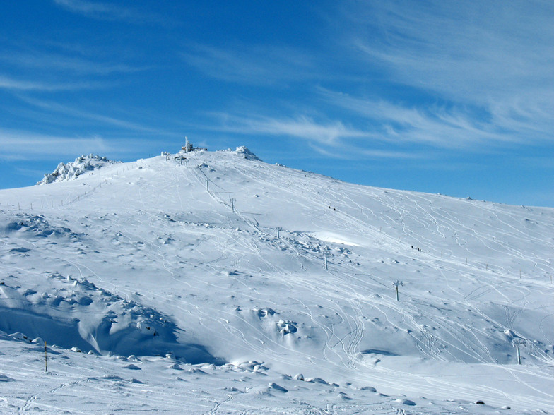


Portillo Storm Snowfall Total Passes 5m / 17 Feet
A snow storm that has now continued for nine days has taken Chilean ski resort Portillo to a snowfall total of 5.2 metres (17 feet) so far, with more snow forecast.

Next 3 days weather summary:Meist trocken. Sehr mild (maximal 19°C am Donnerstag Nachm., min 15°C am Samstag Morgen). Wind zunehmend (Windstille am Mittwoch Nachm., frische Winde aus ONO bis Freitag Nacht). | Tage 4-6 Vitosha Wetter-ZusammenfassungMeist trocken. Sehr mild (maximal 19°C am Samstag Nachm., min 15°C am Sonntag Morg.). Der Wind bleibt meist schwach.. | ||||||||||||||||
Mi 29 | Donnerstag 30 | Freitag 31 | Samstag 1 | Sonntag 2 | Montag 3 | ||||||||||||
PM | Nacht | AM | PM | Nacht | AM | PM | Nacht | AM | PM | Nacht | AM | PM | Nacht | AM | PM | Nacht | |
klar | klar | klar | klar | klar | klar | klar | klar | klar | klar | klar | klar | klar | klar | klar | einige Wolken | klar | |
km/h | |||||||||||||||||
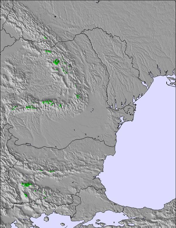
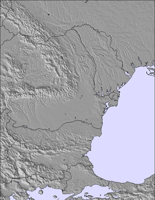
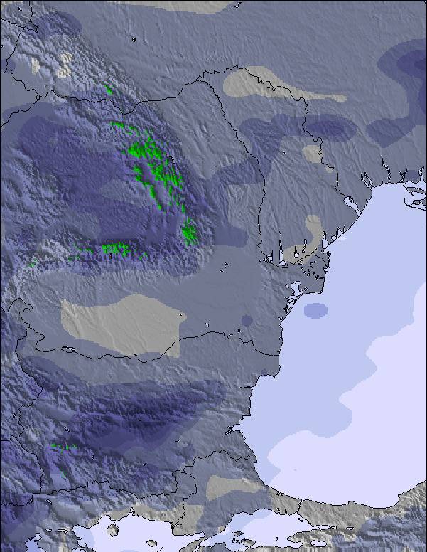
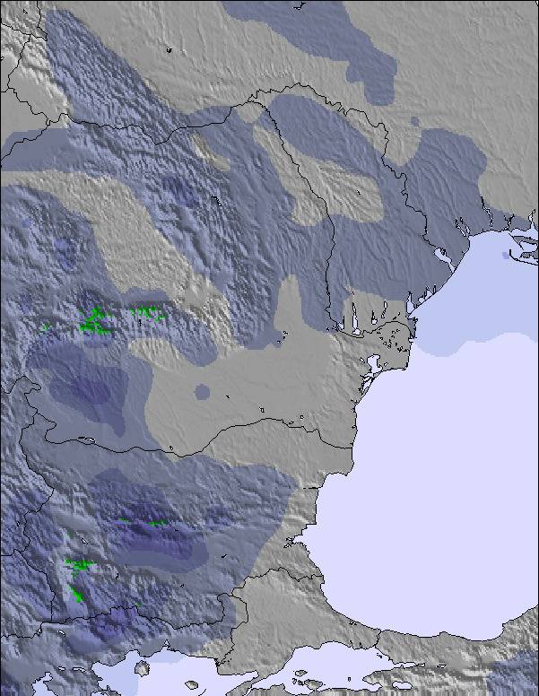
Schnee Karte |  | 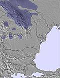 | 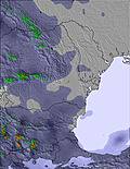 | 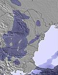 | 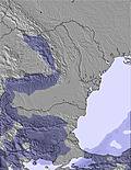 | 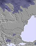 | |||||||||||
— | — | — | — | — | — | — | — | — | — | — | — | — | — | — | — | — | |
mm | — | — | — | — | — | — | — | — | — | — | — | — | — | — | — | — | — |
max °C | 18 | 18 | 17 | 19 | 19 | 17 | 19 | 18 | 17 | 19 | 18 | 16 | 19 | 18 | 16 | 19 | 19 |
min °C | 17 | 16 | 16 | 18 | 17 | 16 | 18 | 16 | 15 | 18 | 16 | 15 | 18 | 16 | 15 | 18 | 16 |
chill °C | 17 | 16 | 16 | 18 | 16 | 15 | 17 | 15 | 13 | 17 | 15 | 14 | 18 | 16 | 15 | 18 | 16 |
Feuchte % | 33 | 29 | 36 | 34 | 38 | 40 | 39 | 34 | 37 | 32 | 38 | 29 | 22 | 33 | 36 | 30 | 33 |
Gefrierpunkt m | 4300 | 4550 | 4500 | 4450 | 4550 | 4300 | 4250 | 4450 | 4350 | 4300 | 4400 | 4450 | 4400 | 4450 | 4100 | 4150 | 4200 |
— | — | 6:15 | — | — | 6:16 | — | — | 6:18 | — | — | 6:18 | — | — | 6:20 | — | — | |
8:51 | — | — | 8:50 | — | — | 8:47 | — | — | 8:46 | — | — | 8:45 | — | — | 8:45 | — | |
Werde Profi und carve ein:
Letzte Schneeberichte in der Nähe von Vitosha:
| Die obere Schneetiefe ist: | 0 cm |
|---|---|
| Die untere Schneetiefe ist: | 0 cm |
| Neuschneetiefe Berg | — |
| Wann hat es das letzte Mal geschneit? | 17 May 2026 |
0.0 | Bluebird Powder Tage Frischer Schnee, meist sonnig, leichter Wind. |
|---|---|
0.0 | Pulverschneetage Neuschnee, bewölkt, Wind |
0.0 | Bluebird Tage Schnee, meist sonnig, leichter Wind. |

Die Tabelle oben zeigt die Wettervorhersage für Vitosha auf der angegebenen Höhe von 1969 m. Unsere ausgeklügelten Wettermodelle ermöglichen uns die Schneevorhersage für die Gipfel-, Mittel- und Talstationen für Vitosha. Das Fenster über der Tabelle ermöglicht das Abrufen der Wettervorhersage für andere Höhen. Für einen umfassenderen Blick auf das Wetter, siehe die Wetterkarte" von Bulgaria.Vitosha
Klicken Sie hier, um weitere Informationen über Gefrierpunkte zu erhalten und zu lesen wie wir unsere Temperaturen prognostizieren.
Allgemein 2.8 Basiert auf 33 Abstimmungen und 10 Beurteilungen
Cons: There are few good pistes (not too long though) but they along with their lifts are usually crowded and you spend most of the time in the queues. So value for money is low, maybe sometimes except for a few detached short pistes suitable for beginners (up to 100-200m gentle slope) and just one 800 m with moderate slope (blue piste). Cons: An adult beginner has nothing to do at main sector near "Aleko" - for last years only children are allowed to use baby-lifts there! Adult beginners are welcome only at baby-lifts owned by Machirski ski-school at Ofeliite and Vetrovala ("Zlatnite mostove" west sector). But apart from that there is just one 800 m blue piste suitable for intermediate skiers and no one for advanced skiers at that sector. Both sectors are about 2 hours drive apart (you have to go down back to the village then go uphill again). Cons: Car access is partially restricted while public transportation is insufficient. Cons: You don't have a money-back option when lifts close due to weather conditions. You can try negotiating for a compensation for the next day - and sometimes you have a chance to obtain it. Cons: "Vitosha Ski" has a monopoly over all pistes and lifts except few small baby lifts. This winter "Vitosha ski" spoiled the whole ski-season due to its jobbery motives and the ski-pistes and lifts (except those few baby lifts) didn't open at all! Pros: There is a wide plateau (few kilometers) there and thanks to the frequent moderate winds snow-kite becomes more and more popular year after year! Pros: You don't need to overnight at Vitosha to take a ski-tour (or just a tour) to the peak where you can drink a tee and have a lunch with friends at the meteorology station before riding your skis or your board downslope. Pros: The main winter touring tracks (mountain-wide) in the alpine zone have relatively well maintained marking poles and offer limited or no avalanche-hazard most of the time. Pros: Fortunately there are relatively few of those noisy snow-mobiles there (you may even don't hear one for the whole trip to the peak).
Dimitar aus Bulgaria schreibt:
Cons: There are few good pistes (not too long though) but they along with their lifts are usually crowded and you spend most of the time in the queues. So value for money is low, maybe sometimes except for a few detached short pistes suitable for beginners (up to 100-200m gentle slope) and just one 800 m with moderate slope (blue piste).
Cons: An adult beginner has nothing to do at main sector near "Aleko" - for last years only children are allowed to use baby-lifts there! Adult beginners are welcome only at baby-lifts owned by Machirski ski-school at Ofeliite and Vetrovala ("Zlatnite mostove" west sector). But apart from that there is just one 800 m blue piste suitable for intermediate skiers and no one for advanced skiers at that sector. Both sectors are about 2 hours drive apart (you have to go down back to the village then go uphill again).
Cons: Car access is partially restricted while public transportation is insufficient.
Cons: You don't have a money-back option when lifts close due to weather conditions. You can try negotiating for a compensation for the next day - and sometimes you have a chance to obtain it.
Cons: "Vitosha Ski" has a monopoly over all pistes and lifts except few small baby lifts. This winter "Vitosha ski" spoiled the whole ski-season due to its jobbery motives and the ski-pistes and lifts (except those few baby lifts) didn't open at all!
Pros: There is a wide plateau (few kilometers) there and thanks to the frequent moderate winds snow-kite becomes more and more popular year after year!
Pros: You don't need to overnight at Vitosha to take a ski-tour (or just a tour) to the peak where you can drink a tee and have a lunch with friends at the meteorology station before riding your skis or your board downslope.
Pros: The main winter touring tracks (mountain-wide) in the alpine zone have relatively well maintained marking poles and offer limited or no avalanche-hazard most of the time.
Pros: Fortunately there are relatively few of those noisy snow-mobiles there (you may even don't hear one for the whole trip to the peak).
Lesen Sie 9 andere Beurteilungen ueber Vitosha oder geben Sie Ihre eigene Bewertung ab.

 Nearest