

Global Weekly Snow Roundup #314
Weekly Global Snow News, updated 14 May 2026: Fresh snowfall in Argentina, Australia and Lesotho signals winter’s approach, while Japan maintains the world’s deepest snowpack.

Next 3 days weather summary:Mäßiger Regen (gesamt 18.0mm), stärkstens am Montag Nachm.. Frost-Tau-Bedingungen (maximal 11°C am Sonntag Nachm., min -1°C am Samstag Morgen). Wind schwächt ab. | Days 4-6 weather summary:leichter Regen (gesamt 2.0mm), meistens fallend am Dienstag Nachm.. Sehr mild (maximal 19°C am Donnerstag Nachm., min 4°C in der Nacht zu Dienstag). Wind schwächt ab. | |||||||||||||||||
Saturday 16 | Sunday 17 | Monday 18 | Tuesday 19 | Wednesday 20 | Thursday 21 | |||||||||||||
AM | PM | Nacht | AM | PM | Nacht | AM | PM | Nacht | AM | PM | Nacht | AM | PM | Nacht | AM | PM | Nacht | |
Schneeschauer | etwas Regen | Schauer | einige Wolken | etwas Regen | etwas Regen | etwas Regen | mäßiger Regen | etwas Regen | bewölkt | etwas Regen | bewölkt | klar | einige Wolken | klar | klar | einige Wolken | klar | |
km/h | ||||||||||||||||||
Snow map |  |  |  |  |  |  | ||||||||||||
— | — | — | — | — | — | — | — | — | — | — | — | — | — | — | — | — | — | |
— | 2 | 1 | — | 2 | 4 | 1 | 6 | 2 | — | 2 | — | — | — | — | — | — | — | |
max °C | 3 | 6 | 4 | 8 | 11 | 6 | 8 | 8 | 7 | 9 | 10 | 8 | 14 | 16 | 13 | 16 | 19 | 15 |
min °C | -1 | 5 | -1 | 5 | 9 | 5 | 6 | 8 | 4 | 6 | 9 | 4 | 8 | 16 | 7 | 10 | 19 | 9 |
-5 | 3 | -1 | 5 | 9 | 5 | 6 | 8 | 3 | 6 | 8 | 2 | 7 | 16 | 6 | 10 | 19 | 9 | |
71 | 67 | 80 | 53 | 82 | 90 | 76 | 87 | 92 | 74 | 91 | 84 | 56 | 56 | 79 | 37 | 40 | 52 | |
1650 | 2000 | 1700 | 2400 | 2550 | 2250 | 2400 | 2450 | 2250 | 2600 | 2750 | 3050 | 3100 | 3350 | 3600 | 3650 | 3850 | 4050 | |
6:01 | — | — | 6:01 | — | — | 6:00 | — | — | 5:58 | — | — | 5:58 | — | — | 5:56 | — | — | |
— | — | 8:55 | — | — | 8:57 | — | — | 8:58 | — | — | 8:59 | — | — | 9:00 | — | — | 9:00 | |
Letzte Schneeberichte in der Nähe von Val Cenis:
| Die obere Schneetiefe ist: | — |
|---|---|
| Die untere Schneetiefe ist: | — |
| Neuschneetiefe Berg | 7 cm |
| Wann hat es das letzte Mal geschneit? | 15 May 2026 |
0.0 | Bluebird Powder Tage Frischer Schnee, meist sonnig, leichter Wind. |
|---|---|
0.0 | Pulverschneetage Neuschnee, bewölkt, Wind |
0.0 | Bluebird Tage Schnee, meist sonnig, leichter Wind. |
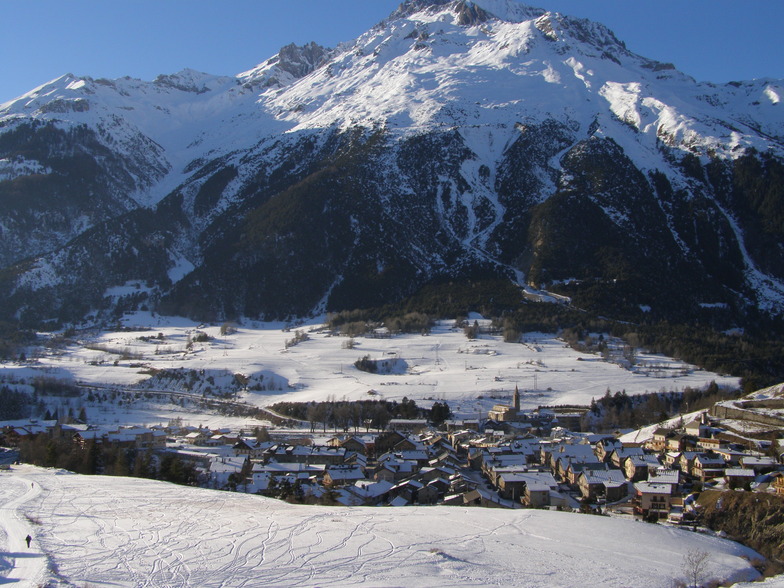
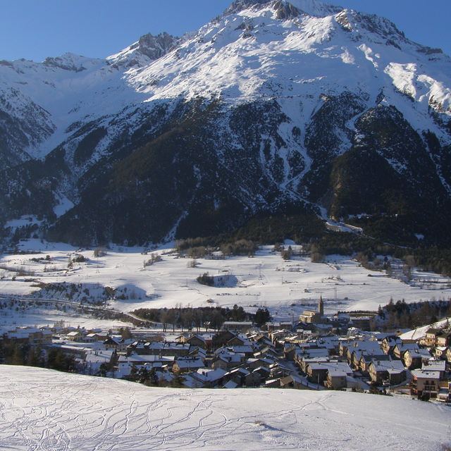
Die Tabelle oben zeigt die Wettervorhersage für Val Cenis auf der angegebenen Höhe von 1400 m. Unsere ausgeklügelten Wettermodelle ermöglichen uns die Schneevorhersage für die Gipfel-, Mittel- und Talstationen für Val Cenis. Das Fenster über der Tabelle ermöglicht das Abrufen der Wettervorhersage für andere Höhen. Für einen umfassenderen Blick auf das Wetter, siehe die Wetterkarte" von France.Val Cenis
Klicken Sie hier, um weitere Informationen über Gefrierpunkte zu erhalten und zu lesen wie wir unsere Temperaturen prognostizieren.
Allgemein 4.2 Basiert auf 31 Abstimmungen und 11 Beurteilungen
Val Cenis it was but now it's 'Grand Cenis' as there is a new link to Termignon which is well laid back and a great village to stay; French proper and that's it! Amazing scenery on the slopes and great characters in the village. Try Le Petite Farme, Marines bar and real France with the best Genepi in the Lion or go to France, not package holiday crap! Hugo.
hugo aus France schreibt:
Val Cenis it was but now it's 'Grand Cenis' as there is a new link to Termignon which is well laid back and a great village to stay; French proper and that's it!
Amazing scenery on the slopes and great characters in the village. Try Le Petite Farme, Marines bar and real France with the best Genepi in the Lion or go to France, not package holiday crap!
Hugo.
Lesen Sie 10 andere Beurteilungen ueber Val Cenis oder geben Sie Ihre eigene Bewertung ab.


 Nearest