
North American Weekly Snow Roundup #307
Weekly Snow News for North America, updated 26 March 2026: Record 1.3m (52") Midwest snowfall contrasts with extreme western US warmth.

Ponte di Legno Weather (Next 3 days): The snow forecast for Ponte di Legno is: Meist trocken. Frost-Tau-Bedingungen (maximal 1°C am Samstag Nachm., min -12°C in der Nacht zu Donnerstag). Wind schwächt ab.
Ponte di Legno Weather (Days 4-6): Eine dünne Neuschneedecke. Temperaturen werden unter dem Gefrierpunkt sein (maximal 0°C am Mittwoch Morg., min -9°C in der Nacht zu Montag). Wind schwächt ab.
| Höhenlage | Schneehöhe | Temp. (°C) | Wind (km/h) | Wetter | ||
|---|---|---|---|---|---|---|
| Bergstation: | -16 | |||||
| Mittelstation: | -12 | |||||
| Tal: | -9 |

Friday 27 | Saturday 28 | Sunday 29 | Monday 30 | Tuesday 31 | ||||||||||||
Nacht | AM | PM | Nacht | AM | PM | Nacht | AM | PM | Nacht | AM | PM | Nacht | AM | PM | Nacht | |
einige Wolken | Schneeschauer | klar | klar | einige Wolken | bewölkt | bewölkt | bewölkt | einige Wolken | einige Wolken | leichter Schnee | leichter Schnee | Schneeschauer | Schneeschauer | klar | Schneeschauer | |
km/h | ||||||||||||||||
Snow map |  |  |  |  |  |  | ||||||||||
— | — | — | — | — | — | — | — | — | — | — | 1 | 2 | — | — | 1 | |
— | — | — | — | — | — | — | — | — | — | — | — | — | — | — | — | |
max °C | -11 | -4 | -2 | -4 | 0 | 1 | -3 | -2 | -2 | -4 | -2 | -2 | -5 | -5 | -5 | -4 |
min °C | -12 | -8 | -5 | -6 | 0 | -2 | -5 | -3 | -4 | -5 | -2 | -3 | -9 | -7 | -6 | -6 |
-19 | -14 | -8 | -9 | 0 | -4 | -8 | -6 | -6 | -5 | -5 | -8 | -16 | -12 | -12 | -12 | |
67 | 62 | 63 | 59 | 40 | 66 | 85 | 54 | 69 | 69 | 36 | 82 | 84 | 57 | 50 | 80 | |
150 | 700 | 1700 | 600 | 2050 | 2150 | 1250 | 1550 | 1900 | 1150 | 1800 | 1750 | 1200 | 1200 | 1550 | 1150 | |
— | 6:07 | — | — | 6:05 | — | — | 7:03 | — | — | 6:01 | — | — | 6:00 | — | — | |
— | — | 6:38 | — | — | 6:39 | — | — | 7:40 | — | — | 6:43 | — | — | 6:44 | — | |
Meist trocken. Frost-Tau-Bedingungen (maximal 1°C am Samstag Nachm., min -12°C in der Nacht zu Donnerstag). Wind schwächt ab.
Eine dünne Neuschneedecke. Temperaturen werden unter dem Gefrierpunkt sein (maximal 0°C am Mittwoch Morg., min -9°C in der Nacht zu Montag). Wind schwächt ab.
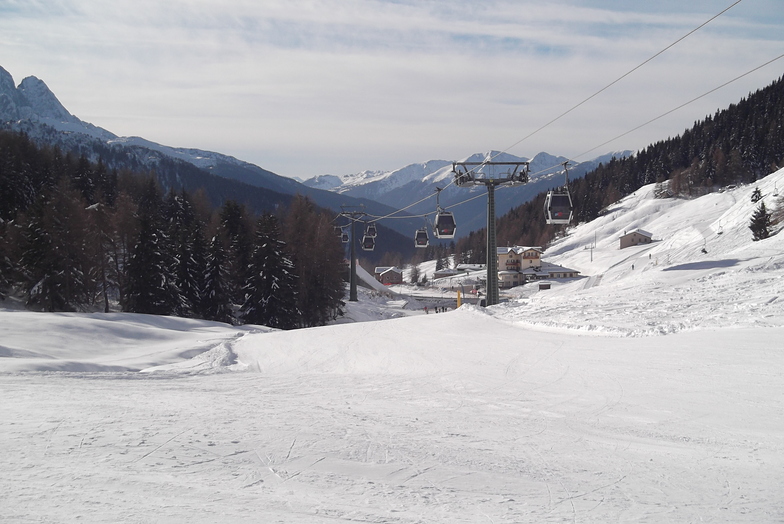
Letzte Schneeberichte in der Nähe von Ponte di Legno:
Blowing moderate snow reported from Paganella Mounta Airport at 1717 metres elevation only 3 kms SSE of Andalo but it is probably falling as rain at the bottom of the ski area aus Andalo
| Die obere Schneetiefe ist: | — |
|---|---|
| Die untere Schneetiefe ist: | — |
| Neuschneetiefe Berg | 7 cm |
| Wann hat es das letzte Mal geschneit? | 25 Mar 2026 |
0.6 | Bluebird Powder Tage Frischer Schnee, meist sonnig, leichter Wind. |
|---|---|
1.3 | Pulverschneetage Neuschnee, bewölkt, Wind |
1.0 | Bluebird Tage Schnee, meist sonnig, leichter Wind. |
Die Tabelle oben zeigt die Wettervorhersage für Ponte di Legno auf der angegebenen Höhe von 2095 m. Unsere ausgeklügelten Wettermodelle ermöglichen uns die Schneevorhersage für die Gipfel-, Mittel- und Talstationen für Ponte di Legno. Das Fenster über der Tabelle ermöglicht das Abrufen der Wettervorhersage für andere Höhen. Für einen umfassenderen Blick auf das Wetter, siehe die Wetterkarte" von Italy.Ponte di Legno
Klicken Sie hier, um weitere Informationen über Gefrierpunkte zu erhalten und zu lesen wie wir unsere Temperaturen prognostizieren.
Allgemein 3.9 Basiert auf 3 Abstimmungen.


 Nearest