

Global Weekly Snow Roundup #314
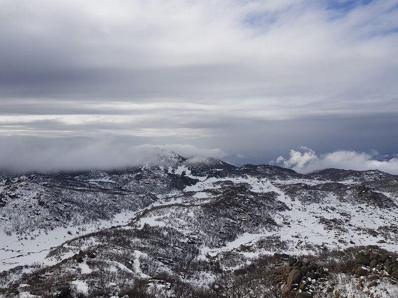
Weekly Global Snow News, updated 14 May 2026: Fresh snowfall in Argentina, Australia and Lesotho signals winter’s approach, while Japan maintains the world’s deepest snowpack.

Next 4 days weather summary:starker Regen (gesamt 29.0mm), stärkstens währ. Sonntagmorg. Milde Temperaturen (maximal 8°C In der Nacht zu Samstag, min 6°C am Sonntag Morg.). Wind abnehmend (frische Winde aus Norden am Sonntag Morg., Windstille bis Montag Nacht). | Days 5-7 weather summary:Meist trocken. Milde Temperaturen (maximal 7°C in der Nacht zu Donnerstag, min 2°C am Mittwoch Morg.). Wind schwächt ab. | |||||||||||||||
Sunday 17 | Monday 18 | Tuesday 19 | Wednesday 20 | Thursday 21 | ||||||||||||
Nacht | AM | PM | Nacht | AM | PM | Nacht | AM | PM | Nacht | AM | PM | Nacht | AM | PM | Nacht | |
einige Wolken | etwas Regen | mäßiger Regen | mäßiger Regen | etwas Regen | Schauer | bewölkt | Schauer | Schauer | einige Wolken | klar | klar | klar | klar | klar | klar | |
km/h | ||||||||||||||||
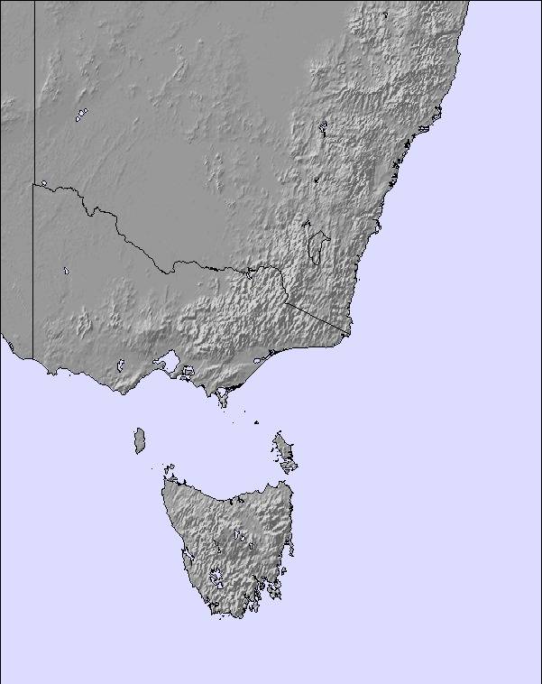
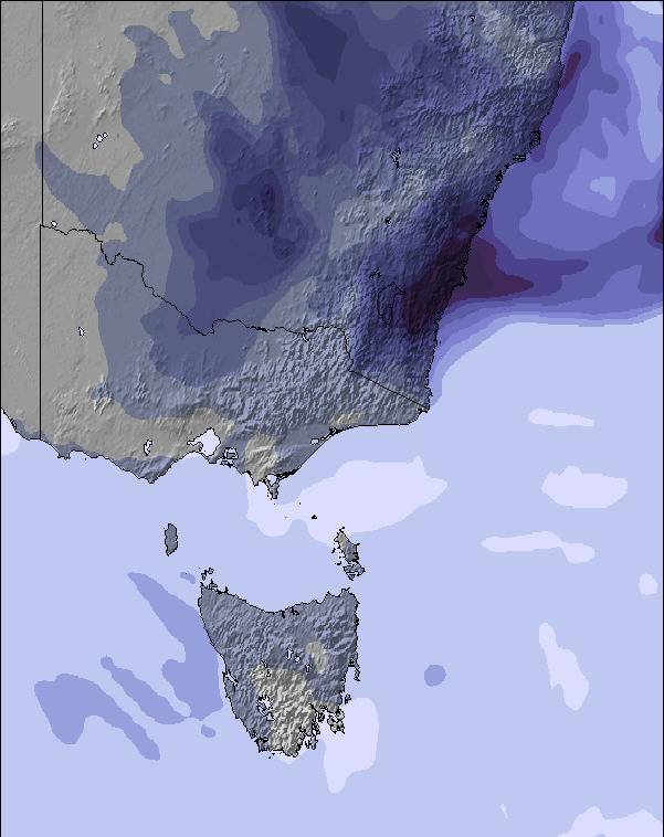
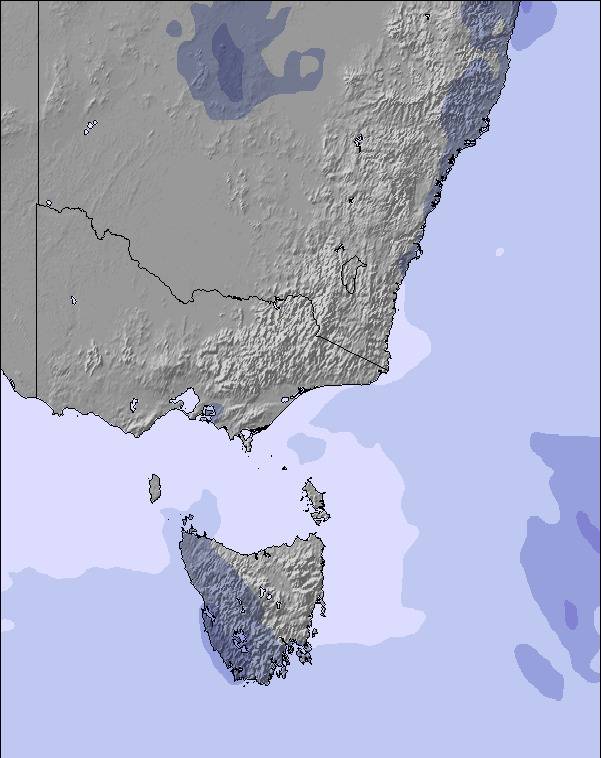
Snow map | 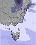 | 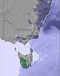 | 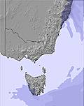 | 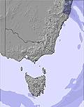 | 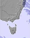 | 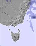 | ||||||||||
— | — | — | — | — | — | — | — | — | — | — | — | — | — | — | — | |
— | 5 | 10 | 9 | 2 | 1 | — | 1 | 1 | — | — | — | — | — | — | — | |
max °C | 8 | 6 | 6 | 6 | 6 | 7 | 7 | 6 | 6 | 5 | 4 | 4 | 5 | 5 | 6 | 7 |
min °C | 7 | 6 | 6 | 6 | 6 | 7 | 6 | 6 | 6 | 3 | 2 | 3 | 3 | 5 | 6 | 6 |
3 | 2 | 1 | 3 | 5 | 6 | 5 | 4 | 2 | -2 | -3 | -2 | -2 | 1 | 3 | 2 | |
80 | 93 | 100 | 100 | 90 | 85 | 80 | 77 | 77 | 72 | 79 | 61 | 66 | 41 | 51 | 36 | |
2850 | 2650 | 2750 | 2700 | 2900 | 2800 | 2750 | 2650 | 2600 | 2400 | 2300 | 2700 | 3200 | 3350 | 3350 | 3400 | |
— | 7:03 | — | — | 7:05 | — | — | 7:05 | — | — | 7:05 | — | — | 7:07 | — | — | |
— | — | 5:13 | — | — | 5:12 | — | — | 5:10 | — | — | 5:10 | — | — | 5:09 | — | |
Letzte Schneeberichte in der Nähe von Mount Buffalo:
| Die obere Schneetiefe ist: | — |
|---|---|
| Die untere Schneetiefe ist: | — |
| Neuschneetiefe Berg | — |
| Wann hat es das letzte Mal geschneit? | 7 May 2026 |
0.1 | Bluebird Powder Tage Frischer Schnee, meist sonnig, leichter Wind. |
|---|---|
0.0 | Pulverschneetage Neuschnee, bewölkt, Wind |
0.0 | Bluebird Tage Schnee, meist sonnig, leichter Wind. |
Die Tabelle oben zeigt die Wettervorhersage für Mount Buffalo auf der angegebenen Höhe von 1594 m. Unsere ausgeklügelten Wettermodelle ermöglichen uns die Schneevorhersage für die Gipfel-, Mittel- und Talstationen für Mount Buffalo. Das Fenster über der Tabelle ermöglicht das Abrufen der Wettervorhersage für andere Höhen. Für einen umfassenderen Blick auf das Wetter, siehe die Wetterkarte" von Australia.Mount Buffalo
Klicken Sie hier, um weitere Informationen über Gefrierpunkte zu erhalten und zu lesen wie wir unsere Temperaturen prognostizieren.
Allgemein 2.4 Basiert auf 3 Abstimmungen und 5 Beurteilungen
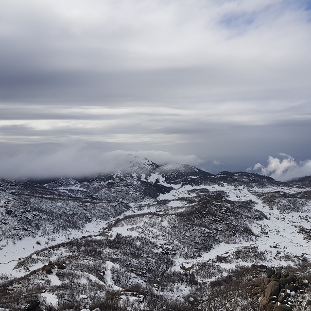
Early snow in 2019 season posted on snow-forecast so off we went to see the snow..The highest point on the mountain one can access is 'The Horn'. The last kilometer of muddy track ends at the parking area. Light fine rain with a 30kph wind was not much fun. The local authorities have not done much of a job keeping the climbing track up to The Horn very clean. Every few metres, from the beginning of the track, lie used tissues where people have not even bothered to cover up their crap or tissue piles. There are 2 main ski areas (free access is unusual for Australia); the upper most being 'Cresta' is a carpark where once a kiosk/ski shop was burnt down and dozed years ago. Silent rusting ski lifts stand testament to happier days gone by. An 'emergency shelter' (a container sized shed) is on the car park but securely locked. There is no phone service here as a sign on the shelter warns. 'Dingo Dell' is the first ski area you come to as you ascent the mountain road. It has a small kiosk and ample parking. No lifts there. Staff not hospitable either. So, all in all, the best part is, it's free..
Jim Faulkner aus Australia schreibt:
Early snow in 2019 season posted on snow-forecast so off we went to see the snow..The highest point on the mountain one can access is 'The Horn'. The last kilometer of muddy track ends at the parking area. Light fine rain with a 30kph wind was not much fun. The local authorities have not done much of a job keeping the climbing track up to The Horn very clean. Every few metres, from the beginning of the track, lie used tissues where people have not even bothered to cover up their crap or tissue piles. There are 2 main ski areas (free access is unusual for Australia); the upper most being 'Cresta' is a carpark where once a kiosk/ski shop was burnt down and dozed years ago. Silent rusting ski lifts stand testament to happier days gone by. An 'emergency shelter' (a container sized shed) is on the car park but securely locked. There is no phone service here as a sign on the shelter warns.
'Dingo Dell' is the first ski area you come to as you ascent the mountain road. It has a small kiosk and ample parking. No lifts there. Staff not hospitable either. So, all in all, the best part is, it's free..
Lesen Sie 4 andere Beurteilungen ueber Mount Buffalo oder geben Sie Ihre eigene Bewertung ab.


 Nearest