


View forecast
Moriyoshi at 1180 m Höhenlage
Herausgegeben on Snow-Forecast.com um: 2 pm (lokale Zeit) / 20 Apr 2024
Now
Sat 20 | Sunday 21 | Monday 22 | Tuesday 23 | Wednesday 24 | Thursday 25 | Friday 26 | ||||||||||||||
PM | Nacht | AM | PM | Nacht | AM | PM | Nacht | AM | PM | Nacht | AM | PM | Nacht | AM | PM | Nacht | AM | PM | Nacht | |
klar | einige Wolken | einige Wolken | klar | klar | klar | bewölkt | einige Wolken | klar | bewölkt | einige Wolken | bewölkt | etwas Regen | etwas Regen | etwas Regen | etwas Regen | einige Wolken | klar | klar | klar | |
km/h | ||||||||||||||||||||
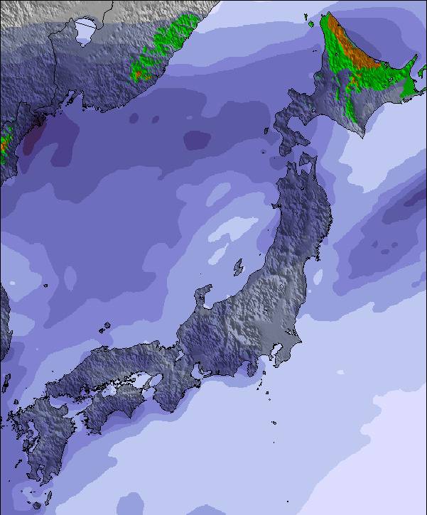
Snow map | 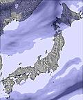 |  | 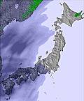 | 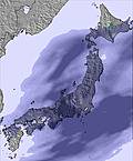 | 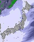 |  |  | |||||||||||||
cm | — | — | — | — | — | — | — | — | — | — | — | — | — | — | — | — | — | — | — | — |
mm | — | — | — | — | — | — | — | — | — | — | — | — | 5 | 4 | 2.0 | 2.0 | — | — | — | — |
max°C | 3 | 4 | 5 | 7 | 7 | 9 | 11 | 8 | 11 | 12 | 10 | 11 | 8 | 8 | 3 | 4 | 9 | 13 | 15 | 13 |
min°C | 2 | 3 | 5 | 7 | 7 | 9 | 10 | 8 | 9 | 9 | 9 | 9 | 8 | 4 | 3 | 3 | 5 | 12 | 14 | 12 |
chill°C | -3 | -3 | 1 | 5 | 5 | 8 | 9 | 8 | 9 | 8 | 8 | 5 | 3 | -2 | -4 | -3 | 0 | 12 | 14 | 11 |
Feuchte% | 70 | 28 | 33 | 60 | 44 | 40 | 54 | 68 | 57 | 68 | 39 | 59 | 85 | 98 | 98 | 99 | 66 | 26 | 39 | 35 |
Gefrierpunkt (m) | 3000 | 3100 | 2450 | 2450 | 2650 | 3150 | 3250 | 3250 | 3200 | 3300 | 3350 | 3400 | 3250 | 2950 | 1800 | 3000 | 3350 | 3250 | 3350 | 3450 |
— | — | 4:50 | — | — | 4:48 | — | — | 4:48 | — | — | 4:46 | — | — | 4:45 | — | — | 4:43 | — | — | |
6:21 | — | — | 6:22 | — | — | 6:22 | — | — | 6:23 | — | — | 6:24 | — | — | 6:25 | — | — | 6:27 | — | |
Zusammenfassung Wetterprognose an folgenden Tagen 0 - 3
Meist trocken. Sehr mild (maximal 11°C am Montag Nachm., min 2°C am Samstag Nachm.). Wind abnehmend (frische Winde aus NW am Samstag Nachm., Windstille bis Montag Nachm.).
Zusammenfassung Wetterprognose an folgenden Tagen 4 - 6
Mäßiger Regen (gesamt 13.0mm), stärkstens am Mittwoch Nachm.. Sehr mild (maximal 13°C am Freitag Morg., min 3°C am Donnerstag Morg.). Wind abnehmend (starke Winde aus SW am Donnerstag Morg., Windstille bis Freitag Morg.).
Popular Moriyoshi Pages
Schneefallradar
Bericht einreichenLetzte Schneeberichte in der Nähe von Moriyoshi:
38 km weg von Moriyoshi
vor 12 hour
Limited skiing due to the lack of snow. Cloudy this morning, clearing later. aus Appi Kogen
Schneeverhältnisse in Moriyoshi
| Die obere Schneetiefe ist: | — |
|---|---|
| Die untere Schneetiefe ist: | — |
| Neuschneetiefe Berg | — |
| Wann hat es das letzte Mal geschneit? | 9 Apr 2024 |
Andere Skigebiete in Japan - Akita berichten: Pulverschnee (0) / Gute Pistenbedingungen (0)
Partnerangebote Snow-Forecast
Show your business here
Schneerückschau
Woche 3 von April hat im Durchschnitt:
0.1 | Bluebird Powder Tage Frischer Schnee, meist sonnig, leichter Wind. |
|---|---|
0.4 | Pulverschneetage Neuschnee, bewölkt, Wind |
0.4 | Bluebird Tage Schnee, meist sonnig, leichter Wind. |

Andere Skigebiete in Japan - Akita berichten: Pulverschnee (0) / Gute Pistenbedingungen (0)
Die Tabelle oben zeigt die Wettervorhersage für Moriyoshi auf der angegebenen Höhe von 1180 m. Unsere ausgeklügelten Wettermodelle ermöglichen uns die Schneevorhersage für die Gipfel-, Mittel- und Talstationen für Moriyoshi. Das Fenster über der Tabelle ermöglicht das Abrufen der Wettervorhersage für andere Höhen. Für einen umfassenderen Blick auf das Wetter, siehe die Wetterkarte" von Japan.Moriyoshi
Klicken Sie hier, um weitere Informationen über Gefrierpunkte zu erhalten und zu lesen wie wir unsere Temperaturen prognostizieren.
Besucher-Beurteilung fuer Moriyoshi
Kostenlose Snow-Forecast.com Wetter Widget für Ihre Website
Das Moriyoshi Skiwetter Wideget unten, ist auf externen Seiten kostenlos eigebettet. Es bietet eine tägliche Zusammenfassung über unsere Moriyoshi Schneevorhersage und derzeitige Wetterbedingungen. gehen Sie einfach auf die Feed-Konfiguration Seite und folgen Sie den 3 einfachen Schritten, um den eigenen HTML-Code-Snippet zu packen und fügen Sie ihn auf Ihrer eigenen Website. Sie können die Höhe der Schneevorhersage wählen (Gipfel, mittel Berg, oder unterer Gipfel) und Messeinheiten metrisch / Schneevorhersage für den Feed auf Ihre eigene Website & hellip anpassen; Klicken Sie hier, um den Code zu bekommen.
Detaillierte Schneevorhersage für Moriyoshi in:
snow-forecast.com

 Nearest