

Global Weekly Snow Roundup #314
Weekly Global Snow News, updated 14 May 2026: Fresh snowfall in Argentina, Australia and Lesotho signals winter’s approach, while Japan maintains the world’s deepest snowpack.

Next 3 days weather summary:sehr leichter Schneefall übergehend in leichten Regen (gesamt 16.0mm) stärkstens in der Nacht zu Montag. Frost-Tau-Bedingungen (maximal 7°C am Montag Morg., min -4°C In der Nacht zu Samstag). Wind schwächt ab. | Days 4-6 weather summary:leichter Regen (gesamt 8.0mm), meistens fallend am Dienstag Nachm.. Sehr mild (maximal 14°C am Donnerstag Nachm., min 3°C am Dienstag Morg.). Wind schwächt ab. | |||||||||||||||||
Saturday 16 | Sunday 17 | Monday 18 | Tuesday 19 | Wednesday 20 | Thursday 21 | |||||||||||||
AM | PM | Nacht | AM | PM | Nacht | AM | PM | Nacht | AM | PM | Nacht | AM | PM | Nacht | AM | PM | Nacht | |
leichter Schnee | leichter Schnee | Schneeschauer | klar | einige Wolken | bewölkt | etwas Regen | mäßiger Regen | Schneeschauer | einige Wolken | etwas Regen | etwas Regen | einige Wolken | Schauer | Schauer | klar | klar | klar | |
km/h | ||||||||||||||||||
Snow map |  |  |  |  |  |  | ||||||||||||
2 | 1 | — | — | — | — | — | — | — | — | — | — | — | — | — | — | — | — | |
— | — | — | — | — | — | 1 | 6 | 9 | — | 1 | 4 | — | 2 | 1 | — | — | — | |
max °C | -1 | 1 | 0 | 3 | 6 | 5 | 7 | 7 | 2 | 6 | 8 | 6 | 7 | 10 | 9 | 11 | 14 | 12 |
min °C | -2 | 0 | -4 | 0 | 5 | 3 | 5 | 5 | 1 | 3 | 8 | 5 | 6 | 10 | 7 | 8 | 13 | 9 |
-5 | -2 | -7 | -2 | 5 | 2 | 5 | 3 | 0 | 3 | 8 | 5 | 6 | 9 | 7 | 8 | 13 | 9 | |
96 | 90 | 87 | 66 | 63 | 82 | 65 | 95 | 90 | 73 | 72 | 99 | 79 | 65 | 83 | 65 | 44 | 73 | |
1500 | 1750 | 1000 | 2100 | 2450 | 2200 | 2400 | 2450 | 1950 | 2500 | 2700 | 2550 | 2700 | 2900 | 2900 | 3050 | 3250 | 3600 | |
5:43 | — | — | 5:43 | — | — | 5:41 | — | — | 5:39 | — | — | 5:39 | — | — | 5:37 | — | — | |
— | — | 8:49 | — | — | 8:50 | — | — | 8:52 | — | — | 8:52 | — | — | 8:53 | — | — | 8:54 | |
Letzte Schneeberichte in der Nähe von Montafon:
| Die obere Schneetiefe ist: | 0 cm |
|---|---|
| Die untere Schneetiefe ist: | 0 cm |
| Neuschneetiefe Berg | 17 cm |
| Wann hat es das letzte Mal geschneit? | 15 May 2026 |
0.0 | Bluebird Powder Tage Frischer Schnee, meist sonnig, leichter Wind. |
|---|---|
0.1 | Pulverschneetage Neuschnee, bewölkt, Wind |
0.0 | Bluebird Tage Schnee, meist sonnig, leichter Wind. |
Die Tabelle oben zeigt die Wettervorhersage für Montafon auf der angegebenen Höhe von 1650 m. Unsere ausgeklügelten Wettermodelle ermöglichen uns die Schneevorhersage für die Gipfel-, Mittel- und Talstationen für Montafon. Das Fenster über der Tabelle ermöglicht das Abrufen der Wettervorhersage für andere Höhen. Für einen umfassenderen Blick auf das Wetter, siehe die Wetterkarte" von Austria.Montafon
Klicken Sie hier, um weitere Informationen über Gefrierpunkte zu erhalten und zu lesen wie wir unsere Temperaturen prognostizieren.
Allgemein 4.1 Basiert auf 20 Abstimmungen und 3 Beurteilungen
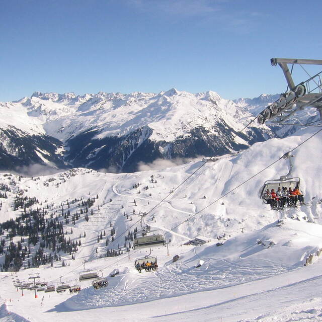
Montafon is an excellent destination in Vorarlberg. Access by car is assured also during heavy snow fall and you can choose between different parking areas in Schruns, St. Gallenkirch or Gaschurn. Offer of perfectly groomed slopes goes from easy ones in Kapell area to black ones. This season, with a lot of snow, the Black Scorpion in the back of Versettla was fantastic. But, in general, all very large slopes. Guaranteed good rides also on weekends when it is crowded. I suggest, also, the Hochjochtotal from 2400m down to 700m in Schruns or from Sennigrat to Silbertal. Restaurants and bars are available everywhere and with the sun shining nothing's better than to chill out on the terrace. A good tip is to ski during weekdays, to avoid crowded slopes and traffic jams early in the morning and later in the afternoon.
Massimo Anselmi aus Italy schreibt:
Montafon is an excellent destination in Vorarlberg. Access by car is assured also during heavy snow fall and you can choose between different parking areas in Schruns, St. Gallenkirch or Gaschurn.
Offer of perfectly groomed slopes goes from easy ones in Kapell area to black ones. This season, with a lot of snow, the Black Scorpion in the back of Versettla was fantastic. But, in general, all very large slopes. Guaranteed good rides also on weekends when it is crowded.
I suggest, also, the Hochjochtotal from 2400m down to 700m in Schruns or from Sennigrat to Silbertal.
Restaurants and bars are available everywhere and with the sun shining nothing's better than to chill out on the terrace.
A good tip is to ski during weekdays, to avoid crowded slopes and traffic jams early in the morning and later in the afternoon.
Lesen Sie 2 andere Beurteilungen ueber Montafon oder geben Sie Ihre eigene Bewertung ab.


 Nearest