


Global Weekly Snow Roundup #318
Weekly Snow News for the world, updated 11 June 2026: Australia's season begins, Val d’Isère reopens and major snowfall is forecast for the Andes.

Nächste 3 Tage Wetterzusammenfassung:Meist trocken. Sehr mild (maximal 13°C am Samstag Nachm., min 5°C am Freitag Morg.). Der Wind bleibt meist schwach.. | Wetterzusammenfassung für Tage 4-6:Meist trocken. Sehr mild (maximal 13°C am Mittwoch Nachm., min 7°C am Montag Morg.). Der Wind bleibt meist schwach.. | |||||||||||||||||
Freitag 12 | Samstag 13 | Sonntag 14 | Montag 15 | Dienstag 16 | Mittwoch 17 | |||||||||||||
AM | PM | Nacht | AM | PM | Nacht | AM | PM | Nacht | AM | PM | Nacht | AM | PM | Nacht | AM | PM | Nacht | |
einige Wolken | klar | klar | klar | klar | einige Wolken | einige Wolken | einige Wolken | klar | klar | klar | klar | bewölkt | bewölkt | klar | klar | klar | klar | |
km/h | ||||||||||||||||||
Schnee Karte |  |  |  |  |  |  | ||||||||||||
— | — | — | — | — | — | — | — | — | — | — | — | — | — | — | — | — | — | |
— | — | — | — | — | — | — | — | — | — | — | — | — | — | — | — | — | — | |
max °C | 6 | 9 | 9 | 11 | 13 | 12 | 11 | 12 | 10 | 9 | 10 | 9 | 9 | 10 | 10 | 11 | 13 | 13 |
min °C | 5 | 9 | 8 | 8 | 13 | 9 | 9 | 11 | 7 | 7 | 10 | 7 | 8 | 10 | 8 | 9 | 13 | 12 |
4 | 7 | 7 | 7 | 12 | 8 | 9 | 10 | 5 | 6 | 9 | 6 | 8 | 9 | 7 | 8 | 13 | 12 | |
75 | 65 | 59 | 36 | 29 | 43 | 28 | 40 | 52 | 47 | 55 | 56 | 44 | 43 | 59 | 50 | 54 | 49 | |
3300 | 3600 | 3850 | 3900 | 4000 | 3850 | 3700 | 3600 | 3550 | 3450 | 3400 | 3450 | 3650 | 3650 | 3850 | 3900 | 4050 | 4200 | |
5:39 | — | — | 5:39 | — | — | 5:39 | — | — | 5:39 | — | — | 5:39 | — | — | 5:39 | — | — | |
— | — | 9:23 | — | — | 9:23 | — | — | 9:24 | — | — | 9:24 | — | — | 9:25 | — | — | 9:25 | |
Werde Profi und carve ein:
Lawineninformationen: European Avalanche Warning Services (EAWS)
Letzte Schneeberichte in der Nähe von Leysin:
| Die obere Schneetiefe ist: | 0 cm |
|---|---|
| Die untere Schneetiefe ist: | 0 cm |
| Neuschneetiefe Berg | — |
| Wann hat es das letzte Mal geschneit? | 16 May 2026 |
0.0 | Bluebird Powder Tage Frischer Schnee, meist sonnig, leichter Wind. |
|---|---|
0.0 | Pulverschneetage Neuschnee, bewölkt, Wind |
0.0 | Bluebird Tage Schnee, meist sonnig, leichter Wind. |
Die Tabelle oben zeigt die Wettervorhersage für Leysin auf der angegebenen Höhe von 2205 m. Unsere ausgeklügelten Wettermodelle ermöglichen uns die Schneevorhersage für die Gipfel-, Mittel- und Talstationen für Leysin. Das Fenster über der Tabelle ermöglicht das Abrufen der Wettervorhersage für andere Höhen. Für einen umfassenderen Blick auf das Wetter, siehe die Wetterkarte" von Switzerland.Leysin
Klicken Sie hier, um weitere Informationen über Gefrierpunkte zu erhalten und zu lesen wie wir unsere Temperaturen prognostizieren.
Allgemein 4.0 Basiert auf 17 Abstimmungen und 16 Beurteilungen
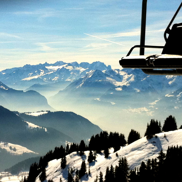
We always hire a car so can travel to and from the glacier and Les Diablerets. Most of the time there are empty slopes. Yes, it’s expensive but that’s Switzerland for you. Enough to keep a decent skier entertained for a week and views are amazing
Kerry aus United Kingdom schreibt:
We always hire a car so can travel to and from the glacier and Les Diablerets. Most of the time there are empty slopes. Yes, it’s expensive but that’s Switzerland for you. Enough to keep a decent skier entertained for a week and views are amazing
Lesen Sie 15 andere Beurteilungen ueber Leysin oder geben Sie Ihre eigene Bewertung ab.


 Nearest