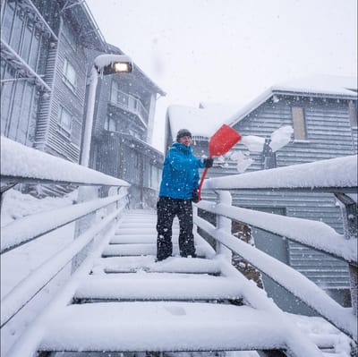
"March Madness" As Snowfall Hits Australia In Early Autumn
Winter made an early-season entrance in Australia overnight, with a polar blast from the Antarctic dumping up to 15cm of fresh snow on the slopes as temperatures tumbled to around -2.C.

Le Chable Weather (Next 3 days): The snow forecast for Le Chable is: Eine dünne Schneedecke am Dienstag Morg.. steigende Nullgradgrenze mit Nieselregen am Mittwoch Nachm.. Frost-Tau-Bedingungen (maximal 3°C am Mittwoch Nachm., min -11°C in der Nacht zu Dienstag). Wind schwächt ab.
Le Chable Weather (Days 4-6): Meist trocken. Frost-Tau-Bedingungen (maximal 10°C am Sonntag Nachm., min -4°C am Freitag Morg.). Wind schwächt ab.
| Höhenlage | Schneehöhe | Temp. (°C) | Wind (km/h) | Wetter | ||
|---|---|---|---|---|---|---|
| Bergstation: | -12 | |||||
| Mittelstation: | -6 | |||||
| Tal: | -1 |

Tuesday 31 | Wednesday 1 | Thursday 2 | Friday 3 | Saturday 4 | Sunday 5 | |||||||||||||
AM | PM | Nacht | AM | PM | Nacht | AM | PM | Nacht | AM | PM | Nacht | AM | PM | Nacht | AM | PM | Nacht | |
leichter Schnee | leichter Schnee | Schneeschauer | klar | etwas Regen | klar | klar | bewölkt | Schneeschauer | klar | einige Wolken | klar | klar | einige Wolken | klar | einige Wolken | einige Wolken | klar | |
km/h | ||||||||||||||||||
Snow map |  |  |  |  |  |  | ||||||||||||
1 | — | 1 | — | — | — | — | — | — | — | — | — | — | — | — | — | — | — | |
— | — | — | — | 1 | — | — | — | — | — | — | — | — | — | — | — | — | — | |
max °C | -1 | 1 | -3 | -1 | 3 | -3 | 2 | 3 | 0 | 3 | 5 | 1 | 7 | 9 | 4 | 9 | 10 | 6 |
min °C | -3 | 1 | -11 | -9 | 2 | -5 | -5 | 3 | -6 | -4 | 5 | -3 | 0 | 9 | 2 | 3 | 10 | 3 |
-7 | -3 | -14 | -12 | 0 | -8 | -5 | 0 | -8 | -4 | 4 | -5 | -2 | 9 | -1 | 2 | 10 | 2 | |
84 | 79 | 95 | 74 | 72 | 64 | 70 | 87 | 81 | 62 | 82 | 58 | 59 | 73 | 73 | 73 | 73 | 63 | |
900 | 1100 | 0 | 800 | 1450 | 850 | 1650 | 1600 | 750 | 1700 | 1950 | 1200 | 2450 | 2650 | 2400 | 2600 | 2600 | 2550 | |
7:13 | — | — | 7:11 | — | — | 7:09 | — | — | 7:07 | — | — | 7:05 | — | — | 7:03 | — | — | |
— | 7:57 | — | — | 7:58 | — | — | — | 8:00 | — | — | 8:00 | — | — | 8:01 | — | — | 8:04 | |
Eine dünne Schneedecke am Dienstag Morg.. steigende Nullgradgrenze mit Nieselregen am Mittwoch Nachm.. Frost-Tau-Bedingungen (maximal 3°C am Mittwoch Nachm., min -11°C in der Nacht zu Dienstag). Wind schwächt ab.
Meist trocken. Frost-Tau-Bedingungen (maximal 10°C am Sonntag Nachm., min -4°C am Freitag Morg.). Wind schwächt ab.
Letzte Schneeberichte in der Nähe von Le Chable:
Snowing in Avoriaz. aus Avoriaz
It is snowing heavily in Flaine. aus Flaine
Snow is falling in Avoriaz. Light winds here. Pretty cold today. The new snow is ankle deep. Most lifts are open. aus Avoriaz
Light rain reported from Leysin at 1356 metres elevation only 2 kms NE of Leysin but it is forecast cold enough for snow at the ski area aus Leysin
Light rain reported from Versvey wx at 378 metres elevation 6 kms W of Leysin but it is forecast cold enough for snow at the ski area aus Leysin
| Die obere Schneetiefe ist: | — |
|---|---|
| Die untere Schneetiefe ist: | — |
| Neuschneetiefe Berg | 14 cm |
| Wann hat es das letzte Mal geschneit? | 30 Mar 2026 |
0.0 | Bluebird Powder Tage Frischer Schnee, meist sonnig, leichter Wind. |
|---|---|
0.3 | Pulverschneetage Neuschnee, bewölkt, Wind |
0.0 | Bluebird Tage Schnee, meist sonnig, leichter Wind. |
Die Tabelle oben zeigt die Wettervorhersage für Le Chable auf der angegebenen Höhe von 1101 m. Unsere ausgeklügelten Wettermodelle ermöglichen uns die Schneevorhersage für die Gipfel-, Mittel- und Talstationen für Le Chable. Das Fenster über der Tabelle ermöglicht das Abrufen der Wettervorhersage für andere Höhen. Für einen umfassenderen Blick auf das Wetter, siehe die Wetterkarte" von Switzerland.Le Chable
Klicken Sie hier, um weitere Informationen über Gefrierpunkte zu erhalten und zu lesen wie wir unsere Temperaturen prognostizieren.


 Nearest