
Ski Lessons by SkiBro
BOOK NOW
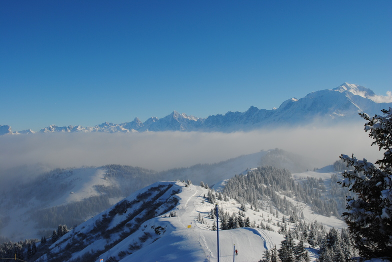
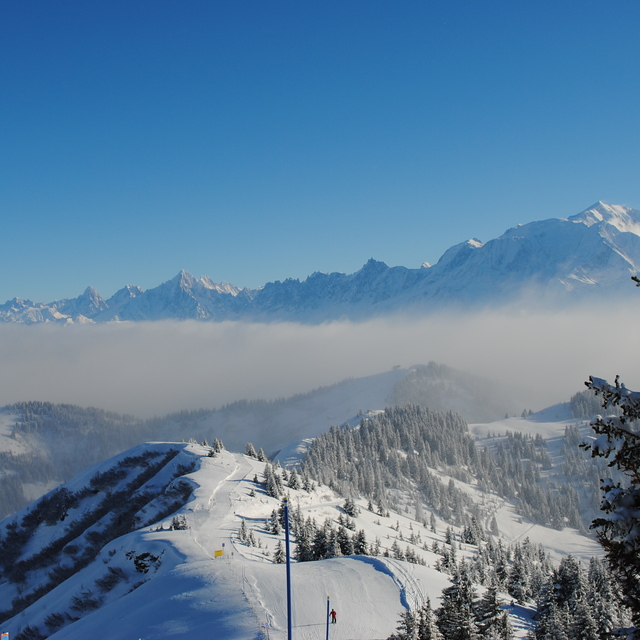
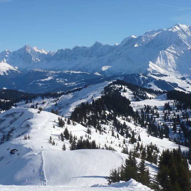
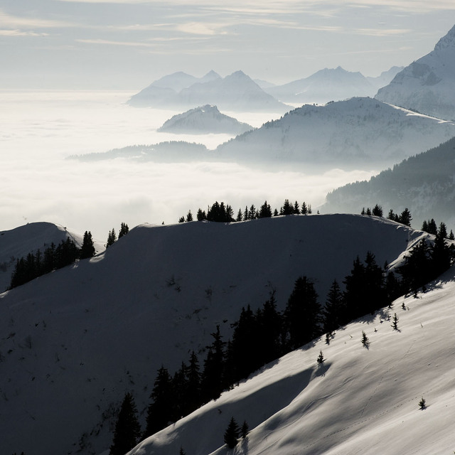
Ski lessons in La Giettaz en Aravis
Book now


La Giettaz en Aravis Weather (Next 3 days): The snow forecast for La Giettaz en Aravis is: leichter Regen (gesamt 2.0mm), meistens fallend am Sonntag Nachm.. Frost-Tau-Bedingungen (maximal 8°C am Montag Nachm., min -1°C in der Nacht zu Freitag). Wind schwächt ab.
La Giettaz en Aravis Weather (Days 4-6): Mäßiger Regen (gesamt 16.0mm) stärkstens am Mittwoch Nachm., dann kälter mit Schneebestreuung am Donnerstag Nachm.. Milde Temperaturen (maximal 7°C am Dienstag Nachm., min 1°C am Donnerstag Nachm.). Wind schwächt ab.
| Höhenlage | Schneehöhe | Temp. (°C) | Wind (km/h) | Wetter | ||
|---|---|---|---|---|---|---|
| Bergstation: | 2.3 m | -1 | ||||
| Mittelstation: | 1 | |||||
| Tal: | 0.1 m | 1 |
Letzte Schneeberichte in der Nähe von La Giettaz en Aravis:
Continuous light rain reported from Annecy – Haute-Savoie – Mont Blanc Airport at 459 metres elevation only 3 kms NW of Annecy-LeSemnoz but it is forecast cold enough for snow at the ski area aus Annecy-LeSemnoz
Light rain reported from Chambéry Aix-les-Bains Airport at 235 metres elevation 9 kms SW of Savoie Grand Revard but it is forecast cold enough for snow at higher elevations in the ski area aus Savoie Grand Revard
Resort closed for the season. See you this summer! aus La Giettaz en Aravis

Saturday 27 | Sunday 28 | Monday 29 | Tuesday 30 | Wednesday 1 | Thursday 2 | ||||||||||||||
Nacht | AM | PM | Nacht | AM | PM | Nacht | AM | PM | Nacht | AM | PM | Nacht | AM | PM | Nacht | AM | PM | Nacht | |
Schneeschauer | einige Wolken | bewölkt | bewölkt | bewölkt | etwas Regen | bewölkt | bewölkt | bewölkt | einige Wolken | bewölkt | etwas Regen | etwas Regen | bewölkt | etwas Regen | Schauer | Schauer | leichter Schnee | mäßiger Schnee | |
km/h | |||||||||||||||||||
Snow map |  |  |  |  |  |  |  | ||||||||||||
cm | — | — | — | — | — | — | — | — | — | — | — | — | — | — | — | — | — | 1.0 | 6 |
mm | — | — | — | — | — | 2.0 | — | — | — | — | — | 2.0 | 1.0 | — | 5 | 5 | 1.0 | 2.0 | — |
max°C | 0 | 3 | 4 | 4 | 4 | 4 | 4 | 6 | 8 | 6 | 6 | 7 | 5 | 5 | 5 | 3 | 3 | 3 | 0 |
min°C | -1 | 0 | 4 | 2 | 3 | 4 | 3 | 3 | 7 | 4 | 5 | 7 | 3 | 3 | 4 | 2 | 2 | 1 | -1 |
chill°C | -4 | -4 | 1 | -2 | -1 | 1 | 0 | 0 | 6 | 1 | 2 | 6 | 2 | 2 | 3 | 1 | 2 | -2 | -3 |
Feuchte% | 65 | 52 | 54 | 70 | 69 | 80 | 70 | 60 | 66 | 61 | 67 | 68 | 76 | 79 | 97 | 80 | 82 | 98 | 99 |
Gefrierpunkt (m) | 1800 | 2350 | 2600 | 2500 | 2600 | 2600 | 2900 | 2850 | 2850 | 3100 | 2900 | 2950 | 2650 | 2600 | 2550 | 2400 | 2350 | 2200 | 1700 |
— | 6:26 | — | — | 6:24 | — | — | 6:22 | — | — | 6:22 | — | — | 6:20 | — | — | 6:18 | — | — | |
— | — | — | 8:36 | — | — | 8:37 | — | — | 8:38 | — | — | 8:39 | — | — | 8:42 | — | — | 8:43 | |
leichter Regen (gesamt 2.0mm), meistens fallend am Sonntag Nachm.. Frost-Tau-Bedingungen (maximal 8°C am Montag Nachm., min -1°C in der Nacht zu Freitag). Wind schwächt ab.
Mäßiger Regen (gesamt 16.0mm) stärkstens am Mittwoch Nachm., dann kälter mit Schneebestreuung am Donnerstag Nachm.. Milde Temperaturen (maximal 7°C am Dienstag Nachm., min 1°C am Donnerstag Nachm.). Wind schwächt ab.
Letzte Schneeberichte in der Nähe von La Giettaz en Aravis:
Continuous light rain reported from Annecy – Haute-Savoie – Mont Blanc Airport at 459 metres elevation only 3 kms NW of Annecy-LeSemnoz but it is forecast cold enough for snow at the ski area aus Annecy-LeSemnoz
Light rain reported from Chambéry Aix-les-Bains Airport at 235 metres elevation 9 kms SW of Savoie Grand Revard but it is forecast cold enough for snow at higher elevations in the ski area aus Savoie Grand Revard
Resort closed for the season. See you this summer! aus La Giettaz en Aravis
| Die obere Schneetiefe ist: | 230 cm |
|---|---|
| Die untere Schneetiefe ist: | 10 cm |
| Neuschneetiefe Berg | 2 cm |
| Wann hat es das letzte Mal geschneit? | 24 Apr 2024 |
0.2 | Bluebird Powder Tage Frischer Schnee, meist sonnig, leichter Wind. |
|---|---|
0.3 | Pulverschneetage Neuschnee, bewölkt, Wind |
0.0 | Bluebird Tage Schnee, meist sonnig, leichter Wind. |
Die Tabelle oben zeigt die Wettervorhersage für La Giettaz en Aravis auf der angegebenen Höhe von 1951 m. Unsere ausgeklügelten Wettermodelle ermöglichen uns die Schneevorhersage für die Gipfel-, Mittel- und Talstationen für La Giettaz en Aravis. Das Fenster über der Tabelle ermöglicht das Abrufen der Wettervorhersage für andere Höhen. Für einen umfassenderen Blick auf das Wetter, siehe die Wetterkarte" von France.La Giettaz en Aravis
Klicken Sie hier, um weitere Informationen über Gefrierpunkte zu erhalten und zu lesen wie wir unsere Temperaturen prognostizieren.
Skigebietsname wird auch La Giettaz.geschrieben.
Allgemein 4.1 Basiert auf 12 Abstimmungen und 1 Beurteilung
Was an awesome place. Great skiing and wonderful village. With the surrounding towns within close proximity was the ideal place to relax after a day of skiing. Love the village. All 'round, will definitely be my choice of places to say with good accommodation at reasonable prices.
Stephane Vignes aus Australia schreibt:
Was an awesome place. Great skiing and wonderful village. With the surrounding towns within close proximity was the ideal place to relax after a day of skiing. Love the village. All 'round, will definitely be my choice of places to say with good accommodation at reasonable prices.
Klicken Sie hier um Ihre eigene Beurteilung über La Giettaz en Aravis abzugeben
Das La Giettaz en Aravis Skiwetter Wideget unten, ist auf externen Seiten kostenlos eigebettet. Es bietet eine tägliche Zusammenfassung über unsere La Giettaz en Aravis Schneevorhersage und derzeitige Wetterbedingungen. gehen Sie einfach auf die Feed-Konfiguration Seite und folgen Sie den 3 einfachen Schritten, um den eigenen HTML-Code-Snippet zu packen und fügen Sie ihn auf Ihrer eigenen Website. Sie können die Höhe der Schneevorhersage wählen (Gipfel, mittel Berg, oder unterer Gipfel) und Messeinheiten metrisch / Schneevorhersage für den Feed auf Ihre eigene Website & hellip anpassen; Klicken Sie hier, um den Code zu bekommen.
Detaillierte Schneevorhersage für La Giettaz en Aravis in:
snow-forecast.com


 Nearest