

Global Weekly Snow Roundup #314
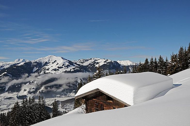
Weekly Global Snow News, updated 14 May 2026: Fresh snowfall in Argentina, Australia and Lesotho signals winter’s approach, while Japan maintains the world’s deepest snowpack.

Next 3 days weather summary:leichte Neuschneedecke, fallend meistens am Samstag Morgen. milderes Wetter mit mäßigem Regen (gesamt 19.0mm) stärkstens in der Nacht zu Montag. Frost-Tau-Bedingungen (maximal 9°C am Montag Nachm., min -1°C am Samstag Morgen). Wind schwächt ab. | Days 4-6 weather summary:Mäßiger Regen (gesamt 16.0mm), stärkstens in der Nacht zu Dienstag. Sehr mild (maximal 14°C am Donnerstag Nachm., min 4°C am Dienstag Morg.). Wind schwächt ab. | |||||||||||||||||
Saturday 16 | Sunday 17 | Monday 18 | Tuesday 19 | Wednesday 20 | Thursday 21 | |||||||||||||
AM | PM | Nacht | AM | PM | Nacht | AM | PM | Nacht | AM | PM | Nacht | AM | PM | Nacht | AM | PM | Nacht | |
leichter Schnee | leichter Schnee | Schneeschauer | klar | klar | einige Wolken | Schauer | Gewittergefahr | starker Regen | einige Wolken | etwas Regen | etwas Regen | etwas Regen | etwas Regen | etwas Regen | Schauer | Schauer | Schauer | |
km/h | ||||||||||||||||||
Snow map |  |  |  |  |  |  | ||||||||||||
5 | 1 | — | — | — | — | — | — | — | — | — | — | — | — | — | — | — | — | |
— | — | — | — | — | — | 1 | 5 | 13 | — | 1 | 3 | 2 | 2 | 4 | 2 | 1 | 1 | |
max °C | 0 | 2 | 2 | 3 | 7 | 7 | 8 | 9 | 7 | 7 | 10 | 9 | 8 | 10 | 10 | 10 | 14 | 11 |
min °C | -1 | 0 | 0 | 2 | 6 | 5 | 6 | 9 | 3 | 4 | 9 | 6 | 7 | 9 | 8 | 9 | 13 | 9 |
-4 | -2 | 0 | 2 | 6 | 5 | 5 | 9 | 3 | 4 | 9 | 6 | 7 | 8 | 8 | 8 | 12 | 9 | |
100 | 96 | 93 | 82 | 68 | 72 | 68 | 74 | 98 | 74 | 62 | 99 | 82 | 73 | 87 | 76 | 56 | 80 | |
1350 | 1650 | 1500 | 1900 | 2300 | 2300 | 2400 | 2600 | 1950 | 2350 | 2600 | 2400 | 2600 | 2800 | 2700 | 2850 | 2900 | 3150 | |
5:33 | — | — | 5:31 | — | — | 5:30 | — | — | 5:28 | — | — | 5:28 | — | — | 5:26 | — | — | |
— | — | 8:40 | — | — | 8:42 | — | — | 8:43 | — | — | 8:44 | — | — | 8:45 | — | — | 8:46 | |
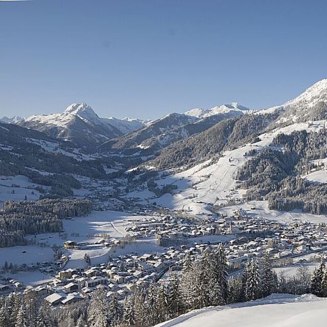
Letzte Schneeberichte in der Nähe von Kitzbühel:
| Die obere Schneetiefe ist: | — |
|---|---|
| Die untere Schneetiefe ist: | — |
| Neuschneetiefe Berg | 19 cm |
| Wann hat es das letzte Mal geschneit? | 15 May 2026 |
0.0 | Bluebird Powder Tage Frischer Schnee, meist sonnig, leichter Wind. |
|---|---|
0.1 | Pulverschneetage Neuschnee, bewölkt, Wind |
0.0 | Bluebird Tage Schnee, meist sonnig, leichter Wind. |
Die Tabelle oben zeigt die Wettervorhersage für Kitzbühel auf der angegebenen Höhe von 1400 m. Unsere ausgeklügelten Wettermodelle ermöglichen uns die Schneevorhersage für die Gipfel-, Mittel- und Talstationen für Kitzbühel. Das Fenster über der Tabelle ermöglicht das Abrufen der Wettervorhersage für andere Höhen. Für einen umfassenderen Blick auf das Wetter, siehe die Wetterkarte" von Austria.Kitzbühel
Klicken Sie hier, um weitere Informationen über Gefrierpunkte zu erhalten und zu lesen wie wir unsere Temperaturen prognostizieren.
Skigebietsname wird auch Kitzbuhel.geschrieben.
Allgemein 4.3 Basiert auf 21 Abstimmungen und 26 Beurteilungen
I came to skiing quite late in life and although have really enjoyed some challenging red runs in other resorts I usually need a good half a day of cruisey blues on good snow to get my ski legs on and more importantly confidence up. And here just hasn’t offered that opportunity. It’s a great resort, but I’d say due to multi-hill terrain it’s a bit stop-start; short run here, lift, short run there, switchback here, and so on. It’s clear the world famous downhill has an impact, with people flying down busy (today slushy) pistes like demons trying to emulate the pros. And the run classifications... it’s like someone has decided each hill needs at least one blue, a red and a black run to show some variety. But in truth there’s sometimes v little between some blues and blacks. Off the mountain I have had a lovely time. Friendly people about the place, good restaurants and social side. In summary: if you fancy a challenge, then you’ll love the slushy runs, aside precipitous mountain drops, while weaving in between others of a similar mindset. If you’re looking for somewhere to build your confidence and put some cruisey miles in: avoid.
Mark T aus Austria schreibt:
I came to skiing quite late in life and although have really enjoyed some challenging red runs in other resorts I usually need a good half a day of cruisey blues on good snow to get my ski legs on and more importantly confidence up. And here just hasn’t offered that opportunity. It’s a great resort, but I’d say due to multi-hill terrain it’s a bit stop-start; short run here, lift, short run there, switchback here, and so on. It’s clear the world famous downhill has an impact, with people flying down busy (today slushy) pistes like demons trying to emulate the pros. And the run classifications... it’s like someone has decided each hill needs at least one blue, a red and a black run to show some variety. But in truth there’s sometimes v little between some blues and blacks. Off the mountain I have had a lovely time. Friendly people about the place, good restaurants and social side. In summary: if you fancy a challenge, then you’ll love the slushy runs, aside precipitous mountain drops, while weaving in between others of a similar mindset. If you’re looking for somewhere to build your confidence and put some cruisey miles in: avoid.
Lesen Sie 25 andere Beurteilungen ueber Kitzbühel oder geben Sie Ihre eigene Bewertung ab.


 Nearest