

Global Weekly Snow Roundup #314
Weekly Global Snow News, updated 14 May 2026: Fresh snowfall in Argentina, Australia and Lesotho signals winter’s approach, while Japan maintains the world’s deepest snowpack.

Next 3 days weather summary:sehr leichter Schneefall übergehend in leichten Regen (gesamt 18.0mm) stärkstens in der Nacht zu Montag. Frost-Tau-Bedingungen (maximal 9°C am Montag Nachm., min -6°C In der Nacht zu Samstag). Wind schwächt ab. | Days 4-6 weather summary:Mäßiger Regen (gesamt 12.0mm), stärkstens am Dienstag Nachm.. Sehr mild (maximal 15°C am Donnerstag Nachm., min 3°C am Dienstag Morg.). Wind schwächt ab. | |||||||||||||||||
Saturday 16 | Sunday 17 | Monday 18 | Tuesday 19 | Wednesday 20 | Thursday 21 | |||||||||||||
AM | PM | Nacht | AM | PM | Nacht | AM | PM | Nacht | AM | PM | Nacht | AM | PM | Nacht | AM | PM | Nacht | |
leichter Schnee | Schneeschauer | Schneeschauer | klar | einige Wolken | einige Wolken | bewölkt | etwas Regen | starker Regen | bewölkt | etwas Regen | etwas Regen | etwas Regen | Schauer | Schauer | einige Wolken | einige Wolken | klar | |
km/h | ||||||||||||||||||
Snow map |  |  |  |  |  |  | ||||||||||||
1 | — | — | — | — | — | — | — | — | — | — | — | — | — | — | — | — | — | |
— | — | — | — | — | — | — | 3 | 15 | — | 3 | 4 | 1 | 3 | 1 | — | — | — | |
max °C | 0 | 2 | -1 | 2 | 7 | 5 | 7 | 9 | 4 | 6 | 7 | 6 | 7 | 10 | 8 | 11 | 15 | 12 |
min °C | -1 | 1 | -6 | -1 | 5 | 0 | 3 | 9 | 1 | 3 | 6 | 4 | 4 | 9 | 4 | 7 | 14 | 5 |
-4 | -2 | -6 | -1 | 5 | -2 | 1 | 8 | 1 | 3 | 6 | 4 | 4 | 8 | 4 | 6 | 14 | 5 | |
85 | 82 | 96 | 72 | 64 | 90 | 72 | 67 | 98 | 88 | 96 | 99 | 88 | 71 | 85 | 64 | 47 | 82 | |
1550 | 1750 | 1100 | 2050 | 2400 | 2050 | 2350 | 2650 | 2100 | 2450 | 2650 | 2550 | 2600 | 2800 | 2650 | 3000 | 3250 | 3500 | |
5:43 | — | — | 5:41 | — | — | 5:41 | — | — | 5:39 | — | — | 5:39 | — | — | 5:37 | — | — | |
— | — | 8:47 | — | — | 8:49 | — | — | 8:50 | — | — | 8:52 | — | — | 8:52 | — | — | 8:53 | |
Letzte Schneeberichte in der Nähe von Galtur-Silvapark:
| Die obere Schneetiefe ist: | — |
|---|---|
| Die untere Schneetiefe ist: | — |
| Neuschneetiefe Berg | 22 cm |
| Wann hat es das letzte Mal geschneit? | 15 May 2026 |
0.0 | Bluebird Powder Tage Frischer Schnee, meist sonnig, leichter Wind. |
|---|---|
0.1 | Pulverschneetage Neuschnee, bewölkt, Wind |
0.0 | Bluebird Tage Schnee, meist sonnig, leichter Wind. |

Die Tabelle oben zeigt die Wettervorhersage für Galtur-Silvapark auf der angegebenen Höhe von 1600 m. Unsere ausgeklügelten Wettermodelle ermöglichen uns die Schneevorhersage für die Gipfel-, Mittel- und Talstationen für Galtur-Silvapark. Das Fenster über der Tabelle ermöglicht das Abrufen der Wettervorhersage für andere Höhen. Für einen umfassenderen Blick auf das Wetter, siehe die Wetterkarte" von Austria.Galtur-Silvapark
Klicken Sie hier, um weitere Informationen über Gefrierpunkte zu erhalten und zu lesen wie wir unsere Temperaturen prognostizieren.
Skigebietsname wird auch Galtur Silvapark.geschrieben.
Allgemein 4.2 Basiert auf 11 Abstimmungen und 3 Beurteilungen
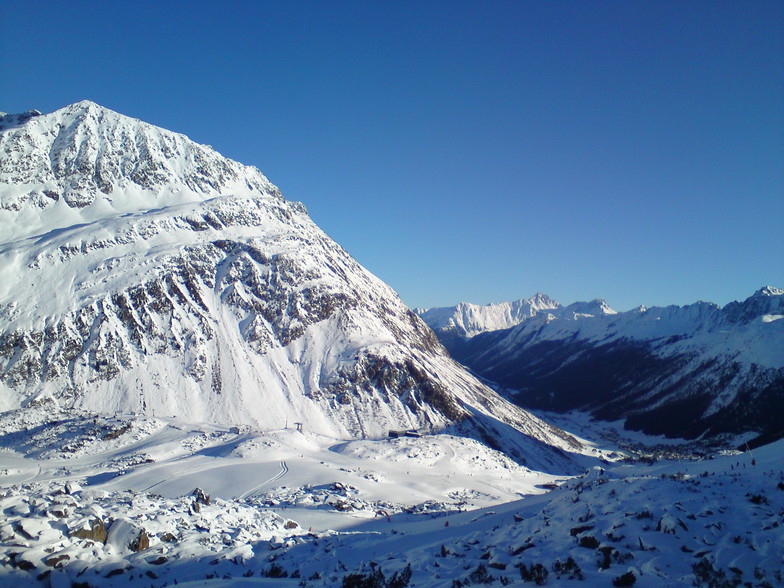
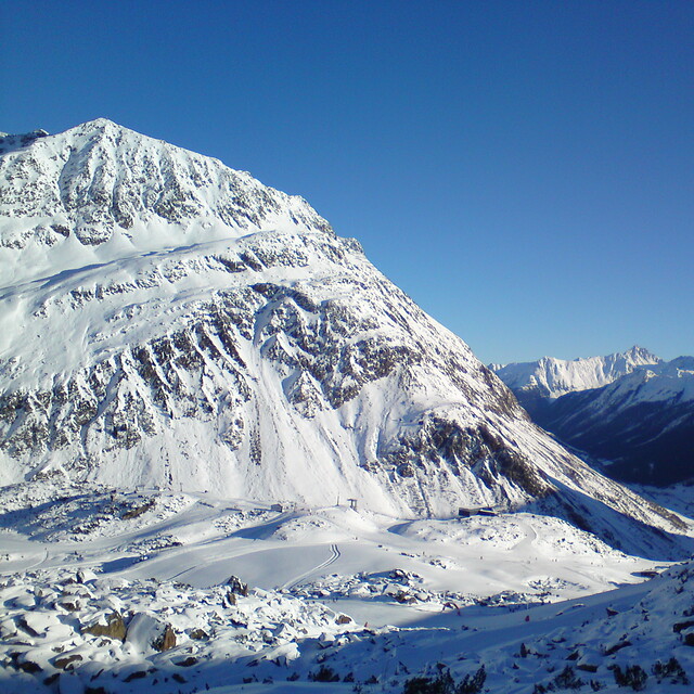
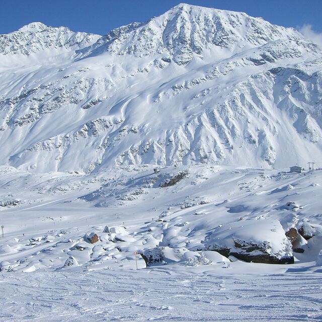
A small friendly resort with an excellent snow record, the village stands at 1584m with much of the skiing above the tree line. Whilst the ski area is relatively small it does not suffer from the crowds of some of the more, well known resorts. A short free bus ride away is the larger resort of Ischgl, which provides over 200km of well-groomed pistes. The village is effectively split into two; the centre is a mainly hotels, while a mix of apartments and hotels can be found at the foot of the lift system. Nightlife is generally quite, there are a couple of Bars which can be lively. Overall a friendly resort-offering crowd free skiing.
stuart aus United Kingdom schreibt:
A small friendly resort with an excellent snow record, the village stands at 1584m with much of the skiing above the tree line. Whilst the ski area is relatively small it does not suffer from the crowds of some of the more, well known resorts. A short free bus ride away is the larger resort of Ischgl, which provides over 200km of well-groomed pistes. The village is effectively split into two; the centre is a mainly hotels, while a mix of apartments and hotels can be found at the foot of the lift system. Nightlife is generally quite, there are a couple of Bars which can be lively. Overall a friendly resort-offering crowd free skiing.
Lesen Sie 2 andere Beurteilungen ueber Galtur-Silvapark oder geben Sie Ihre eigene Bewertung ab.


 Nearest