

Global Weekly Snow Roundup #314
Weekly Global Snow News, updated 14 May 2026: Fresh snowfall in Argentina, Australia and Lesotho signals winter’s approach, while Japan maintains the world’s deepest snowpack.

Next 3 days weather summary:leichte Neuschneedecke, fallend meistens am Montag Nachm.. Temperaturen werden unter dem Gefrierpunkt sein (maximal -1°C am Sonntag Nachm., min -10°C am Samstag Morgen). Wind schwächt ab. | Days 4-6 weather summary:Meist trocken. Frost-Tau-Bedingungen (maximal 7°C am Donnerstag Morg., min -1°C am Dienstag Morg.). Wind schwächt ab. | |||||||||||||||||
Saturday 16 | Sunday 17 | Monday 18 | Tuesday 19 | Wednesday 20 | Thursday 21 | |||||||||||||
AM | PM | Nacht | AM | PM | Nacht | AM | PM | Nacht | AM | PM | Nacht | AM | PM | Nacht | AM | PM | Nacht | |
leichter Schnee | leichter Schnee | Schneeschauer | einige Wolken | Schneeschauer | leichter Schnee | leichter Schnee | leichter Schnee | leichter Schnee | bewölkt | leichter Schnee | leichter Schnee | klar | einige Wolken | einige Wolken | einige Wolken | klar | klar | |
km/h | ||||||||||||||||||
Snow map |  |  |  |  |  |  | ||||||||||||
— | 1 | — | — | — | 1 | 1 | 3 | 2 | — | — | — | — | — | — | — | — | — | |
— | — | — | — | — | — | — | — | — | — | — | — | — | — | — | — | — | — | |
max °C | -9 | -7 | -4 | -3 | -1 | -2 | -3 | -3 | -2 | -1 | 0 | 1 | 2 | 4 | 5 | 7 | 7 | 7 |
min °C | -10 | -8 | -7 | -3 | -2 | -4 | -4 | -3 | -3 | -1 | -1 | 0 | 1 | 3 | 4 | 5 | 7 | 7 |
-16 | -12 | -11 | -5 | -4 | -6 | -6 | -7 | -5 | -3 | -4 | -4 | -2 | 0 | 2 | 3 | 6 | 6 | |
87 | 90 | 48 | 46 | 90 | 93 | 88 | 90 | 97 | 84 | 96 | 69 | 59 | 78 | 41 | 20 | 43 | 22 | |
1600 | 1900 | 1400 | 2350 | 2500 | 2250 | 2350 | 2400 | 2200 | 2550 | 2700 | 2850 | 3100 | 3200 | 3650 | 3750 | 3750 | 4100 | |
6:01 | — | — | 6:01 | — | — | 6:00 | — | — | 5:58 | — | — | 5:58 | — | — | 5:56 | — | — | |
— | — | 8:57 | — | — | 8:58 | — | — | 8:59 | — | — | 9:00 | — | — | 9:01 | — | — | 9:02 | |
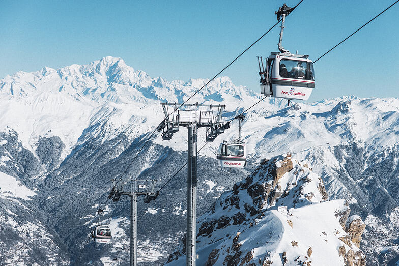
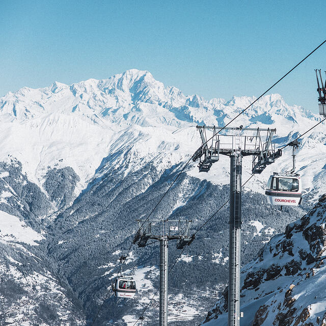
Letzte Schneeberichte in der Nähe von Courchevel:
| Die obere Schneetiefe ist: | — |
|---|---|
| Die untere Schneetiefe ist: | — |
| Neuschneetiefe Berg | 13 cm |
| Wann hat es das letzte Mal geschneit? | 15 May 2026 |
0.4 | Bluebird Powder Tage Frischer Schnee, meist sonnig, leichter Wind. |
|---|---|
0.7 | Pulverschneetage Neuschnee, bewölkt, Wind |
0.5 | Bluebird Tage Schnee, meist sonnig, leichter Wind. |
Die Tabelle oben zeigt die Wettervorhersage für Courchevel auf der angegebenen Höhe von 2738 m. Unsere ausgeklügelten Wettermodelle ermöglichen uns die Schneevorhersage für die Gipfel-, Mittel- und Talstationen für Courchevel. Das Fenster über der Tabelle ermöglicht das Abrufen der Wettervorhersage für andere Höhen. Für einen umfassenderen Blick auf das Wetter, siehe die Wetterkarte" von France.Courchevel
Klicken Sie hier, um weitere Informationen über Gefrierpunkte zu erhalten und zu lesen wie wir unsere Temperaturen prognostizieren.
Allgemein 4.3 Basiert auf 68 Abstimmungen und 68 Beurteilungen
I have been going to Courchevel every year for the last 12 years. I go at the end of December/ very early January. Often there is very little snow on 1650 and medium snow on 1850. This creates over-crowding on the limited slopes open at that time of the year. Snow is coming later and later in the season - ...?climate change. If you are going to Courchevel, I suggest you go mid-January onwards. If you go earlier, there is likely to be limited number of slopes open; lots of slopes but half of them mud and grass at the end of December. Val Thorens for me this winter.
Jonah aus United Kingdom schreibt:
I have been going to Courchevel every year for the last 12 years. I go at the end of December/ very early January. Often there is very little snow on 1650 and medium snow on 1850. This creates over-crowding on the limited slopes open at that time of the year. Snow is coming later and later in the season - ...?climate change. If you are going to Courchevel, I suggest you go mid-January onwards. If you go earlier, there is likely to be limited number of slopes open; lots of slopes but half of them mud and grass at the end of December.
Val Thorens for me this winter.
Lesen Sie 67 andere Beurteilungen ueber Courchevel oder geben Sie Ihre eigene Bewertung ab.


 Nearest