

Global Weekly Snow Roundup #314
Weekly Global Snow News, updated 14 May 2026: Fresh snowfall in Argentina, Australia and Lesotho signals winter’s approach, while Japan maintains the world’s deepest snowpack.

Next 3 days weather summary:Mild mit leichtem Regen (gesamt 4.0mm) am Montag Nachm. kälter mit leichtem Schneebestreuung, fallend meistens am Montag Nachm.. Frost-Tau-Bedingungen (maximal 4°C am Sonntag Nachm., min -5°C am Samstag Morgen). Wind schwächt ab. | Days 4-6 weather summary:leichter Regen (gesamt 8.0mm), meistens fallend am Dienstag Nachm.. Sehr mild (maximal 10°C am Donnerstag Nachm., min 1°C am Dienstag Morg.). Wind schwächt ab. | |||||||||||||||||
Saturday 16 | Sunday 17 | Monday 18 | Tuesday 19 | Wednesday 20 | Thursday 21 | |||||||||||||
AM | PM | Nacht | AM | PM | Nacht | AM | PM | Nacht | AM | PM | Nacht | AM | PM | Nacht | AM | PM | Nacht | |
leichter Schnee | leichter Schnee | Schneeschauer | klar | bewölkt | etwas Regen | etwas Regen | leichter Schnee | Schneeschauer | einige Wolken | etwas Regen | etwas Regen | bewölkt | Schauer | Schauer | einige Wolken | klar | klar | |
km/h | ||||||||||||||||||
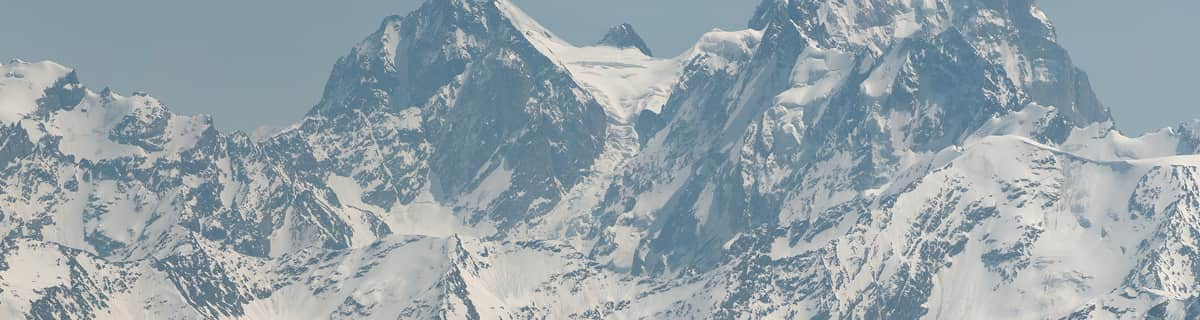
Snow map |  |  |  |  |  |  | ||||||||||||
2 | 1 | — | — | — | — | — | 1 | 1 | — | — | — | — | — | — | — | — | — | |
— | — | — | — | — | 1 | 1 | 2 | — | — | 1 | 4 | — | 2 | 1 | — | — | — | |
max °C | -4 | -2 | -2 | 1 | 4 | 3 | 3 | 3 | 1 | 4 | 5 | 3 | 4 | 7 | 6 | 8 | 10 | 9 |
min °C | -5 | -2 | -4 | -2 | 3 | 1 | 2 | 1 | 0 | 1 | 5 | 3 | 4 | 7 | 5 | 5 | 10 | 8 |
-9 | -5 | -4 | -2 | 3 | -1 | 0 | -1 | -2 | 1 | 5 | 2 | 3 | 5 | 4 | 4 | 9 | 8 | |
90 | 86 | 78 | 55 | 66 | 80 | 70 | 97 | 84 | 65 | 75 | 97 | 81 | 70 | 85 | 58 | 53 | 56 | |
1400 | 1800 | 1300 | 2100 | 2450 | 2300 | 2400 | 2250 | 2050 | 2500 | 2650 | 2550 | 2650 | 2900 | 2900 | 3100 | 3250 | 3650 | |
5:43 | — | — | 5:43 | — | — | 5:41 | — | — | 5:41 | — | — | 5:39 | — | — | 5:39 | — | — | |
— | — | 8:50 | — | — | 8:51 | — | — | 8:52 | — | — | 8:53 | — | — | 8:54 | — | — | 8:55 | |
Letzte Schneeberichte in der Nähe von Brandnertal (Brand und Bürserberg):
Light rain reported from Rheineck Airport at 420 metres elevation 5 kms NE of Heiden - Grub - Oberegg Appenzellerland but it is forecast cold enough for snow at higher elevations in the ski area aus Heiden - Grub - Oberegg Appenzellerland
| Die obere Schneetiefe ist: | — |
|---|---|
| Die untere Schneetiefe ist: | — |
| Neuschneetiefe Berg | 15 cm |
| Wann hat es das letzte Mal geschneit? | 15 May 2026 |
0.0 | Bluebird Powder Tage Frischer Schnee, meist sonnig, leichter Wind. |
|---|---|
0.4 | Pulverschneetage Neuschnee, bewölkt, Wind |
0.0 | Bluebird Tage Schnee, meist sonnig, leichter Wind. |
Die Tabelle oben zeigt die Wettervorhersage für Brandnertal (Brand und Bürserberg) auf der angegebenen Höhe von 2000 m. Unsere ausgeklügelten Wettermodelle ermöglichen uns die Schneevorhersage für die Gipfel-, Mittel- und Talstationen für Brandnertal (Brand und Bürserberg). Das Fenster über der Tabelle ermöglicht das Abrufen der Wettervorhersage für andere Höhen. Für einen umfassenderen Blick auf das Wetter, siehe die Wetterkarte" von Austria.Brandnertal (Brand und Bürserberg)
Klicken Sie hier, um weitere Informationen über Gefrierpunkte zu erhalten und zu lesen wie wir unsere Temperaturen prognostizieren.
Skigebietsname wird auch Brandnertal.geschrieben.
Allgemein 4.1 Basiert auf 14 Abstimmungen und 3 Beurteilungen
I first came here 25 years ago as a 12 year old boy with my father. I have now returned with my daughter who is only 3 and skiing for the first time. Brand is a superb little Austrian resort with fantastic facilities for children. We stayed at the 4 star Sporthotel Beck which has a excellent kids club and is part of the Kinder hotels group. With a nursery slope in the village, horse riding, sledging, quad biking and an excellent kids club. Brand is ideal for beginners and intermediate skiers. There are a some good apres bars and some nice restaurants, but don't come here for mad apres-ski as you wont find it - head to St Anton or Ischgl for that. Although like many resorts in Austria the village is quite low we had plenty of snow and some great powder days. So if you are a first time skier or are taking the kids and are looking for a quaint little Austrian resort - head to Brandnertal.
Shane aus United Kingdom schreibt:
I first came here 25 years ago as a 12 year old boy with my father. I have now returned with my daughter who is only 3 and skiing for the first time. Brand is a superb little Austrian resort with fantastic facilities for children. We stayed at the 4 star Sporthotel Beck which has a excellent kids club and is part of the Kinder hotels group. With a nursery slope in the village, horse riding, sledging, quad biking and an excellent kids club. Brand is ideal for beginners and intermediate skiers. There are a some good apres bars and some nice restaurants, but don't come here for mad apres-ski as you wont find it - head to St Anton or Ischgl for that. Although like many resorts in Austria the village is quite low we had plenty of snow and some great powder days. So if you are a first time skier or are taking the kids and are looking for a quaint little Austrian resort - head to Brandnertal.


 Nearest