

Global Weekly Snow Roundup #314
Weekly Global Snow News, updated 14 May 2026: Fresh snowfall in Argentina, Australia and Lesotho signals winter’s approach, while Japan maintains the world’s deepest snowpack.

Next 3 days weather summary:Mäßiger Regen (gesamt 18.0mm), stärkstens in der Nacht zu Montag. Frost-Tau-Bedingungen (maximal 10°C am Sonntag Nachm., min -1°C In der Nacht zu Samstag). Wind schwächt ab. | Days 4-6 weather summary:Mäßiger Regen (gesamt 16.0mm), stärkstens in der Nacht zu Dienstag. Sehr mild (maximal 18°C am Donnerstag Nachm., min 6°C in der Nacht zu Dienstag). Wind schwächt ab. | |||||||||||||||||
Saturday 16 | Sunday 17 | Monday 18 | Tuesday 19 | Wednesday 20 | Thursday 21 | |||||||||||||
AM | PM | Nacht | AM | PM | Nacht | AM | PM | Nacht | AM | PM | Nacht | AM | PM | Nacht | AM | PM | Nacht | |
Schauer | etwas Regen | Schauer | einige Wolken | bewölkt | bewölkt | bewölkt | etwas Regen | mäßiger Regen | etwas Regen | etwas Regen | mäßiger Regen | etwas Regen | Schauer | einige Wolken | einige Wolken | klar | klar | |
km/h | ||||||||||||||||||
Snow map |  |  |  |  |  |  | ||||||||||||
— | — | — | — | — | — | — | — | — | — | — | — | — | — | — | — | — | — | |
1 | 4 | 1 | — | — | — | — | 5 | 7 | 1 | 3 | 8 | 2 | 2 | — | — | — | — | |
max °C | 3 | 5 | 4 | 7 | 10 | 8 | 10 | 10 | 8 | 7 | 8 | 7 | 11 | 14 | 11 | 15 | 18 | 15 |
min °C | 1 | 4 | -1 | 3 | 10 | 4 | 7 | 10 | 5 | 7 | 8 | 6 | 8 | 13 | 7 | 10 | 18 | 9 |
1 | 3 | -1 | 3 | 10 | 3 | 6 | 9 | 3 | 6 | 7 | 6 | 8 | 13 | 6 | 10 | 18 | 9 | |
81 | 76 | 82 | 71 | 60 | 74 | 65 | 68 | 90 | 91 | 92 | 92 | 82 | 57 | 78 | 51 | 56 | 71 | |
1600 | 1800 | 1500 | 2150 | 2350 | 2200 | 2350 | 2450 | 2150 | 2450 | 2700 | 2500 | 2650 | 2850 | 3450 | 3650 | 3700 | 3950 | |
5:58 | — | — | 5:58 | — | — | 5:56 | — | — | 5:56 | — | — | 5:54 | — | — | 5:54 | — | — | |
— | — | 8:59 | — | — | 9:00 | — | — | 9:00 | — | — | 9:02 | — | — | 9:04 | — | — | 9:05 | |
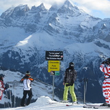
Letzte Schneeberichte in der Nähe von Avoriaz:
Resort is closed for the season. Snowing lightly, refreshing pistes. aus La Giettaz en Aravis
| Die obere Schneetiefe ist: | — |
|---|---|
| Die untere Schneetiefe ist: | — |
| Neuschneetiefe Berg | 14 cm |
| Wann hat es das letzte Mal geschneit? | 15 May 2026 |
0.0 | Bluebird Powder Tage Frischer Schnee, meist sonnig, leichter Wind. |
|---|---|
0.0 | Pulverschneetage Neuschnee, bewölkt, Wind |
0.0 | Bluebird Tage Schnee, meist sonnig, leichter Wind. |
Die Tabelle oben zeigt die Wettervorhersage für Avoriaz auf der angegebenen Höhe von 1144 m. Unsere ausgeklügelten Wettermodelle ermöglichen uns die Schneevorhersage für die Gipfel-, Mittel- und Talstationen für Avoriaz. Das Fenster über der Tabelle ermöglicht das Abrufen der Wettervorhersage für andere Höhen. Für einen umfassenderen Blick auf das Wetter, siehe die Wetterkarte" von France.Avoriaz
Klicken Sie hier, um weitere Informationen über Gefrierpunkte zu erhalten und zu lesen wie wir unsere Temperaturen prognostizieren.
Allgemein 4.2 Basiert auf 63 Abstimmungen und 43 Beurteilungen
If you are looking for a totally ski in/out experience, with short airport transfers, then you cannot go wrong with a visit to Avoriaz. Nightlife and apres is limited, as it is a very family focused resort. But there is still a great buzz and ambience with music pumping out at La Folie Douce, which is pretty central and within staggering or skiing distance to all residencies. You will not be disappointed with the ski coverage on the Portes du Soleil lift pass, that takes you into Switzerland. Snow conditions have always been perfect when I have visited. Usually big dumps before I arrive and clear blue skies for my week. I think this may be sheer luck. Eating and drinking out is what it is .. you are in France. Although this year I have booked into the Club Belambra Hotel on a fully inclusive deal. One of the very few hotels in this resort. Fingers crossed, it is worth it. No matter where you decide to go, happy and safe skiing to you all.
Liam aus Ireland schreibt:
If you are looking for a totally ski in/out experience, with short airport transfers, then you cannot go wrong with a visit to Avoriaz.
Nightlife and apres is limited, as it is a very family focused resort. But there is still a great buzz and ambience with music pumping out at La Folie Douce, which is pretty central and within staggering or skiing distance to all residencies.
You will not be disappointed with the ski coverage on the Portes du Soleil lift pass, that takes you into Switzerland.
Snow conditions have always been perfect when I have visited. Usually big dumps before I arrive and clear blue skies for my week. I think this may be sheer luck.
Eating and drinking out is what it is .. you are in France.
Although this year I have booked into the Club Belambra Hotel on a fully inclusive deal. One of the very few hotels in this resort. Fingers crossed, it is worth it.
No matter where you decide to go, happy and safe skiing to you all.
Lesen Sie 42 andere Beurteilungen ueber Avoriaz oder geben Sie Ihre eigene Bewertung ab.


 Nearest