North America Weekly Roundup #240
(Updated 8 May 2024) A comprehensive review of snow conditions, weather, and updates for North America's winter sports destinations.

Snow Hits Rockies With Force: Over 44 Inches Forecast, Keeping Ski Areas Thriving
- North America boasts twice as many operational ski areas compared to Europe, with significant snowfall hitting the Rockies and US West Coast.
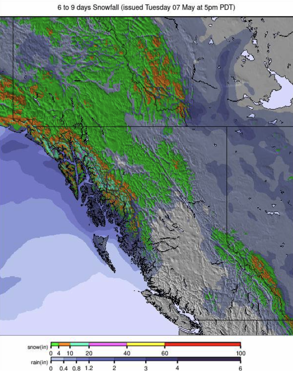
- A massive snowstorm blankets the Rockies with over 44 inches (110cm) of snow expected, keeping nine centers operational in Arizona, Colorado, and Utah.
- Despite the advancing season, some East Coast ski areas like Killington and Jay Peak plan to extend their operations into May.
NORTH AMERICA INTRO
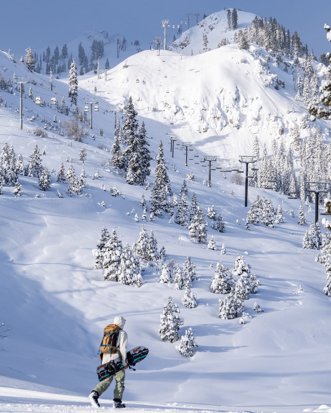
There are about twice as many ski areas still operational in North America compared to Europe this week, with the US reporting the most open areas in the world. That's perhaps not that impressive when you can count the ski areas open in Europe on two hands and the southern hemisphere's ski season hasn't started yet, but nonetheless the US is the only country where the number of open centres is still in double figures. The dedication to the cause has been rewarded too with some wintery conditions, first on the West Coast at the weekend when roads were closed and a winter weather advisory was posted. Over two feet (60cm) of snowfall was reported on higher slopes but unfortunately, 100mph winds were part of the mix too. The wintery weather then moved inland to hit the Rockies with even greater accumulations expected by the middle of this week. With two more centres closing in Canada at the weekend, we are down to three still operating, two on the West Coast, and one on the East. Both sides of the country have reported some fresh May snowfall this week, up to 16" (40cm) in fact.
ROCKIES REPORT
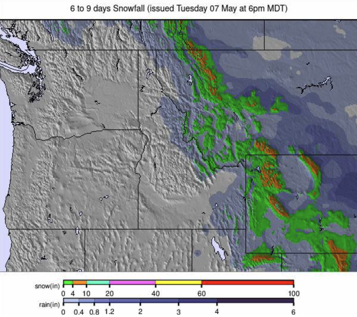
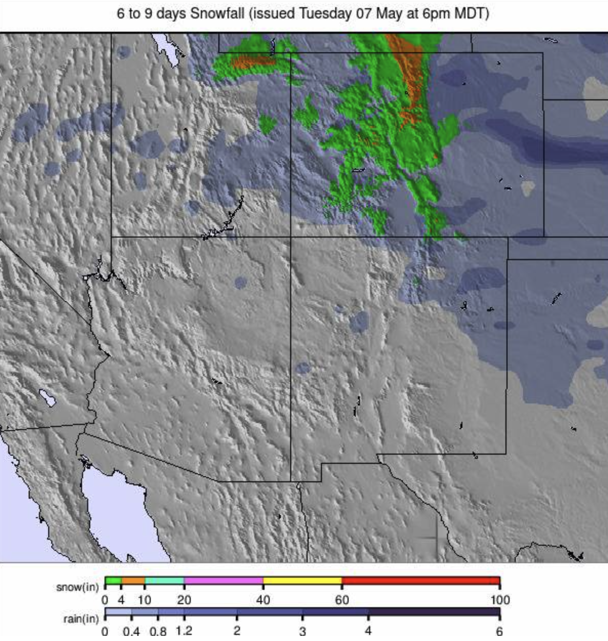
It has been quite the start to the week in the Rockies with a huge snowstorm bringing winter weather warning advisories and some road closures. It’s been dumping since Sunday and forecast totals by the time the storm is due to pass through midweek of over 44” (110cm) will be exceptional for early May. There are still nine centres open in Arizona, Colorado and Utah to make the most of it all. They include Arapahoe Basin (60/170cm / 24/68”), Breckenridge (0/69” / 0/172cm), Copper (28/58” / 70/145cm), Loveland (18/66” / 45/165cm) and Winter Park (24/77” / 60/193cm) in Colorado and Brighton, Snowbird (18/112” / 45/279cm) and Solitude (20/90” / 50/224cm) in Utah. Snowbird posted the biggest falls from the latest storm so far, 29” (73cm) with the snow still falling. It’s now just three inches (7cm) off hitting the 600” (1,525cm) seasonal snowfall total, probably later today. The Arizona Snowbowl extended its season through May for only the second time in its history, opening Fridays to Sundays for the rest of this month through to the Memorial Day holiday on the final Monday. Snowbird, which has the deepest snow cover in the region, is among the resorts switching to an earlier daily opening/closing schedule from Wednesday, moving from the usual 9 am – 3 pm to now 8 am – 2 pm operations.
ROCKIES FORECAST
The weather is expected to remain fairly cool for early May with plenty of sunshine but still, an inch or two of snowfall is expected to refresh higher slopes each evening. Freeze-thaw conditions temperatures from the low 20s to mid-40s.
USA WEST REPORT
It's been one of the snowiest weeks of the season in California with heavy snowfall through the weekend, coupled with winds gusting at up to 100mph (160 kph) resulting in a winter weather warning and some road closures. The Palisades (12/100” / 30/249cm) posted the biggest accumulation, a remarkable 26” (65cm) in 24 hours on Saturday-Sunday. It’s one of half-a-dozen ski areas still open on the West Coast including Mt Bachelor (18/94” / 45/236cm) and Timberline (64/162” / 160/405cm) in Oregon, which has the deepest base in North America. Mt Hood Meadows (66/128” / 160/320cm) is also due to reopen at the weekend. Back in California, Mammoth Mountain (62/102” / 165/255cm) has switched to a late spring operating schedule since Monday with the lifts running from 7:30 AM-2 PM moving forward. There's also a little less terrain open midweek, with the Rollercoaster Express opening weekends Fri-Sun through May. It reported about a foot (30cm) of snowfall from the weekend storm. The Palisades switches to 7 AM – 2 PM opening from Wednesday.
USA WEST FORECAST
Sunny weather and rising temperatures over the remainder of this week will see daytime highs in the 50s and low 60s with overnight lows, even at high altitudes, remaining a few degrees above freezing.
USA EAST REPORT
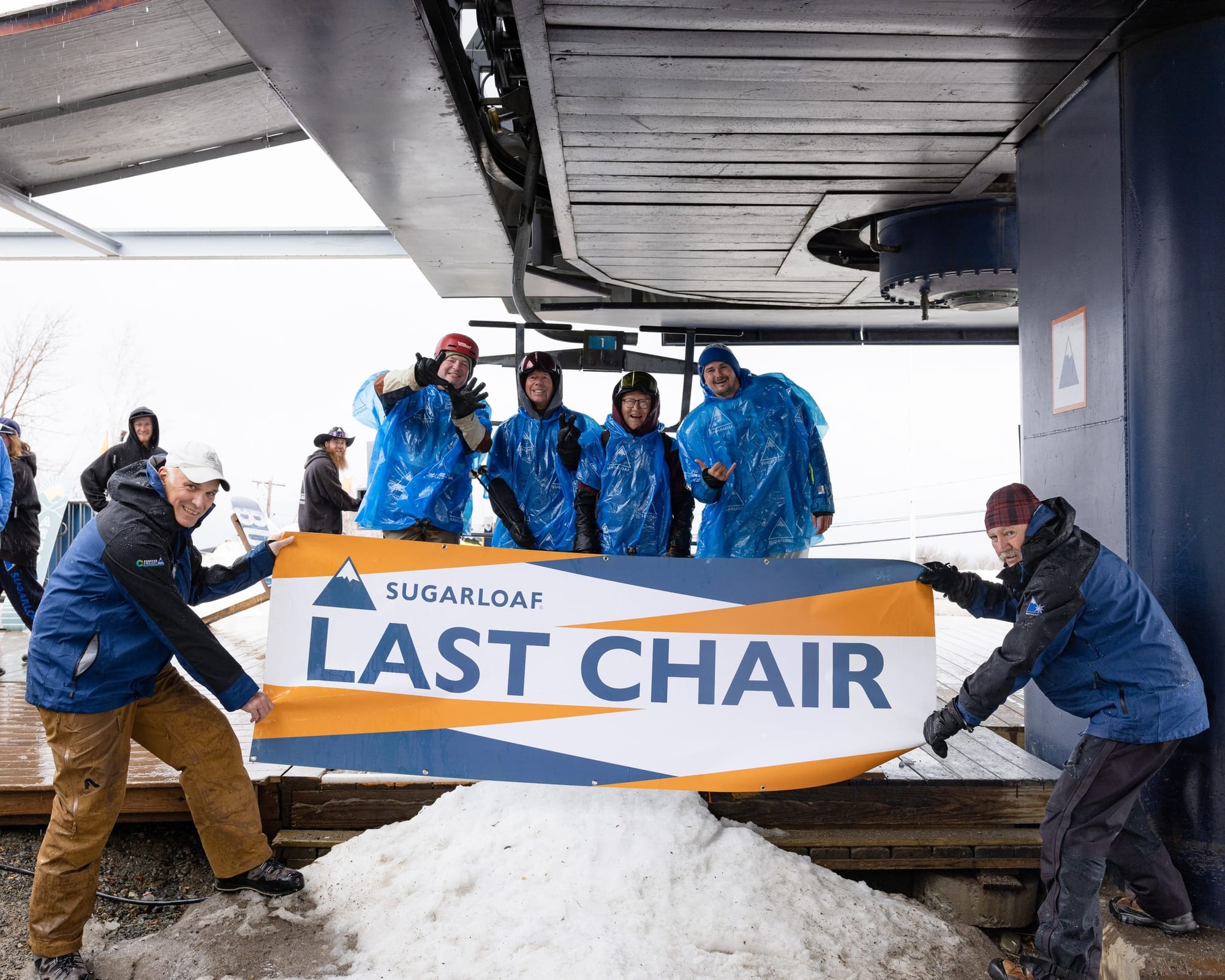
On the US East Coast after Maine’s Sugarloaf opened last weekend (along with the unexpected reopening of Sugarbush too) it was thought to be really just Killington still open now with the focus on its long Superstar run which it piled the snow up on in winter and spring to such a depth it hopes it'll survive the thaw for much of May. Famed for its bumps later in the day, Superstar is usually groomed overnight. The slope is now open Fridays to Sundays and closed Mondays to Thursdays. However, a second Vermont area, Jay Peak, has now announced they plan to re-open this coming Saturday and Sunday, for what they expect to be definitely the final weekend of their season. They expect that the Jet and (likely) Haynes runs will be open on Saturday and probably just the Jet on Sunday, served by the Jet triple chairlift.
USA EAST FORECAST
A wet end to the week with the potential for snow on high slopes, temperatures ranging from the mid-20s up high overnight to low 50s at resort bases in the afternoons.
CANADA
CANADA REPORT
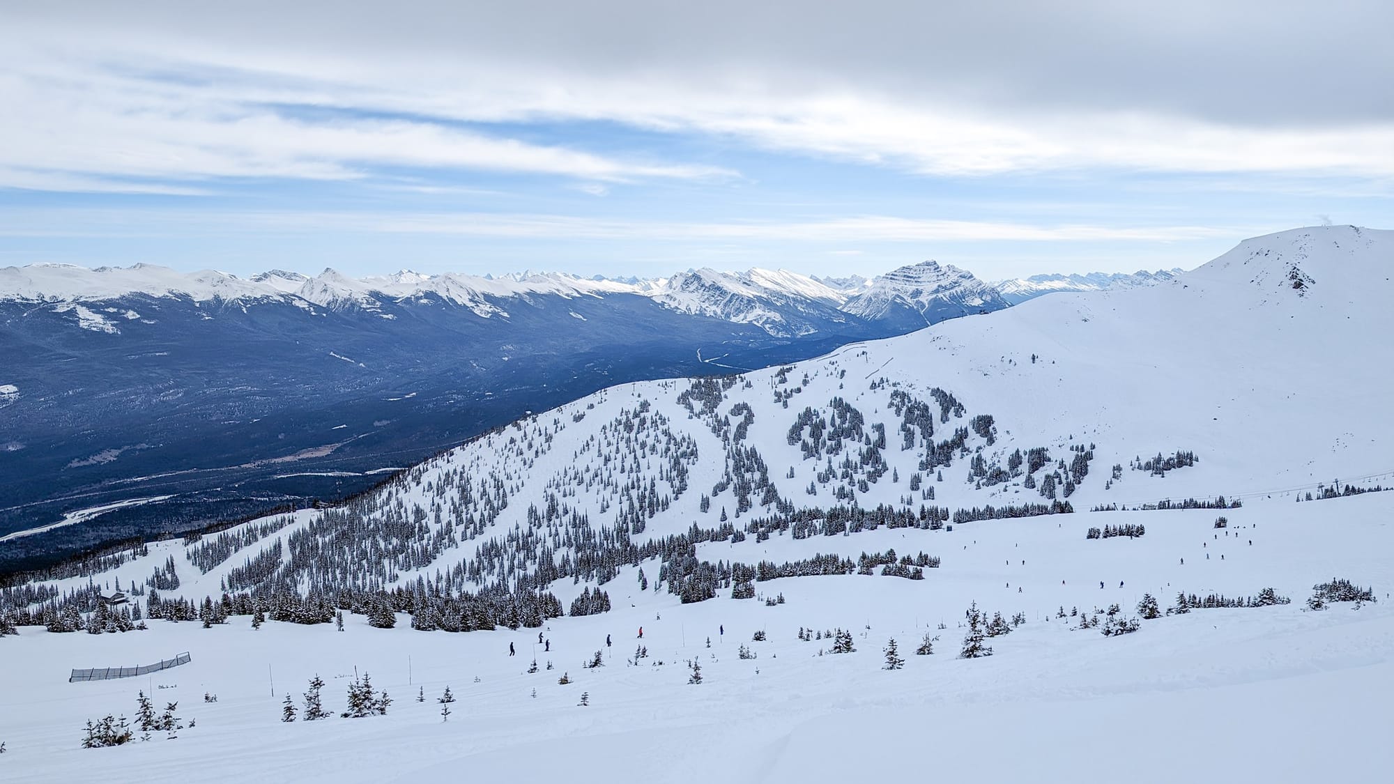
We’re into May but Canada has seen snowfalls on its ski slopes from coast to coast. On the west, it has been more gradual, 5-10cm (2-4") day after day so that one of the two survivors there, Sunshine near Banff, reported 40cm (16") in 7 days. On the east the snow arrived quickly, as part of a storm front, over the weekend, severe enough for Environment Canada to issue a winter storm warning for an area near the Labrador border before it blew in, with heavy snowfall and high winds impacting some of eastern Quebec. However, the ski season in Eastern Canada is really over now but for one centre, Sommet St Sauveur, which has been re-opening at weekends giving access to limited snow left up high. Back in the West the other resort open for another two weekends is Whistler Blackcomb, which announced it was now mandatory to ride the gondola back down Whistler Mountain at the end of the day as they gear up the lower mountain for the start of the 2024 summer biking season. Lake Louise and Marmot Basin near Jasper ended their 23-24 seasons last weekend.
CANADA FORECAST
Some very warm temperatures in western Canada through the remainder of the week. Whistler may see afternoon highs close to +30C later this week, and at Sunshine, it will be in the low 20s. Overnight lows are still close to freezing though on high slopes.