


View forecast
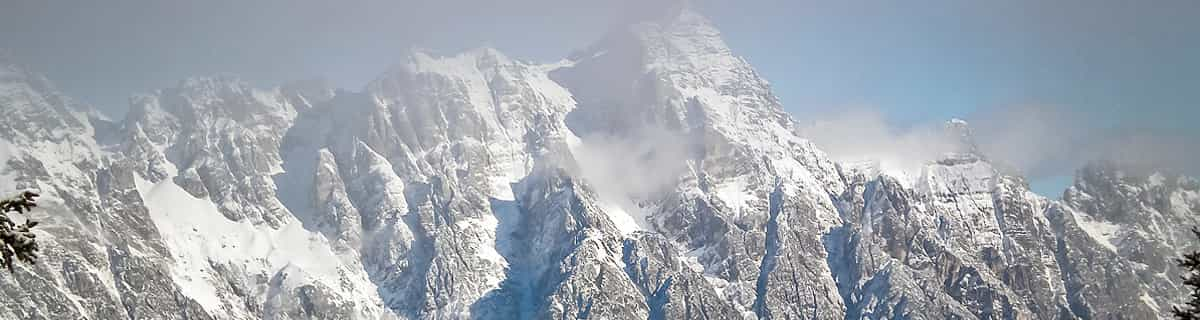
Vítkovice - Aldrov at 685 m Höhenlage
Herausgegeben on Snow-Forecast.com um: 7 am (lokale Zeit) / 23 Apr 2024
Now
Tuesday 23 | Wednesday 24 | Thursday 25 | Friday 26 | Saturday 27 | Sunday 28 | Monday 29 | |||||||||||||||
AM | PM | Nacht | AM | PM | Nacht | AM | PM | Nacht | AM | PM | Nacht | AM | PM | Nacht | AM | PM | Nacht | AM | PM | Nacht | |
bewölkt | bewölkt | leichter Schnee | etwas Regen | etwas Regen | leichter Schnee | leichter Schnee | leichter Schnee | Schneeschauer | einige Wolken | etwas Regen | Schauer | klar | klar | Schauer | einige Wolken | klar | einige Wolken | bewölkt | klar | klar | |
km/h | |||||||||||||||||||||
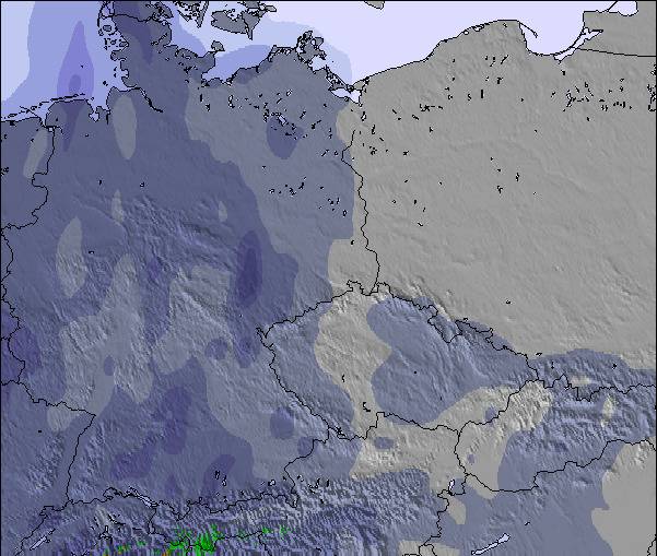
Snow map | 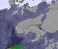 | 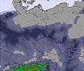 | 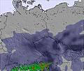 | 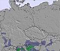 | 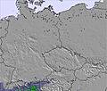 | 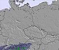 | 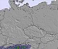 | ||||||||||||||
cm | — | — | — | — | — | — | — | — | — | — | — | — | — | — | — | — | — | — | — | — | — |
mm | — | — | 1.0 | 1.0 | 2.0 | 2.0 | — | 1.0 | — | — | 1.0 | 1.0 | — | — | 1.0 | — | — | — | — | — | — |
max°C | 2 | 5 | 2 | 2 | 4 | 3 | 0 | 2 | 1 | 5 | 9 | 8 | 9 | 11 | 9 | 11 | 15 | 13 | 13 | 17 | 14 |
min°C | -1 | 5 | 1 | 2 | 3 | 0 | 0 | 1 | 0 | 2 | 7 | 6 | 8 | 11 | 8 | 9 | 14 | 11 | 13 | 16 | 12 |
chill°C | -1 | 5 | 1 | 1 | 1 | -4 | -4 | -3 | -4 | -2 | 4 | 4 | 6 | 8 | 5 | 7 | 14 | 10 | 10 | 14 | 10 |
Feuchte% | 53 | 60 | 84 | 88 | 76 | 93 | 98 | 87 | 88 | 76 | 50 | 82 | 72 | 70 | 93 | 67 | 56 | 85 | 71 | 62 | 80 |
Gefrierpunkt (m) | 900 | 1300 | 900 | 950 | 1200 | 850 | 750 | 1000 | 750 | 1250 | 1800 | 1850 | 1900 | 2300 | 2500 | 2700 | 2850 | 3150 | 3600 | 3650 | 3700 |
5:46 | — | — | 5:43 | — | — | 5:41 | — | — | 5:41 | — | — | 5:39 | — | — | 5:37 | — | — | 5:35 | — | — | |
— | — | 8:06 | — | — | 8:07 | — | — | 8:08 | — | — | 8:10 | — | — | 8:12 | — | — | 8:14 | — | — | 8:15 | |
Zusammenfassung Wetterprognose an folgenden Tagen 0 - 3
leichter Regen (gesamt 7.0mm) zuerst, dann kälter mit Schneebestreuung am Donnerstag Morg.. Frost-Tau-Bedingungen (maximal 5°C am Dienstag Nachm., min -1°C am Dienstag Morg.). Wind schwächt ab.
Zusammenfassung Wetterprognose an folgenden Tagen 4 - 6
leichter Regen (gesamt 3.0mm), meistens fallend am Freitag Nachm.. Sehr mild (maximal 15°C am Sonntag Nachm., min 2°C am Freitag Morg.). Wind schwächt ab.
Popular Vítkovice - Aldrov Pages
Schneefallradar
Bericht einreichenLetzte Schneeberichte in der Nähe von Vítkovice - Aldrov:
15 km weg von Vítkovice - Aldrov
vor 14 hour
Snow reported from Pec Pod Snezkou at 816 metres elevation only 4 kms NE of Černý Důl Ski Resort aus Černý Důl
15 km weg von Vítkovice - Aldrov
vor 17 hourContinuous light snow reported from Pec Pod Snezkou at 816 metres elevation only 4 kms NE of Černý Důl Ski Resort aus Černý Důl
Schneeverhältnisse in Vítkovice - Aldrov
| Die obere Schneetiefe ist: | — |
|---|---|
| Die untere Schneetiefe ist: | — |
| Neuschneetiefe Berg | — |
| Wann hat es das letzte Mal geschneit? | 20 Apr 2024 |
Andere Skigebiete in Czech Republic berichten: Pulverschnee (0) / Gute Pistenbedingungen (0)
Partnerangebote Snow-Forecast
Show your business here
Schneerückschau
Woche 4 von April hat im Durchschnitt:
0.0 | Bluebird Powder Tage Frischer Schnee, meist sonnig, leichter Wind. |
|---|---|
0.1 | Pulverschneetage Neuschnee, bewölkt, Wind |
0.1 | Bluebird Tage Schnee, meist sonnig, leichter Wind. |
Andere Skigebiete in Czech Republic berichten: Pulverschnee (0) / Gute Pistenbedingungen (0)
Die Tabelle oben zeigt die Wettervorhersage für Vítkovice - Aldrov auf der angegebenen Höhe von 685 m. Unsere ausgeklügelten Wettermodelle ermöglichen uns die Schneevorhersage für die Gipfel-, Mittel- und Talstationen für Vítkovice - Aldrov. Das Fenster über der Tabelle ermöglicht das Abrufen der Wettervorhersage für andere Höhen. Für einen umfassenderen Blick auf das Wetter, siehe die Wetterkarte" von Czech Republic.Vítkovice - Aldrov
Klicken Sie hier, um weitere Informationen über Gefrierpunkte zu erhalten und zu lesen wie wir unsere Temperaturen prognostizieren.
Skigebietsname wird auch Vitkovice - Aldrov.geschrieben.
Besucher-Beurteilung fuer Vítkovice - Aldrov
Kostenlose Snow-Forecast.com Wetter Widget für Ihre Website
Das Vítkovice - Aldrov Skiwetter Wideget unten, ist auf externen Seiten kostenlos eigebettet. Es bietet eine tägliche Zusammenfassung über unsere Vítkovice - Aldrov Schneevorhersage und derzeitige Wetterbedingungen. gehen Sie einfach auf die Feed-Konfiguration Seite und folgen Sie den 3 einfachen Schritten, um den eigenen HTML-Code-Snippet zu packen und fügen Sie ihn auf Ihrer eigenen Website. Sie können die Höhe der Schneevorhersage wählen (Gipfel, mittel Berg, oder unterer Gipfel) und Messeinheiten metrisch / Schneevorhersage für den Feed auf Ihre eigene Website & hellip anpassen; Klicken Sie hier, um den Code zu bekommen.
Detaillierte Schneevorhersage für Vítkovice - Aldrov in:
snow-forecast.com

 Nearest